English
 Español
 Deutsch
 日本語
日本語 Polska
 Français
 中國
中國 한국의
한국의 Українська
 Italiano
 Nederlands
 Türkçe
 Português
 Bahasa Indonesia
 Русский
 हिंदी
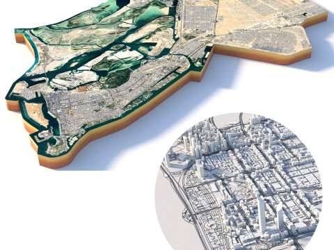
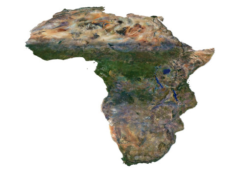
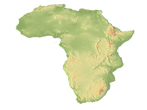
हिंदीRelief of Africa Explore its Diverse Terrain Modelo 3D


$
36.80 USD
Você tem $0.00 Créditos. Comprar créditos

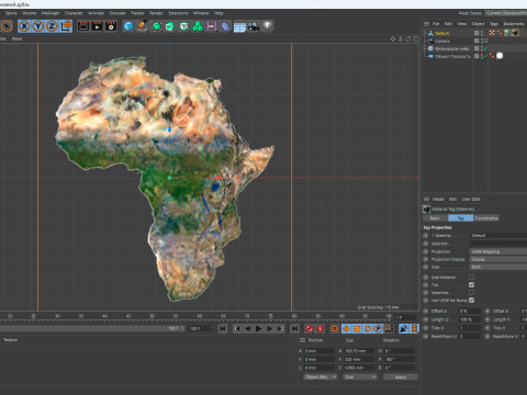
- Formatos disponíveis: Cinema4D (.c4d) 933.94 MB
Tornar: Standard
- Polígonos:7 988 024
- Vértices:3 998 016
- Animados:No
- Textura:
- Equipados:No
- Materiais:
- Low-poly:No
- Coleção:No
- Mapeamento UVW:No
- Plugins Utilizados:No
- Pronto para impressão:No
- Scan 3D:No
- Conteúdo adulto:No
- PBR:No
- Treinamento de IA:No
- Geometria:Polygonal
- UVs não embalados:Unknown
- Visualizações:7318
- Data: 2024-05-24
- ID do Item:508213
Relief of Africa Explore its Diverse Terrain Modelo 3D c4d, De sychev23021983
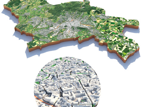
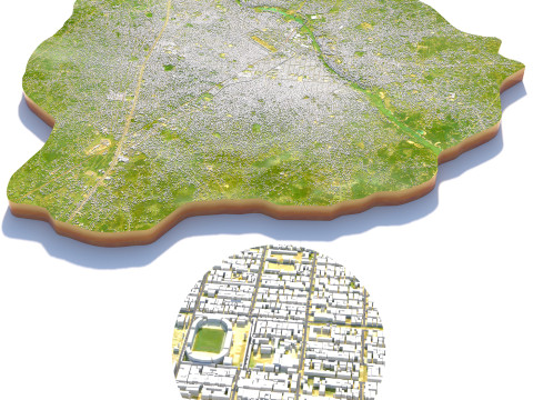
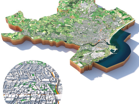
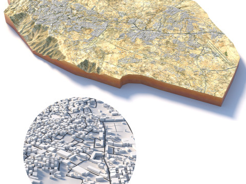
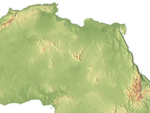
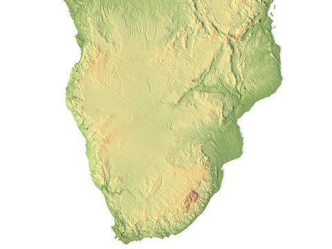
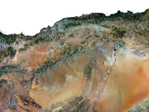
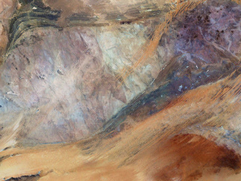
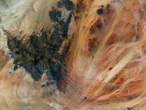
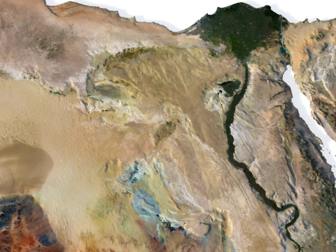
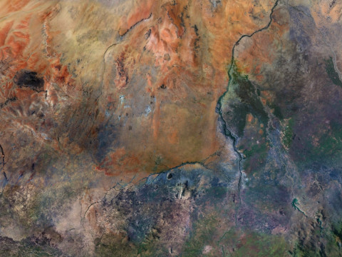
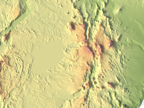
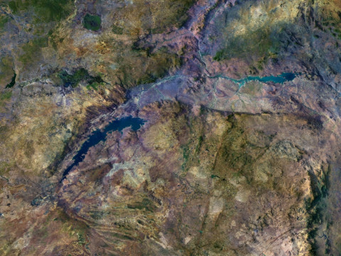
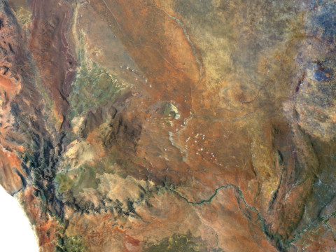
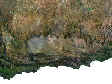
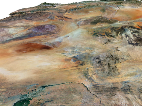
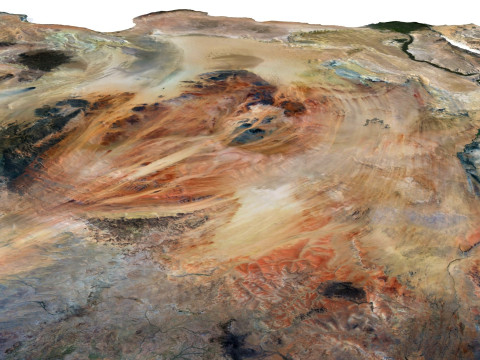
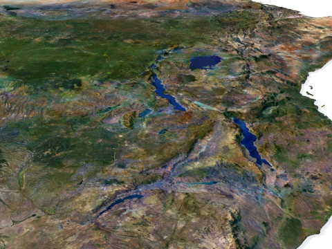
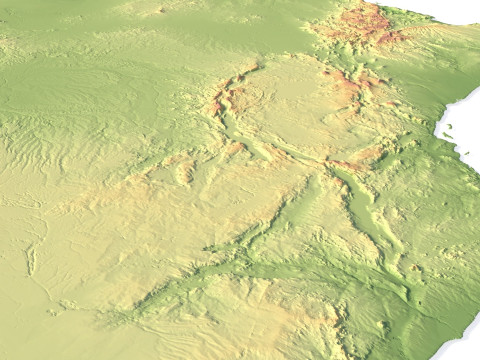
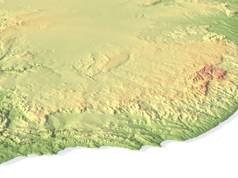
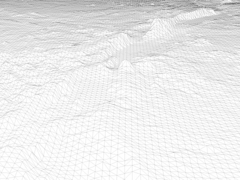
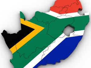
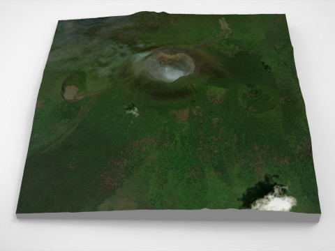
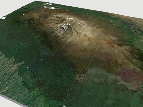
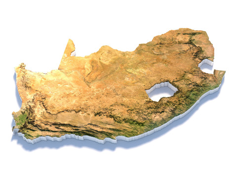
Explore the dynamic relief of the African continent with our three-dimensional model. From majestic mountains to expansive plains, open valleys, and scenic coastlines, our model provides a detailed depiction of the diversity of landscapes across this remarkable continent.
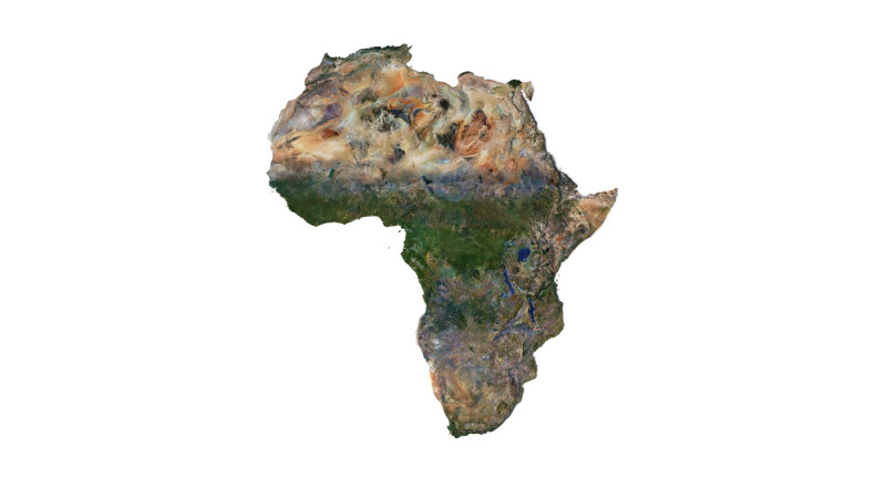
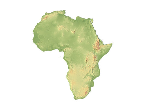
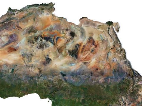
Africa Terrain 3D Map 3D Model
3D models
- Format: C4D
- File size (unzipped): 457 MB
- Polygons: 7 9** 024
- Vertices: 3 998 016
- Geometry: Polygonal Tris only
- Model size: 183.75 mm x 205 mm x 0.995 mm
- Projection: Mercator
- Base: Open
Textures
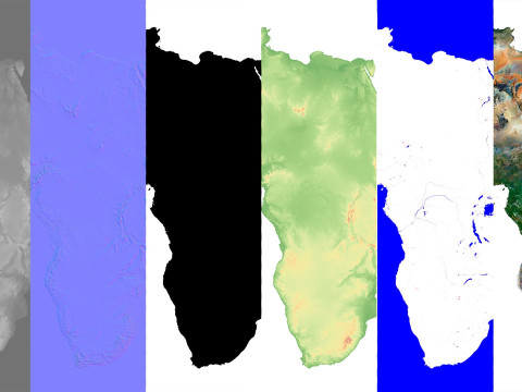
- Height Map TIF 7344*8193*16b - You can use this map in the displacement channel instead of the polygonal mesh.
- Normal Map TIF 7344*8193*48b - Use this map to reveal fine details of the relief.
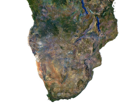
- Satellite Map TIF 14700*16400*48b
- Water Mask TIF 14700*16400*48b - Use this map for masking in the Reflection channel to get glare from the water surface.
- Pseudo-color Map 14700*16400*48b - Use this map to get elevation information based on the color shade.
- Boundary Mask TIF 14700*16400*48b - Use this map as a mask for your background.
Other models can be made on request.
Modifications, conversion to OBJ, FBX, STL and other formats, more detailed models and better textures on request.
Shustrik-Maps.com – Premium 3D Models for Terrain, Maps & Beyond
High-Quality STL Files for 3D Printing & CNC
Precisa de mais formatos?
Se precisar de um formato diferente, por favor abra um novo Support Ticket e solicite isso. Podemos converter modelos 3D para: .stl, .c4d, .obj, .fbx, .ma/.mb, .3ds, .3dm, .dxf/.dwg, .max. .blend, .skp, .glb. Não convertemos cenas 3D e formatos como .step, .iges, .stp, .sldprt.!Informação de utilização
Relief of Africa Explore its Diverse Terrain - Pode utilizar este modelo 3D isento de royalties para fins pessoais e comerciais, de acordo com a Licença Básica ou Prolongada.A Licença Básica abrange a maioria dos casos de utilização padrão, incluindo anúncios digitais, projetos de design e visualização, contas comerciais em redes sociais, aplicações nativas, aplicações web, videojogos e produtos finais físicos ou digitais (gratuitos e vendidos).
A Licença Estendida inclui todos os direitos concedidos ao abrigo da Licença Básica, sem limitações de utilização, e permite que o modelo 3D seja utilizado em projetos comerciais ilimitados ao abrigo dos termos de isenção de royalties.
Leia mais
Vocêm fornecem garantia de devolução do dinheiro?
Sim, fornecemos. Se você comprou um produto e encontrou algum erro nas renderizações ou na descrição, tentaremos corrigir o problema assim que possível. Se não pudermos corrigir o erro, cancelaremos seu pedido e você receberá seu dinheiro de volta em até 24 horas após fazer o download do item. Leia mais condições aquiPalavras-chave
africa landscape terrain map relief topography continent geographic landscapes geological cartographyNão há comentários para este item.

dae fbx mb obj stl png
deformer
Landscapes