English
 Español
 Deutsch
 日本語
日本語 Polska
 Français
 中國
中國 한국의
한국의 Українська
 Italiano
 Nederlands
 Türkçe
 Português
 Bahasa Indonesia
 Русский
 हिंदी
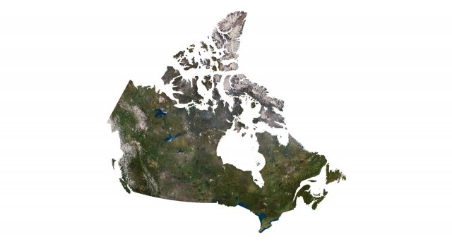
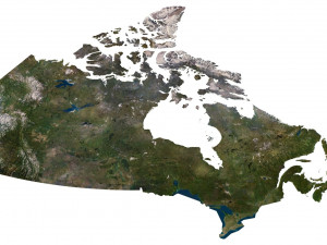
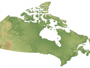
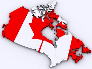
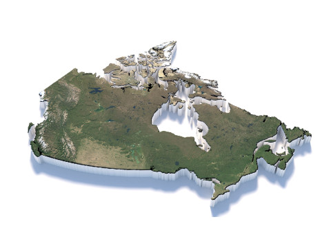
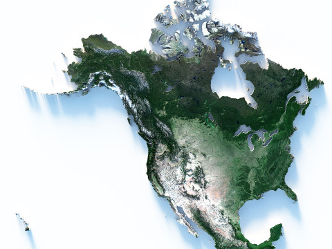
हिंदीCanada Terrain 3D Map 3D Модель

-20%
obj c4d stl
sychev23021983
Landscapes
$31.20
$39.00
HALLOWEEN
PRE SALE 50% OFF
$
36.80 USD
У вас есть $0.00 Кредиты. Купить Кредиты

- Доступные форматы: Cinema4D (.c4d) 944.56 MB
Рендер: Standard
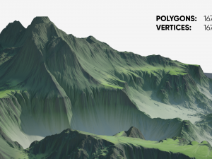
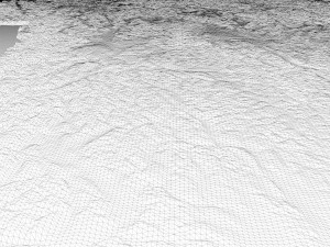
- Полигоны:9 985 440
- Вершины:4 997 195
- Анимированная:No
- Текстуры:
- Скелет:No
- Материалы:
- Лоу-поли:No
- Коллекция:No
- UVW mapping:
- Плагины:No
- Для печати:No
- 3D Скан:No
- Контент для взрослых:No
- PBR:No
- Геометрия:Polygonal
- Unwrapped UVs:Unknown
- Просмотры:2616
- Дата: 2023-07-05
- ID Продукта:453376
Format: C4D
File size (unzipped): 571 MB
Polygons: 9 985 440
Vertices: 4 997 195
Geometry: Polygonal Tris only
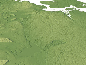
Model size: 1375 mm x 1200 mm x 3.46 mm
Projection: Lambert Conformal Conic
Base: Open
UV layer: Yes (frontal)
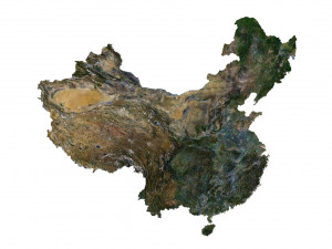
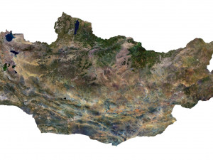
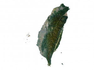
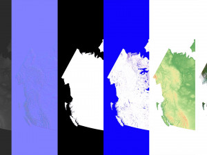
Textures
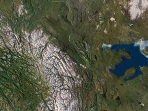
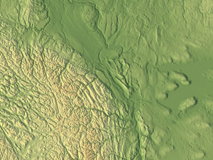
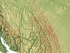
Height Map TIF 8193*7448*16b - You can use this map in the displacement channel instead of the polygonal mesh.
Normal Map TIF 8193*7448*48b - Use this map to reveal fine details of the relief.
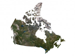
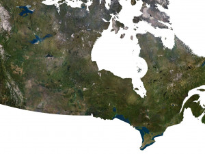
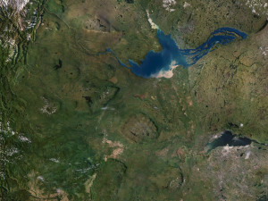
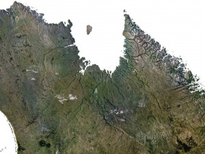
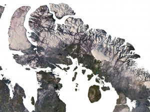
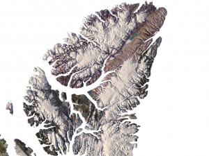
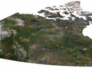
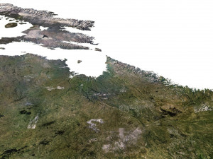
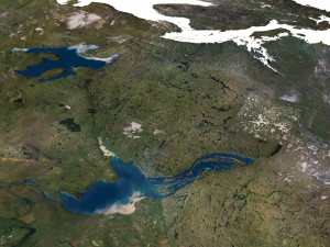
Satellite Map TIF 11000*10000*48b
Water Mask TIF 11000*10000*48b - Use this map for masking in the Reflection channel to get glare from the water surface.
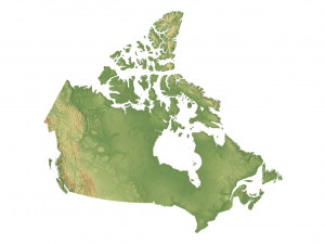
Pseudo-color Map 11000*10000*48b - Use this map to get elevation information based on the color shade.
Boundary Mask TIF 11000*10000*48b - Use this map as a mask for your background.
Other models can be made on request.
Modifications, conversion to OBJ, FBX, STL and other formats, more detailed models and better textures on request. Для печати: Нет
ПодробнейFile size (unzipped): 571 MB
Polygons: 9 985 440
Vertices: 4 997 195
Geometry: Polygonal Tris only
Model size: 1375 mm x 1200 mm x 3.46 mm
Projection: Lambert Conformal Conic
Base: Open
UV layer: Yes (frontal)
Textures
Height Map TIF 8193*7448*16b - You can use this map in the displacement channel instead of the polygonal mesh.
Normal Map TIF 8193*7448*48b - Use this map to reveal fine details of the relief.
Satellite Map TIF 11000*10000*48b
Water Mask TIF 11000*10000*48b - Use this map for masking in the Reflection channel to get glare from the water surface.
Pseudo-color Map 11000*10000*48b - Use this map to get elevation information based on the color shade.
Boundary Mask TIF 11000*10000*48b - Use this map as a mask for your background.
Other models can be made on request.
Modifications, conversion to OBJ, FBX, STL and other formats, more detailed models and better textures on request. Для печати: Нет
Нужно больше форматов?
Если вам необходим другой формат, пожалуйста, сделайте запрос при помощи тикета поддержки. Мы можем cконвертировать 3D модели в такие форматы: .stl, .c4d, .obj, .fbx, .ma/.mb, .3ds, .3dm, .dxf/.dwg, .max. .blend, .skp, .glb. Мы не конвертируем 3d сцены и такие форматы, как .step, .iges, .stp, .sldprt и т. д.!
Если вам необходим другой формат, пожалуйста, сделайте запрос при помощи тикета поддержки. Мы можем cконвертировать 3D модели в такие форматы: .stl, .c4d, .obj, .fbx, .ma/.mb, .3ds, .3dm, .dxf/.dwg, .max. .blend, .skp, .glb. Мы не конвертируем 3d сцены и такие форматы, как .step, .iges, .stp, .sldprt и т. д.!
Canada Terrain 3D Map 3D Модель c4d, от sychev23021983
canada northern america map landscape terrain country relief geography continent mountainК данному товару нет ни одного комментария.

-50%

dae fbx mb obj stl png
deformer
Landscapes