English
 Español
 Deutsch
 日本語
日本語 Polska
 Français
 中國
中國 한국의
한국의 Українська
 Italiano
 Nederlands
 Türkçe
 Português
 Bahasa Indonesia
 Русский
 हिंदी
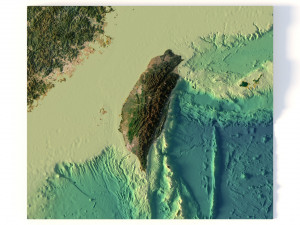
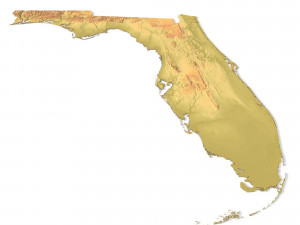
हिंदीFlorida Topographic Map STL Model 3D 打印模型


- 请求作者的产品支持

- 可用的格式:
- 项目 ID:402263
- 日期: 2022-06-17
- 集合:No
- 以毫米为单位的宽度:338
- 以毫米为单位的高度:0.25
- 以毫米为单位的深度:324
- 打印准备:No
- 3D扫描:No
- 成人内容:No
- PBR:No
- 人工智能培训:No
- 日期:2532
描述
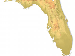
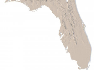
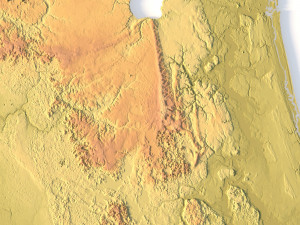
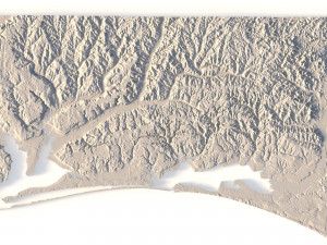
Create Detailed Florida Terrain Models with This 3D STL File
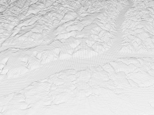
The Florida Topographic Map STL model provides an accurate representation of the state’s topography and elevation. Ideal for crafting physical models from wood, metal, plastic, or concrete, this 3D model is perfect for creating raised relief maps and visualizing terrain features. It is designed for professionals and hobbyists looking to capture Florida’s unique geographical features using GIS data for precise landscape modeling.
- File size: 808 MB / 400 MB
- Model size: 338.4 mm x 324.42 mm x 0.246 mm
- Resolution: 0,06 mm
- Projection: Mercator
- Scaling factor: X — 1; Y — 1; Z — 3
- Polygons: 16 958 128
- Vertices: 8 530 608
- Geometry: Polygonal Tris only
- Base: Open / Closed
Features of the Florida Topographic STL Model
Compatible with FDM/SLA 3D printers for creating physical models.
Works with CNC machines for wood or metal terrain carving.
Supports laser engraving for high-precision topographic detail on metal surfaces.
需要更多的格式吗?
如果你需要一个不同的格式,请打开一个新的支持票和为此请求。我们可以转换到 3D 模型: .stl, .c4d, .obj, .fbx, .ma/.mb, .3ds, .3dm, .dxf/.dwg, .max. .blend, .skp, .glb. 免费格式转换我们不转换 3d 场景 以及 .step, .iges, .stp, .sldprt 等格式。!
使用信息
Florida Topographic Map STL Model - 您可以根据基本许可或扩展许可,将此免版税 3D 模型用于个人或商业用途。基本许可涵盖大多数标准用例,包括数字广告、设计和可视化项目、商业社交媒体账户、原生应用、Web 应用、视频游戏以及实体或数字最终产品(免费和出售)。
扩展许可包含基本许可授予的所有权利,没有任何使用限制,并允许在免版税条款下将 3D 模型用于无限的商业项目。
阅读更多
你提供退款保证呢?
是的我们做了。如果你购买的产品呈现或描述中发现一些错误,我们会尽快解决这个问题。如果我们不能纠正错误,我们将取消您的订单,你会得到你的钱回来在 24 小时内下载该项目。 阅读更多的条件在这里关键字
作者的随机物品