English
 Español
 Deutsch
 日本語
日本語 Polska
 Français
 中國
中國 한국의
한국의 Українська
 Italiano
 Nederlands
 Türkçe
 Português
 Bahasa Indonesia
 Русский
 हिंदी
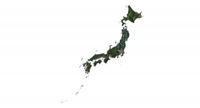
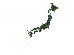
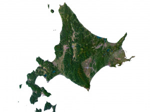
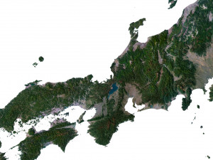
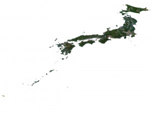
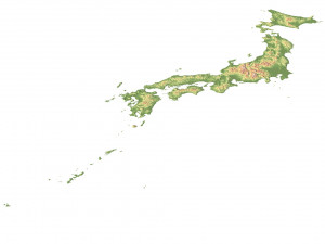
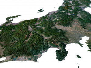
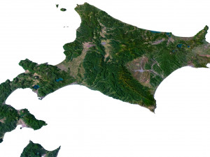
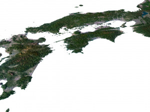
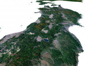
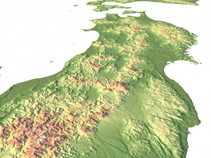
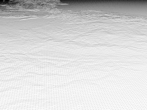
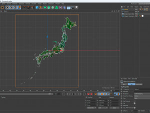
हिंदीJapan Terrain 3D Map 3D 模型


- 可用的格式: Cinema4D (.c4d) 194.32 MB
渲染: StandardAutodesk FBX (.fbx) 203.40 MB
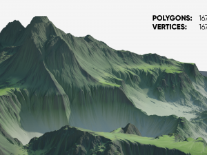
- 多边形:9 986 528
- 顶点:4 997 745
- 动画:No
- 纹理:
- 操纵:No
- 材料:
- 低聚:No
- 集合:No
- UVW 贴图:
- 使用插件:No
- 打印准备:No
- 3D扫描:No
- 成人内容:No
- PBR:No
- 人工智能培训:No
- 几何:Polygonal
- 包装 UVs:Unknown
- 日期:2396
- 日期: 2023-07-04
- 项目 ID:453220
Format: C4D
File size (unzipped): 571 MB
Polygons: 9 986 528
Vertices: 4 997 745
Geometry: Polygonal Tris only
Model size: 1087.5 mm x 1250 mm x 1.154 mm
Projection: Mercator
Base: Open
UV layer: Yes (frontal)
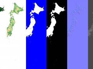
Textures
Height Map TIF 7128*8193*16b - You can use this map in the displacement channel instead of the polygonal mesh.
Normal Map TIF 7128*8193*48b - Use this map to reveal fine details of the relief.
Satellite Map TIF 8704*1004*24b
Water Mask TIF 8704*1004*24b - Use this map for masking in the Reflection channel to get glare from the water surface.
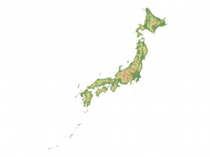
Pseudo-color Map 8704*1004*24b - Use this map to get elevation information based on the color shade.
Boundary Mask TIF 8704*1004*24b - Use this map as a mask for your background.
Other models can be made on request.
Modifications, conversion to OBJ, FBX, STL and other formats, more detailed models and better textures on request.
如果你需要一个不同的格式,请打开一个新的支持票和为此请求。我们可以转换到 3D 模型: .stl, .c4d, .obj, .fbx, .ma/.mb, .3ds, .3dm, .dxf/.dwg, .max. .blend, .skp, .glb. 我们不转换 3d 场景 以及 .step, .iges, .stp, .sldprt 等格式。!
Japan Terrain 3D Map 3D 模型 c4d, fbx, 从 sychev23021983
japan iceland map landscape terrain country relief geography continent mountain