English
 Español
 Deutsch
 日本語
日本語 Polska
 Français
 中國
中國 한국의
한국의 Українська
 Italiano
 Nederlands
 Türkçe
 Português
 Bahasa Indonesia
 Русский
 हिंदी
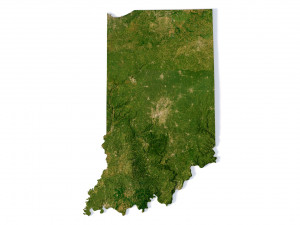
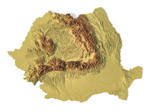
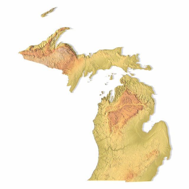
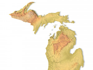
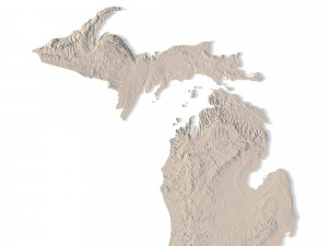
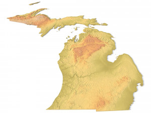
हिंदी密歇根州地形图STL模型 3D 打印模型
- 请求作者的产品支持

- 可用的格式:
- 项目 ID:402312
- 日期: 2022-06-17
- 集合:No
- 以毫米为单位的宽度:356
- 以毫米为单位的高度:0.8
- 以毫米为单位的深度:408
- 打印准备:
- 3D扫描:No
- 成人内容:No
- PBR:No
- 人工智能培训:No
- 日期:2595
描述
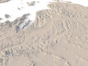
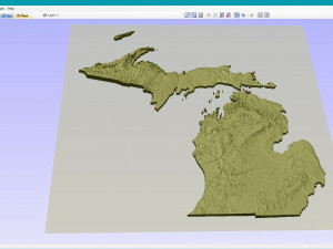
Create Detailed Michigan Terrain Models with This High-Resolution 3D STL
The Michigan Topographic Map STL model provides a high-resolution depiction of the state’s diverse topography and distinctive geographic features. This 3D model is ideal for creating physical relief maps from materials such as wood, metal, plastic, or concrete. Whether for landform visualization, educational projects, or professional GIS applications, this model delivers accurate elevation data for detailed terrain modeling. Perfect for use with 3D printers, CNC machines, and laser engravers.
- File size: 1.21 GB / 622 MB
- Model size: 356.1 mm x 407.76 mm x 0.842 mm
- Resolution: 0,06 mm
- Projection: Mercator
- Scaling factor: X — 1; Y — 1; Z — 3
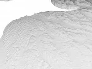
- Polygons: 26 204 218
- Vertices: 13 137 353
- Geometry: Polygonal Tris only
- Base: Open / Closed
Features of the Michigan Topographic STL Model
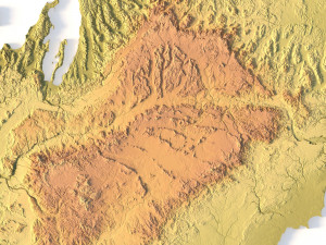
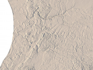
Precise elevation data capturing Michigan’s varied landforms, from its Great Lakes shoreline to inland areas.
Compatible with FDM/SLA 3D printers for creating detailed terrain models.
Designed for CNC machining to craft relief maps from wood or metal.
Supports high-precision laser engraving for detailed metal surfaces.
需要更多的格式吗?
如果你需要一个不同的格式,请打开一个新的支持票和为此请求。我们可以转换到 3D 模型: .stl, .c4d, .obj, .fbx, .ma/.mb, .3ds, .3dm, .dxf/.dwg, .max. .blend, .skp, .glb. 免费格式转换我们不转换 3d 场景 以及 .step, .iges, .stp, .sldprt 等格式。!
使用信息
密歇根州地形图STL模型 - 您可以根据基本许可或扩展许可,将此免版税 3D 模型用于个人或商业用途。基本许可涵盖大多数标准用例,包括数字广告、设计和可视化项目、商业社交媒体账户、原生应用、Web 应用、视频游戏以及实体或数字最终产品(免费和出售)。
扩展许可包含基本许可授予的所有权利,没有任何使用限制,并允许在免版税条款下将 3D 模型用于无限的商业项目。
阅读更多