English
 Español
 Deutsch
 日本語
日本語 Polska
 Français
 中國
中國 한국의
한국의 Українська
 Italiano
 Nederlands
 Türkçe
 Português
 Bahasa Indonesia
 Русский
 हिंदी
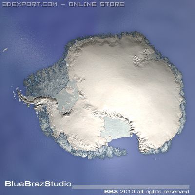
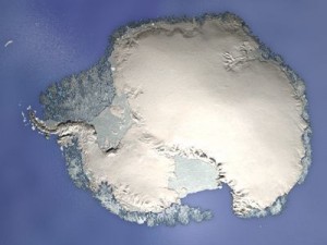
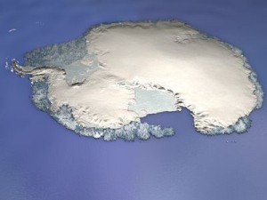
हिंदीsouth pole 3D 模型
$
50.00 USD
- 请求作者的产品支持

- 可用的格式:
- 项目 ID:21514
- 日期: 2010-01-08
- 多边形:34648
- 顶点:62324
- 动画:No
- 纹理:
- 操纵:No
- 材料:
- 几何:Polygonal
- 日期:5246
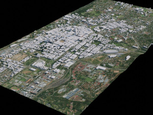
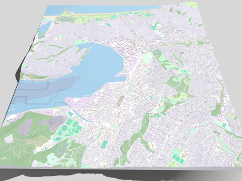
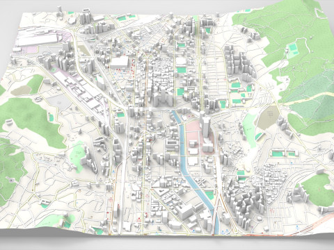
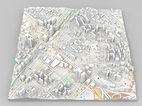
描述
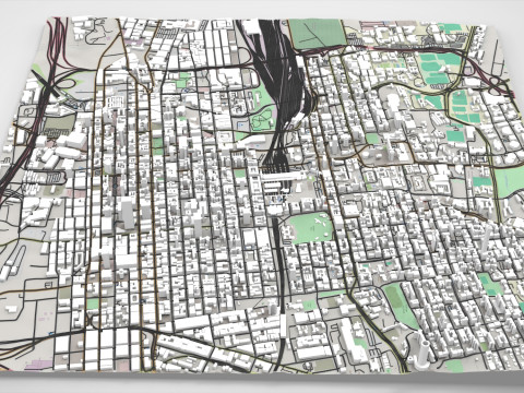
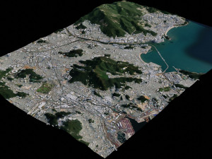
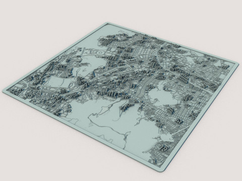
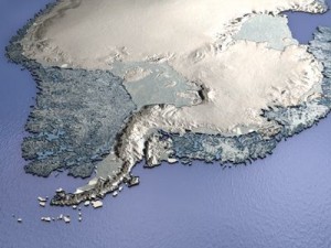
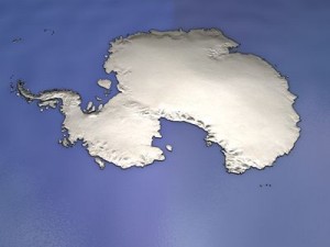
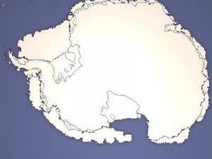
c4d file (obj-dxf-3ds) for a 3d relief map of south poleall formats zip files has enclosed tex, material and maps. but it could need some texture reassigning.
polygons 34648
vertices 62324
需要更多的格式吗?
如果你需要一个不同的格式,请打开一个新的支持票和为此请求。我们可以转换到 3D 模型: .stl, .c4d, .obj, .fbx, .ma/.mb, .3ds, .3dm, .dxf/.dwg, .max. .blend, .skp, .glb. 免费格式转换我们不转换 3d 场景 以及 .step, .iges, .stp, .sldprt 等格式。!
使用信息
south pole - 您可以根据基本许可或扩展许可,将此免版税 3D 模型用于个人或商业用途。基本许可涵盖大多数标准用例,包括数字广告、设计和可视化项目、商业社交媒体账户、原生应用、Web 应用、视频游戏以及实体或数字最终产品(免费和出售)。
扩展许可包含基本许可授予的所有权利,没有任何使用限制,并允许在免版税条款下将 3D 模型用于无限的商业项目。
阅读更多
你提供退款保证呢?
是的我们做了。如果你购买的产品呈现或描述中发现一些错误,我们会尽快解决这个问题。如果我们不能纠正错误,我们将取消您的订单,你会得到你的钱回来在 24 小时内下载该项目。 阅读更多的条件在这里关键字
作者的随机物品


没有对这一项目的评论。