English
 Español
 Deutsch
 日本語
日本語 Polska
 Français
 中國
中國 한국의
한국의 Українська
 Italiano
 Nederlands
 Türkçe
 Português
 Bahasa Indonesia
 Русский
 हिंदी
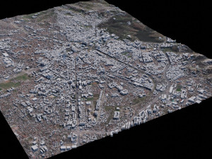
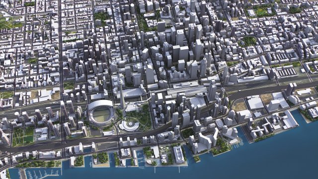
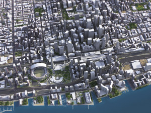
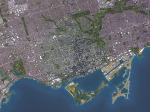
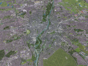
हिंदीToronto - 3D City Model 低聚 3D 模型


$
399.00 USD
你有 $0.00 学分. 买学分

- 可用的格式: Autodesk 3DS MAX (.max) 212.11 MB
- 多边形:1
- 顶点:1
- 动画:
- 纹理:
- 操纵:No
- 材料:
- 低聚:
- 集合:No
- UVW 贴图:
- 使用插件:No
- 打印准备:No
- 3D扫描:No
- 成人内容:No
- PBR:
- 人工智能培训:
- 几何:Polygonal
- 包装 UVs:No
- 日期:1407
- 日期: 2024-01-22
- 项目 ID:488194
Toronto - 3D City Model 3D 模型 max, 从 3d.city.models
TOP-QUALITY 3D CITY MODEL - 2024 UPDATE- Message us to get a FREE sample scene of this product!
- Download an overview sample - https://each.city/sample
- 24/7 customer support — customization, flexible pricing and exclusive discounts
WHAT IS INCLUDED
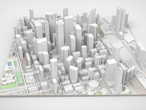
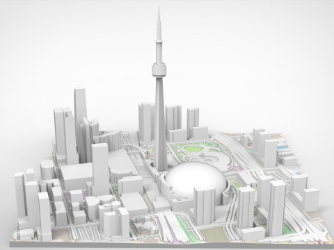
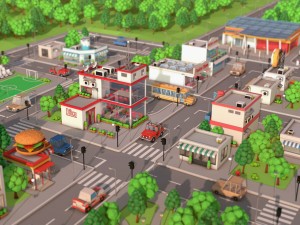
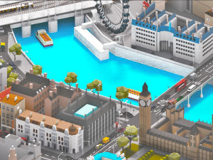
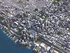
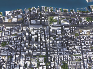
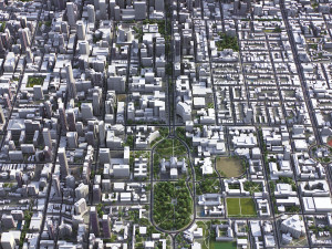
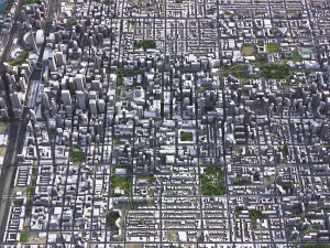
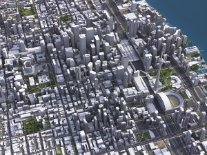
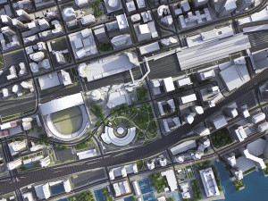
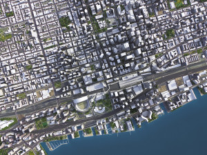
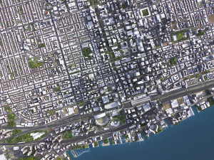
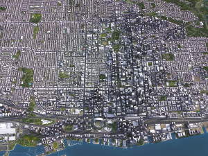
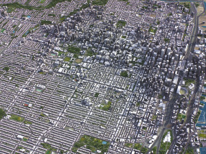
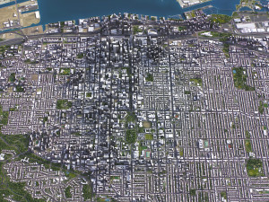
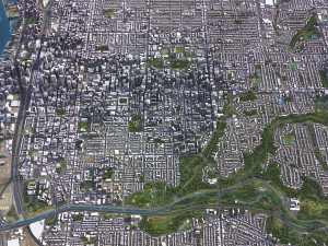
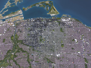
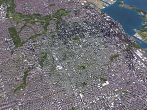
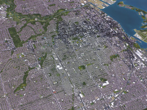
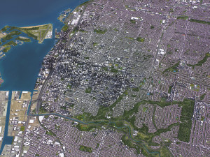
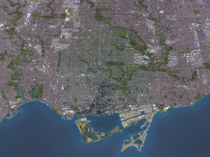
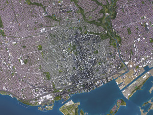
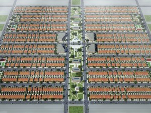
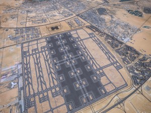
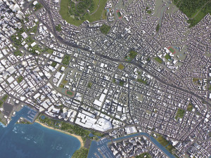
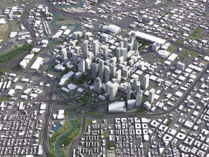
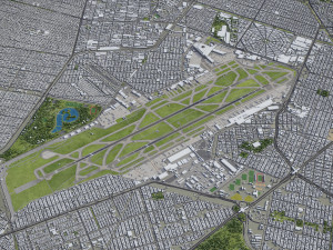
- Scene size: Entire area — refer to promo images for scene extents
- Units: Meters — real-world scale
- Updated: January 2024 — want the latest? Ask before you pay
KEY BENEFITS
- 24/7 customer support — reach out to us anytime for pre-sale inquiries or after-sale support
- Extensive file format support — 3ds Max (native), fbx, obj, dae, c4d, skp, 3dm, rvt, blend, etc., or ask for more before payment
- Georeferencing — either Web Mercator, Trаnsverse Mercator, or original CRS. If a specific CRS is essential, ask before you pay
- Any scene size or crop to an area-of-interest — for best performance and format compatibility, inquire before paying
- Buildings, land-use areas, roads and railways split by type — layers / named objects
- Detailed landmarks with regular updates and improvements — available annually or upon pre-purchase inquiry
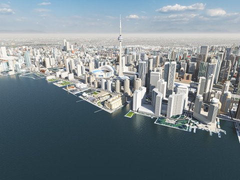
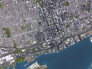
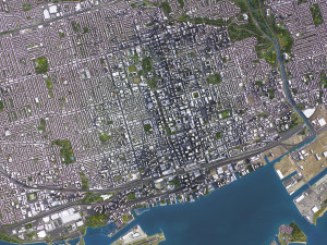
- Realistic and detailed surface texture — 1-meter resolution satellite imagery
- Flat surface, easy for detailing and geometry edits — topography terrain available at an additional cost. Message us for a quote
- Realistic low-poly vegetation — individual trees in max and fbx formats, additional formats upon request before you pay
- Product is ready to render out-of-the-box — 3ds Max + Corona Render
PRESENTATION IMAGES & MATERIALS
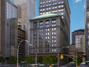
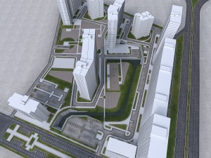
- 4K high-resolution renders — refer to images for level of detail and scene size
- Produced in 3ds Max — other software requires its rendering settings
- Trees, vegetation, land-use and airport surface with the textures assigned
- Buildings are UV mapped, split by material IDs, and no textures assigned
CUSTOMIZE & SAVE
- Message us to get a fully customizable model based on the options listed below
- Fast turnaround, flexible pricing and discounts
DATA AUTHENTICITY
- 100% real buildings coverage — unlike other sellers, we don’t use AI generated building footprints
- Combining multiple sources — you may provide us with any dataset to include in the model
GEOREFERENCING and GEOLOCATION - allows you to precisely position 3D content
- Web Mercator / WGS 84 — specified by true scale latitude
- Trаnsverse Mercator — defined by central meridian
- Original CRS — local or optimal for this area
TOPOGRAPHY TERRAIN
- Up to 1-meter accuracy digital terrain model (DTM) — quad mesh
- Multiple terrain LODs — triangle mesh optimized for the best polycount / details balance
- Buildings and roads placed on the optimized terrain
- Separate land surface and water bodies
- High-resolution satellite or surface texture — up to 0.2 meter accuracy
- Contour lines — 3D splines, up to 1-meter interval
MANUAL MODELING
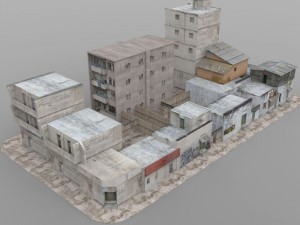
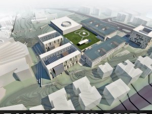
- Buildings and structures — LOD2 and LOD3
- Elevated highways — interchanges, bridges and flyovers
TEXTURING
- High-resolution surface texture — satellite image up to 0.2 meter accuracy
- Streets and roads with markings texture — UV mapped along the center line
- Procedural textures assigned to all buildings — LOD1 only
- Realistic textures on individual buildings — LOD2 and LOD3
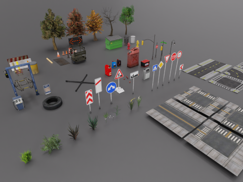
TREES & FORESTS
- Individual trees — real trees from OSM data
- Procedural forests — based on distribution areas, convertible to individual trees
OTHER EXTRAS
- Individual buildings and streets — separate objects with address and/or name
- Administrative boundaries of all levels — named polygons or outlines
- Road and railway splines — for traffic animation, etc.
- Public trаnsport stops — individual named objects
FILE FORMATS
- max — Autodesk 3ds Max
- fbx, obj, dae, 3ds — Exchange Formats
- uproject, uasset — Unreal Engine
- glb, gltf — Games, Web, AR/VR
- unitypackage — Unity 3D
- 3dm — Rhino 3D
- skp — SketchUp
- rvt — Autodesk Revit
- c4d — Cinema4D
- blend — Blender
- ma, mb — Autodesk Maya
- dwg, dxf — Autodesk AutoCAD
- stl — 3D Print
需要更多的格式吗?
如果你需要一个不同的格式,请打开一个新的支持票和为此请求。我们可以转换到 3D 模型: .stl, .c4d, .obj, .fbx, .ma/.mb, .3ds, .3dm, .dxf/.dwg, .max. .blend, .skp, .glb. 我们不转换 3d 场景 以及 .step, .iges, .stp, .sldprt 等格式。!使用信息
Toronto - 3D City Model - 您可以根据基本许可或扩展许可,将此免版税 3D 模型用于个人或商业用途。基本许可涵盖大多数标准用例,包括数字广告、设计和可视化项目、商业社交媒体账户、原生应用、Web 应用、视频游戏以及实体或数字最终产品(免费和出售)。
扩展许可包含基本许可授予的所有权利,没有任何使用限制,并允许在免版税条款下将 3D 模型用于无限的商业项目。
阅读更多
你提供退款保证呢?
是的我们做了。如果你购买的产品呈现或描述中发现一些错误,我们会尽快解决这个问题。如果我们不能纠正错误,我们将取消您的订单,你会得到你的钱回来在 24 小时内下载该项目。 阅读更多的条件在这里关键字
没有对这一项目的评论。