
 English
 Español
 Deutsch
 日本語
日本語 Polska
 Français
 中國
中國 한국의
한국의 Українська
 Italiano
 Nederlands
 Türkçe
 Português
 Bahasa Indonesia
 Русский
 हिंदी
हिंदीMinnesota Topographic Map STL Model 3D Принт Модель


- Доступные форматы:
- Бесплатное конвертирование
- Коллекция:No
- Ширина в миллиметрах:345
- Высота в миллиметрах:1
- Глубина в миллиметрах:380
- Для печати:
- 3D Скан:No
- Контент для взрослых:No
- PBR:No
- AI Обучение:No
- Просмотры:2332
- Дата: 2022-06-17
- ID Продукта:402313
Minnesota Topographic Map STL Model 3D Принт Модель от sychev23021983
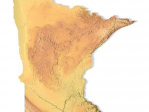
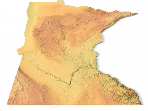
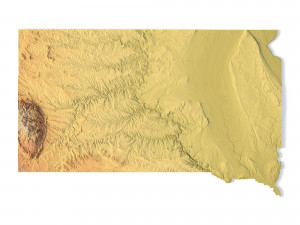
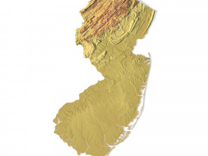
Create Detailed Minnesota Terrain Models with This High-Resolution 3D STL
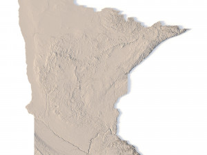
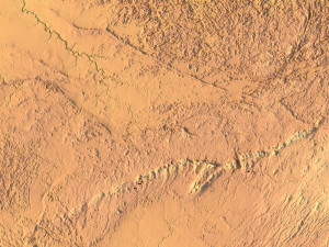
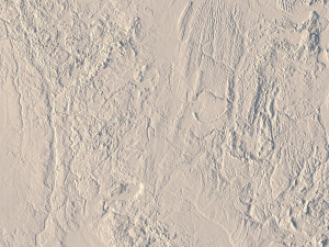
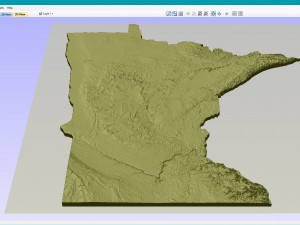
The Minnesota Topographic Map STL model offers a high-resolution depiction of the state’s varied topography and geographic features. This 3D model is perfect for crafting physical relief maps from materials such as wood, metal, plastic, or concrete. Whether used for landform visualization, educational projects, or professional GIS applications, this model provides accurate elevation data for detailed terrain modeling. Ideal for use with 3D printers, CNC machines, and laser engravers.
- File size: 698 MB / 711 MB
- Model size: 345.1 mm x 379.6 mm x 0.956 mm
- Resolution: 0,1 mm
- Projection: Mercator
- Scaling factor: X — 1; Y — 1; Z — 3
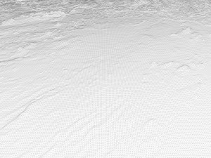
- Polygons: 14 651 674
- Vertices: 7 336 103
- Geometry: Polygonal Tris only
- Base: Open / Closed
Features of the Minnesota Topographic STL Model
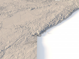
Accurate elevation data showcasing Minnesota’s lakes, plains, and hilly landforms.
Compatible with FDM/SLA 3D printers for creating precise terrain models.
Designed for CNC machining to craft relief maps from wood or metal.
Supports high-precision laser engraving for metal surface detailing.
Нужно больше форматов?
Если вам необходим другой формат, пожалуйста, сделайте запрос при помощи тикета поддержки. Мы можем cконвертировать 3D модели в такие форматы: .stl, .c4d, .obj, .fbx, .ma/.mb, .3ds, .3dm, .dxf/.dwg, .max. .blend, .skp, .glb. Мы не конвертируем 3d сцены и такие форматы, как .step, .iges, .stp, .sldprt и т. д.!Информация об использовании
Minnesota Topographic Map STL Model - Вы можете использовать эту бесплатную 3D модель как в личных, так и в коммерческих целях в соответствии с Базовой или Расширенной лицензией.Базовая лицензия охватывает большинство стандартных вариантов использования, включая цифровую рекламу, проекты дизайна и визуализации, бизнес-аккаунты в социальных сетях, нативные приложения, веб-приложения, видеоигры, а также физические или цифровые конечные продукты (как бесплатные, так и платные).
Расширенная лицензия включает в себя все права, предоставленные в рамках Базовой лицензии, без ограничений по использованию и позволяет использовать 3D модель в неограниченном количестве коммерческих проектов на условиях безвозмездной оплаты.
Подробней
Есть ли у вас Гарантия Возврата Денег?
Если какой либо продукт не соответствует описанию продукта или превью на сайте, мы постараемся исправить это как можно скорей, чтобы вы остались довольны. При условии, что ничего нельзя исправить и вы обратитесь к нам в течении 24 часов, мы отменим ваш платёж и деньги вернутся на ваш счёт. Для получения дополнительной информации, пожалуйста, см. подробней в Центре Помощи.Ключевые слова


