English
 Español
 Deutsch
 日本語
日本語 Polska
 Français
 中國
中國 한국의
한국의 Українська
 Italiano
 Nederlands
 Türkçe
 Português
 Bahasa Indonesia
 Русский
 हिंदी
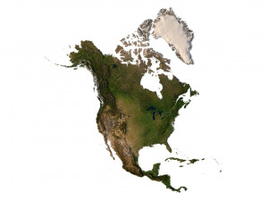
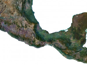
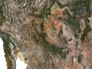
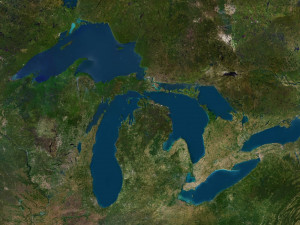
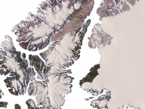
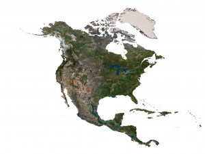
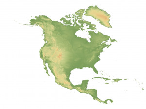
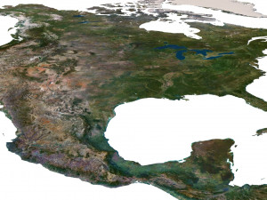
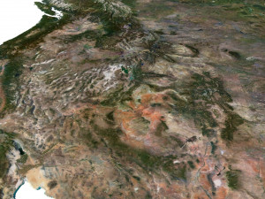
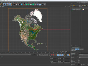
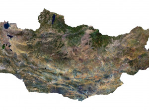
हिंदीNorth America Terrain 3D Map 3D 模型

$
36.80 USD
你有 $0.00 学分. 买学分

- 可用的格式: Cinema4D (.c4d) 426.10 MB
渲染: Standard
- 多边形:9 984 852
- 顶点:4 996 900
- 动画:No
- 纹理:
- 操纵:No
- 材料:
- 低聚:No
- 集合:No
- UVW 贴图:No
- 使用插件:No
- 打印准备:No
- 3D扫描:No
- 成人内容:No
- PBR:No
- 几何:Polygonal
- 包装 UVs:Unknown
- 日期:2525
- 日期: 2023-07-29
- 项目 ID:456686
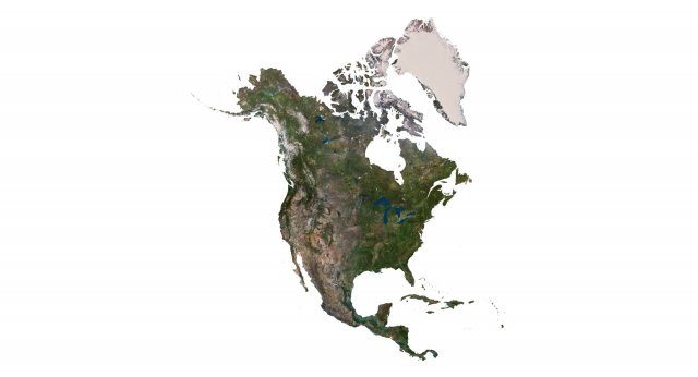
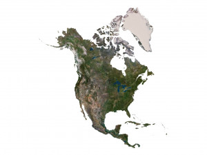
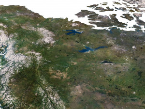
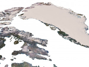
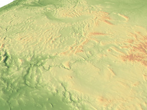
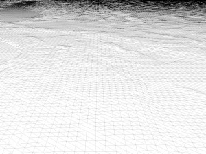
North America Terrain 3D Map 3D 模型 c4d, 从 sychev23021983
Format: C4DFile size (unzipped): 571 MB
Polygons: 9 984 852
Vertices: 4 996 900
Geometry: Polygonal Tris only
Model size: 1375 mm x 1500 mm x 1.34 mm
Projection: Mercator
Base: Open
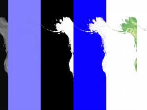
Textures
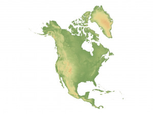
Height Map TIF 7509*8192*16b - You can use this map in the displacement channel instead of the polygonal mesh.
Normal Map TIF 7509*8192*48b - Use this map to reveal fine details of the relief.
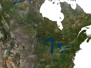
Satellite Map TIF 11000*12000*48b
Water Mask TIF 11000*12000*48b - Use this map for masking in the Reflection channel to get glare from the water surface.
Pseudo-color Map 11000*12000*48b - Use this map to get elevation information based on the color shade.
Boundary Mask TIF 11000*12000*48b - Use this map as a mask for your background.
Other models can be made on request.
Modifications, conversion to OBJ, FBX, STL and other formats, more detailed models and better textures on request. 打印准备: 否
需要更多的格式吗?
如果你需要一个不同的格式,请打开一个新的支持票和为此请求。我们可以转换到 3D 模型: .stl, .c4d, .obj, .fbx, .ma/.mb, .3ds, .3dm, .dxf/.dwg, .max. .blend, .skp, .glb. 我们不转换 3d 场景 以及 .step, .iges, .stp, .sldprt 等格式。!使用信息
North America Terrain 3D Map - 您可以根据基本许可或扩展许可,将此免版税 3D 模型用于个人或商业用途。基本许可涵盖大多数标准用例,包括数字广告、设计和可视化项目、商业社交媒体账户、原生应用、Web 应用、视频游戏以及实体或数字最终产品(免费和出售)。
扩展许可包含基本许可授予的所有权利,没有任何使用限制,并允许在免版税条款下将 3D 模型用于无限的商业项目。
阅读更多
你提供退款保证呢?
是的我们做了。如果你购买的产品呈现或描述中发现一些错误,我们会尽快解决这个问题。如果我们不能纠正错误,我们将取消您的订单,你会得到你的钱回来在 24 小时内下载该项目。 阅读更多的条件在这里关键字
north america landscape terrain country relief geography continent mountain earth map topography topo height elevation atlas没有对这一项目的评论。