English
 Español
 Deutsch
 日本語
日本語 Polska
 Français
 中國
中國 한국의
한국의 Українська
 Italiano
 Nederlands
 Türkçe
 Português
 Bahasa Indonesia
 Русский
 हिंदी
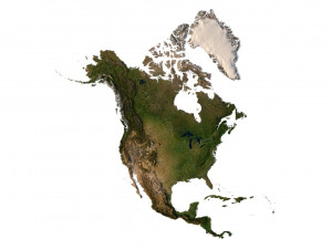
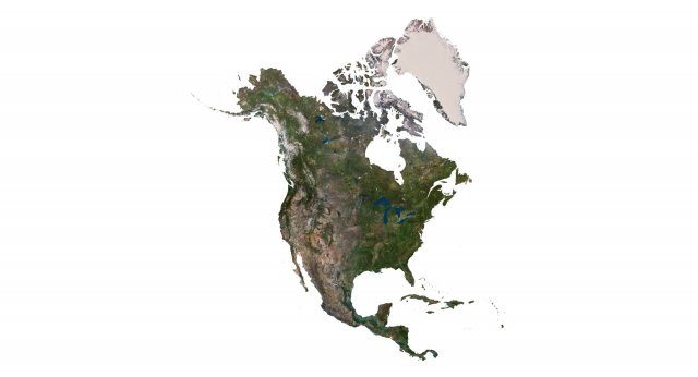
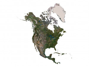
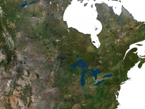
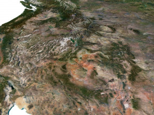
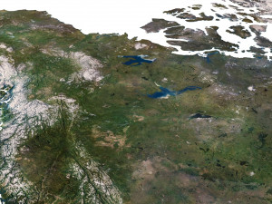
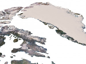
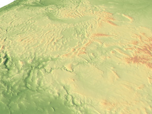
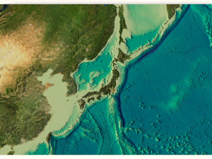
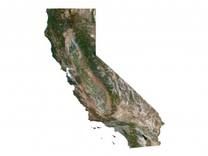
हिंदीNorth America Terrain 3D Map 3D मॉडल


-20%
obj c4d stl
sychev23021983
Landscapes
$31.20
$39.00
$
36.80 USD
आपके पास है $0.00 क्रेडिट्स. क्रेडिट्स खरीदें

- उपलब्ध फ़ॉर्मेट्स: Cinema4D (.c4d) 426.10 MB
रेंडर: Standard
- बहुभुज:9 984 852
- वर्टिसिस:4 996 900
- एनिमेटेड:No
- टेक्सचर:
- रिग्ड:No
- सामग्रियां:
- लो-पॉली:No
- कलेक्शन:No
- UVW मैपिंग:No
- इस्तेमाल किए गए प्लगइन्स:No
- प्रिंट के लिए तैयार:No
- 3D स्कैन:No
- एडल्ट कंटेन्ट:No
- PBR:No
- ज्यामिति:Polygonal
- खुला हुआ UVs:Unknown
- व्यूस:2531
- तिथि: 2023-07-29
- आइटम ID:456686
North America Terrain 3D Map 3D मॉडल c4d, से sychev23021983
Format: C4DFile size (unzipped): 571 MB
Polygons: 9 984 852
Vertices: 4 996 900
Geometry: Polygonal Tris only
Model size: 1375 mm x 1500 mm x 1.34 mm
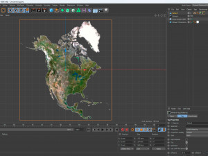
Projection: Mercator
Base: Open
Textures
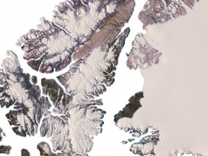
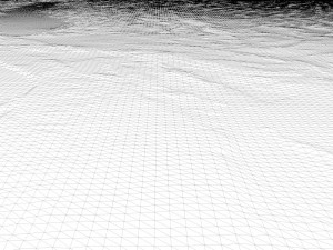
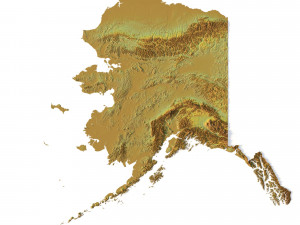
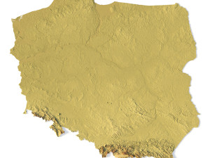
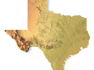
Height Map TIF 7509*8192*16b - You can use this map in the displacement channel instead of the polygonal mesh.
Normal Map TIF 7509*8192*48b - Use this map to reveal fine details of the relief.
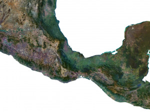
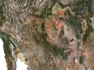
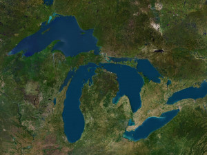
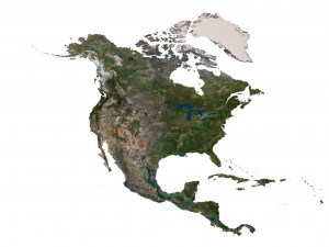
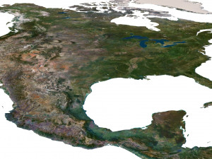
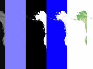
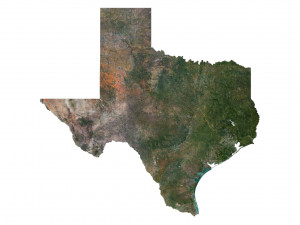
Satellite Map TIF 11000*12000*48b
Water Mask TIF 11000*12000*48b - Use this map for masking in the Reflection channel to get glare from the water surface.
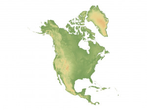
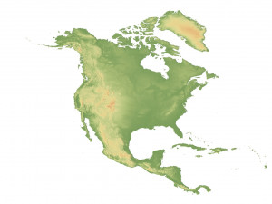
Pseudo-color Map 11000*12000*48b - Use this map to get elevation information based on the color shade.
Boundary Mask TIF 11000*12000*48b - Use this map as a mask for your background.
Other models can be made on request.
Modifications, conversion to OBJ, FBX, STL and other formats, more detailed models and better textures on request. प्रिंट के लिए तैयार: नहीं
क्या आपको और फ़ॉर्मेट्स चाहिए?
अगर आपको किसी अलग फ़ॉर्मेट की जरूरत है, तो कृपया हमें कन्वर्शन अनुरोध भेजें। हम 3D मॉडल को इसमें कन्वर्ट कर सकते हैं: .stl, .c4d, .obj, .fbx, .ma/.mb, .3ds, .3dm, .dxf/.dwg, .max. .blend, .skp, .glb. हम 3D दृश्यों को कन्वर्ट नहीं करते हैं और .step, .uges, .stp, .sldprt जैसे प्रारूप।!Usage Information
North America Terrain 3D Map - You can use this royalty-free 3D model for both personal and commercial purposes in accordance with the Basic or Extended License.The Basic License covers most standard use cases, including digital advertisements, design and visualization projects, business social media accounts, native apps, web apps, video games, and physical or digital end products (both free and sold).
The Extended License includes all rights granted under the Basic License, with no usage limitations, and allows the 3D model to be used in unlimited commercial projects under Royalty-Free terms.
और पढ़ें
क्या आप पैसे वापसी की गारंटी प्रदान करते हैं?
हां, हम करते हैं। अगर आपने कोई उत्पाद खरीदा है और रेंडर या विवरण में कुछ त्रुटि पाई है, तो हम समस्या को जल्द से जल्द ठीक करने का कोशिश करेंगे। अगर हम त्रुटि को ठीक नहीं कर सकते हैं, तो हम आपका ऑर्डर रद्द कर देंगे और आइटम डाउनलोड करने के 24 घंटों के भीतर आपको अपना पैसा वापस मिल जाएगा। और शर्तें यहां पढ़ेंकीवर्ड्स
north america landscape terrain country relief geography continent mountain earth map topography topo height elevation atlasइस आइटम के लिए कोई कमेंट्स नहीं है।