English
 Español
 Deutsch
 日本語
日本語 Français
 한국의
한국의 Nederlands
 Türkçe
Modèle STL de carte topographique du Nebraska Modèles 3D en vedette
- Demander l'assistance produit

- Formats disponibles:
- ID de produit:402320
- Date: 2022-06-17
- Collection:No
- Largeur en millimètres:389
- Hauteur en millimètres:2.1
- Profondeur en millimètres:178
- Prêt à imprimer:Yes
- 3D Balayage:No
- Contenu adulte:No
- PBR:No
- IA Formation:No
- Vus:3419
Description
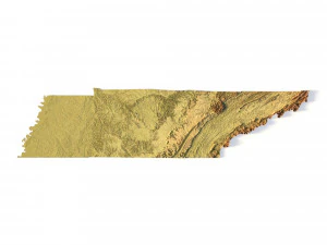
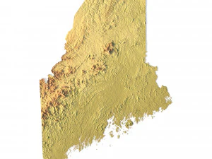
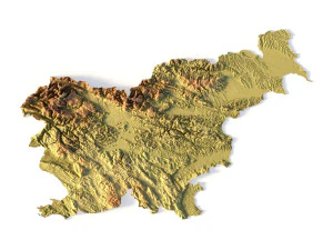
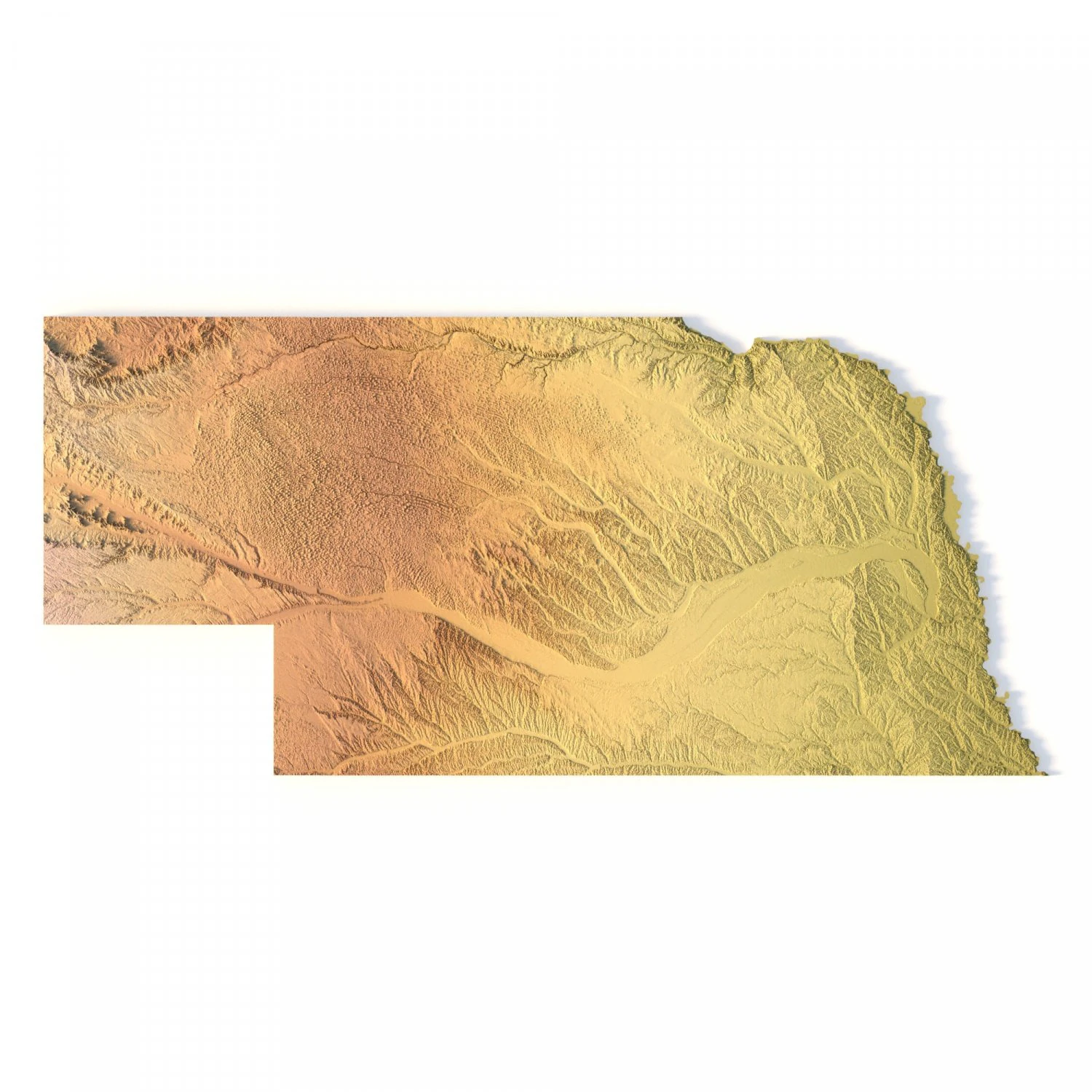
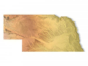
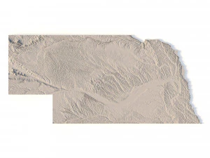
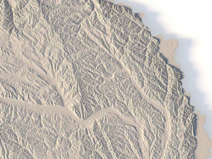
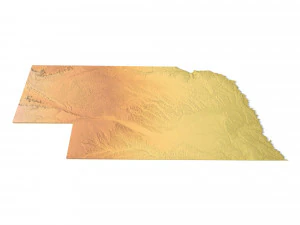
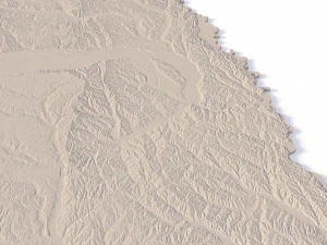
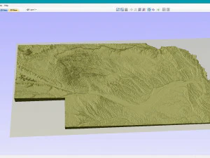
Create Detailed Nebraska Terrain Models with This High-Resolution 3D STL
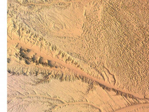
The Nebraska Topographic Map STL model provides a high-resolution depiction of the state’s distinctive topography and geographic features. This 3D model is ideal for crafting physical relief maps from materials like wood, metal, plastic, or concrete. Whether for landform visualization, educational projects, or professional GIS applications, this model offers accurate elevation data for precise terrain modeling. It’s perfect for use with 3D printers, CNC machines, and laser engravers.
- File size: 850 MB / 555 MB
- Model size: 389.36 mm x 177.84 mm x 2.104 mm
- Resolution: 0.08 mm
- Projection: Mercator
- Scaling factor: X – 0.0000004; Y – 0.0000004; Z – 0.0000012
- Number of polygons: 17 842 724
- Number of vertices: 8 929 262
- Polygonal mesh: Triangles only
- Base: Open / Closed
Features of the Nebraska Topographic STL Model
Precise elevation data capturing Nebraska’s plains, sandhills, and river valleys.
Compatible with FDM/SLA 3D printers for high-quality terrain models.
Designed for CNC machining to create relief maps from wood or metal.
Supports high-precision laser engraving for metal surface detailing.
Avez besoin de plus de formats?
Si vous avea besoin d’\autre format veuillez ouvrir un billet d’\assistance et demandez le. Nous pouvons convertir les modèles de 3D en: .stl, .c4d, .obj, .fbx, .ma/.mb, .3ds, .3dm, .dxf/.dwg, .max. .blend, .skp, .glb. Conversion de format libreNous ne convertissons pas les scènes 3D et des formats tels que .step, .iges, .stp, .sldprt.!
Informations d'utilisation
Modèle STL de carte topographique du Nebraska - Vous pouvez utiliser ce modèle 3D libre de droits à des fins personnelles et commerciales, conformément à la Licence de Base ou à la Licence Étendue.La Licence de Base couvre la plupart des cas d'utilisation courants, notamment les publicités numériques, les projets de conception et de visualisation, les comptes de réseaux sociaux professionnels, les applications natives, les applications web, les jeux vidéo et les produits finis physiques ou numériques (gratuits ou payants).
La Licence Étendue inclut tous les droits accordés par la Licence de Base, sans limitation d'utilisation, et autorise l'utilisation du modèle 3D dans un nombre illimité de projets commerciaux, dans des conditions de libre de droits.
En savoir plus
Fournissez-vous garantie de remboursement?
Oui. Si vous avez acheté un produit et trouvé une erreur dans le rend ou la description, nous allons essayer de résoudre le problème le plus tôt possible. Si nous ne pouvons pas corriger l'erreur, nous allons annuler votre commande et vous récupérer votre argent dans les 24 heures de téléchargement de l'élément. Lire la suite de conditions iciMots clés