English
 Español
 Deutsch
 日本語
日本語 Polska
 Français
 中國
中國 한국의
한국의 Українська
 Italiano
 Nederlands
 Türkçe
 Português
 Bahasa Indonesia
 Русский
 हिंदी
हिंदीUs political map with counties Model 3D


-50%
3ds max2009 max2009 obj
Plutonius
Projectile
$45.00
$90.00
SALE ENDS
$
200.00

- Format yang tersedia: 3D Studio (.3ds) 18.23 MBAutodesk 3DS MAX (.max) ver. 2010 14.67 MB
Memberikan: StandardWavefront OBJ (.obj) 23.64 MB
- Poligon:470658
- Sudut:241917
- Animasi:No
- Bertekstur:
- Dimanipulasi:No
- Material:
- Low-poly:No
- Koleksi:No
- Pemetaan UVW:No
- Plugin Digunakan:No
- Siap Cetak:
- Pindai 3D:No
- Konten Dewasa:No
- PBR:No
- Geometri:Polygonal
- Unwrapped UVs:Unknown
- Tampilan:3819
- Tanggal: 2016-05-01
- ID Barang:119840
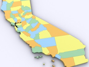
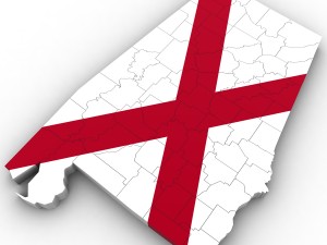
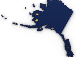
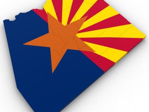
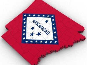
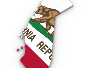
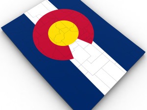
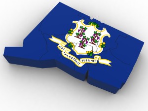
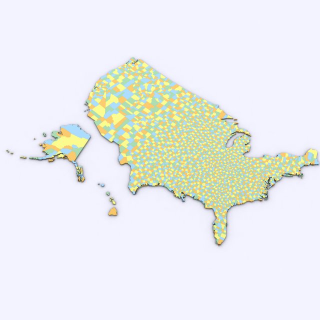
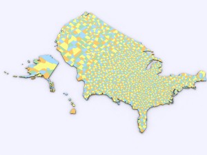
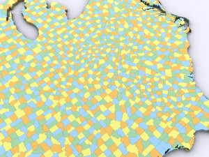
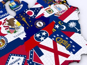
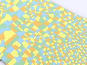
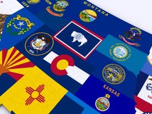
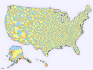
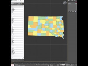
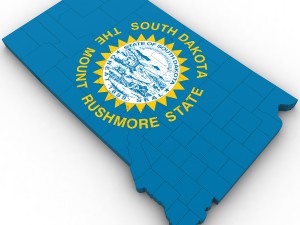
3d model of the political map of the united states. map includes every county in the entire united states.
all counties are grouped by the state they are in for easy navigation.
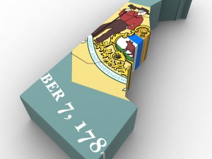
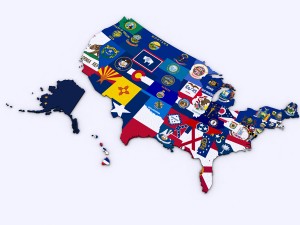
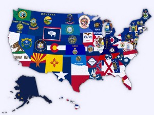
modifier stack is uncollapsed allowing for easy change of the extrusion of each county. product also includes a version that features a high resolution image of the flag of each state.
includes over 3,000 counties in the united states.
Baca lebih lanjutall counties are grouped by the state they are in for easy navigation.
modifier stack is uncollapsed allowing for easy change of the extrusion of each county. product also includes a version that features a high resolution image of the flag of each state.
includes over 3,000 counties in the united states.
Perlu lebih banyak format?
Jika Anda membutuhkan format yang berbeda, silakan buka Tiket Dukungan baru dan minta itu. Kita dapat mengonversi model 3D menjadi: .stl, .c4d, .obj, .fbx, .ma/.mb, .3ds, .3dm, .dxf/.dwg, .max. .blend, .skp, .glb. Kami tidak mengonversi adegan 3d dan format seperti .step, .iges, .stp, .sldprt.!
Jika Anda membutuhkan format yang berbeda, silakan buka Tiket Dukungan baru dan minta itu. Kita dapat mengonversi model 3D menjadi: .stl, .c4d, .obj, .fbx, .ma/.mb, .3ds, .3dm, .dxf/.dwg, .max. .blend, .skp, .glb. Kami tidak mengonversi adegan 3d dan format seperti .step, .iges, .stp, .sldprt.!
Us political map with counties Model 3D 3ds, max, obj, Dari Plutonius
united states usa map county state america nation country political detailedTidak ada komentar untuk item ini.