English
 Español
 Deutsch
 日本語
日本語 Polska
 Français
 中國
中國 한국의
한국의 Українська
 Italiano
 Nederlands
 Türkçe
 Português
 Bahasa Indonesia
 Русский
 हिंदी
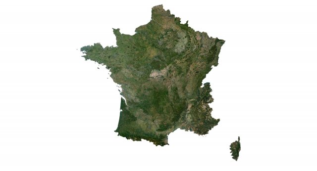
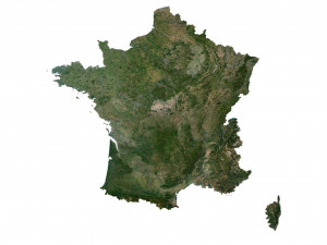
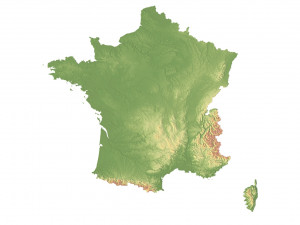
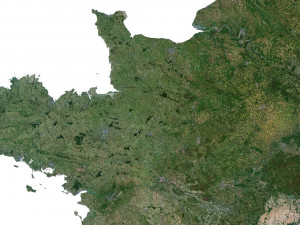
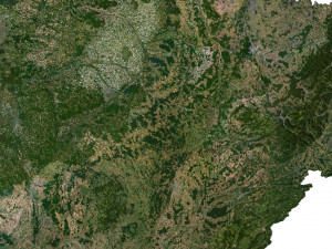
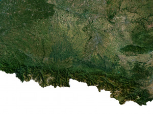
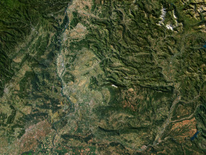
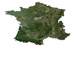
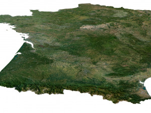
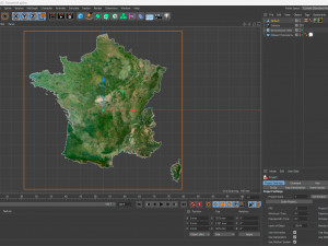
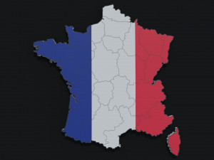
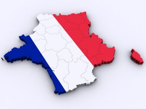
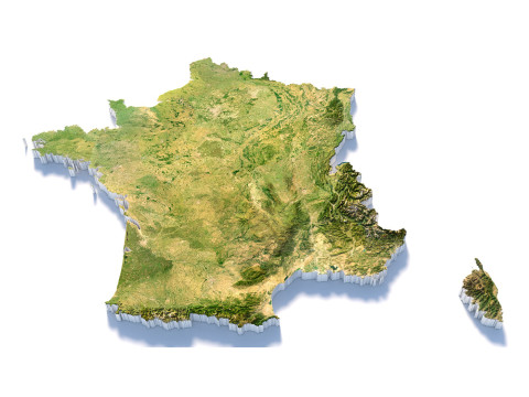
हिंदीFrance Terrain 3D Map 3D Model

HALLOWEEN
PRE SALE 50% OFF
$
36.80 USD
Elinizde olan $0.00 Krediler. Kredi Satın Al

- Hazır formatlar: Cinema4D (.c4d) 971.33 MB
Derleme: Standard
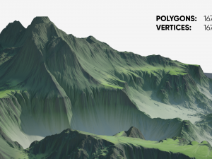
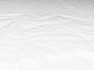
- Poligonlar:9 990 450
- Noktalar:4 999 696
- Animasyon:No
- Dokulu:
- Rigged:No
- Malzemeler:
- Low-poly:No
- Koleksiyon:No
- UVW mapping:
- Kullanılan Eklentiler:No
- Baskıya Hazır:No
- 3D Tarama:No
- Yetişkin(+18) içerik:No
- PBR:No
- Geometri:Polygonal
- Unwrapped UVs:Unknown
- Görüntülemeler:2340
- Tarih: 2023-07-04
- Ürün ID:453280
Format: C4D
File size (unzipped): 572 MB
Polygons: 9 990 450
Vertices: 4 999 696
Geometry: Polygonal Tris only
Model size: 1375 mm x 1375 mm x 3.181 mm
Projection: Mercator
Base: Open
UV layer: Yes (frontal)
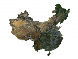
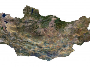
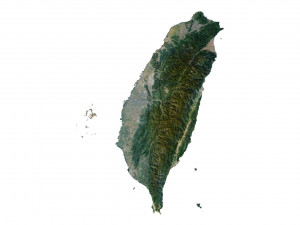
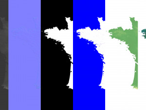
Textures
Height Map TIF 8193*8193*16b - You can use this map in the displacement channel instead of the polygonal mesh.
Normal Map TIF 8193*8193*48b - Use this map to reveal fine details of the relief.
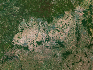
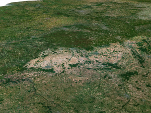
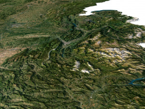
Satellite Map TIF 11000*11000*48b
Water Mask TIF 11000*11000*48b - Use this map for masking in the Reflection channel to get glare from the water surface.
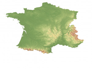
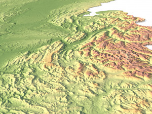
Pseudo-color Map 11000*11000*48b - Use this map to get elevation information based on the color shade.
Boundary Mask TIF 11000*11000*48b - Use this map as a mask for your background.
Other models can be made on request.
Modifications, conversion to OBJ, FBX, STL and other formats, more detailed models and better textures on request. Baskıya Hazır: Hayır
Daha fazla okuFile size (unzipped): 572 MB
Polygons: 9 990 450
Vertices: 4 999 696
Geometry: Polygonal Tris only
Model size: 1375 mm x 1375 mm x 3.181 mm
Projection: Mercator
Base: Open
UV layer: Yes (frontal)
Textures
Height Map TIF 8193*8193*16b - You can use this map in the displacement channel instead of the polygonal mesh.
Normal Map TIF 8193*8193*48b - Use this map to reveal fine details of the relief.
Satellite Map TIF 11000*11000*48b
Water Mask TIF 11000*11000*48b - Use this map for masking in the Reflection channel to get glare from the water surface.
Pseudo-color Map 11000*11000*48b - Use this map to get elevation information based on the color shade.
Boundary Mask TIF 11000*11000*48b - Use this map as a mask for your background.
Other models can be made on request.
Modifications, conversion to OBJ, FBX, STL and other formats, more detailed models and better textures on request. Baskıya Hazır: Hayır
Daha fazla formata mı ihtiyaç duyuyorsunuz?
Farklı bir formata ihtiyaç duyuyorsanız lütfen destek ekibimize bir talep açarak ihtiyacınızı belirtiniz. 3D modelleri şu formatlara dönüştürebiliriz: .stl, .c4d, .obj, .fbx, .ma/.mb, .3ds, .3dm, .dxf/.dwg, .max. .blend, .skp, .glb. 3d sahneleri dönüştürmüyoruz ve .step, .iges, .stp, .sldprt gibi formatlar.!
Farklı bir formata ihtiyaç duyuyorsanız lütfen destek ekibimize bir talep açarak ihtiyacınızı belirtiniz. 3D modelleri şu formatlara dönüştürebiliriz: .stl, .c4d, .obj, .fbx, .ma/.mb, .3ds, .3dm, .dxf/.dwg, .max. .blend, .skp, .glb. 3d sahneleri dönüştürmüyoruz ve .step, .iges, .stp, .sldprt gibi formatlar.!
France Terrain 3D Map 3D Model c4d, Kimden sychev23021983
france corsica map landscape terrain country relief geography continent mountainBu ürün için yorum bulunmamaktadır.

-50%

dae fbx mb obj stl png
deformer
Landscapes