English
 Español
 Deutsch
 日本語
日本語 Polska
 Français
 中國
中國 한국의
한국의 Українська
 Italiano
 Nederlands
 Türkçe
 Português
 Bahasa Indonesia
 Русский
 हिंदी
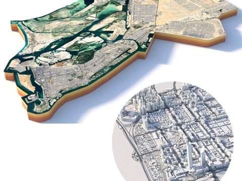
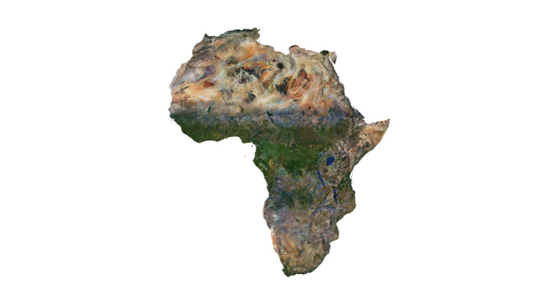
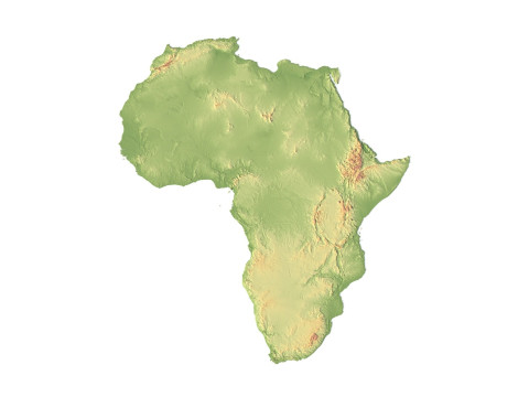
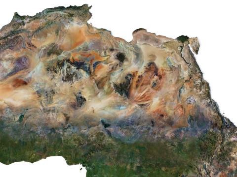
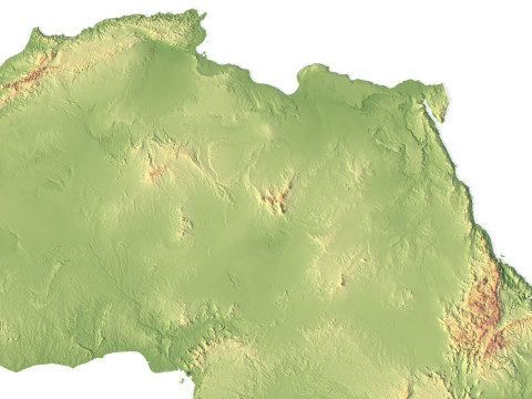
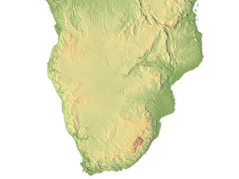
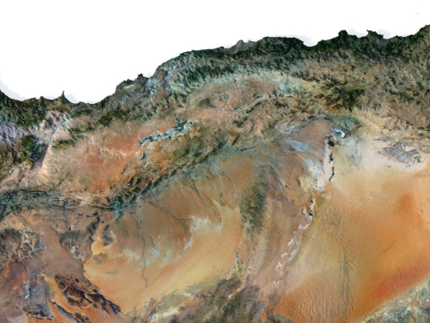
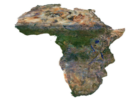
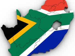
हिंदीRelief of Africa Explore its Diverse Terrain 3D Model


-20%
obj c4d stl
sychev23021983
Landscapes
$31.20
$39.00

$
36.80 USD
Elinizde olan $0.00 Krediler. Kredi Satın Al

- Hazır formatlar: Cinema4D (.c4d) 933.94 MB
Derleme: Standard
- Poligonlar:7 988 024
- Noktalar:3 998 016
- Animasyon:No
- Dokulu:
- Rigged:No
- Malzemeler:
- Low-poly:No
- Koleksiyon:No
- UVW mapping:No
- Kullanılan Eklentiler:No
- Baskıya Hazır:No
- 3D Tarama:No
- Yetişkin(+18) içerik:No
- PBR:No
- AI Eğitim:No
- Geometri:Polygonal
- Unwrapped UVs:Unknown
- Görüntülemeler:7320
- Tarih: 2024-05-24
- Ürün ID:508213
Relief of Africa Explore its Diverse Terrain 3D Model c4d, Kimden sychev23021983
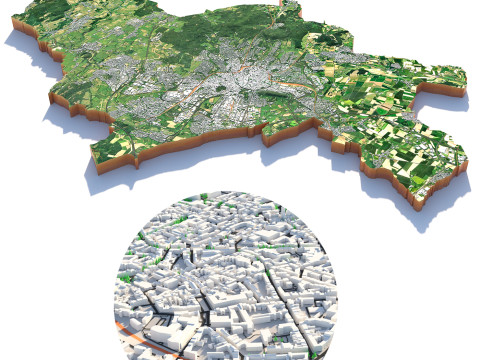
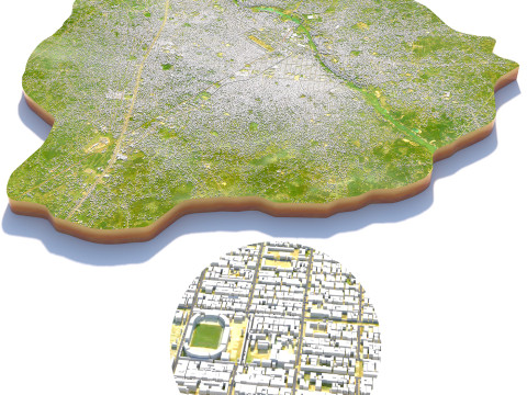
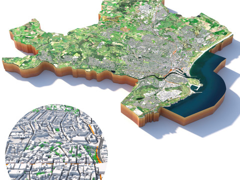
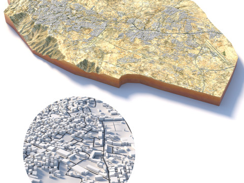
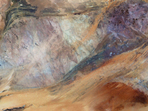
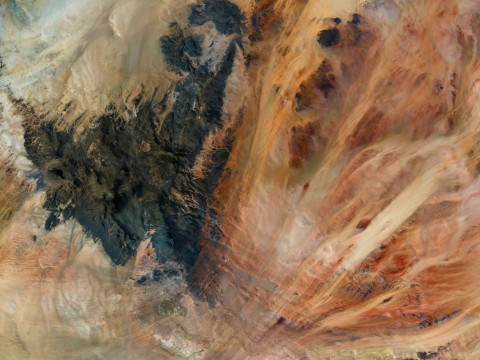
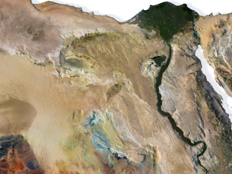
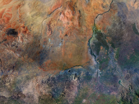
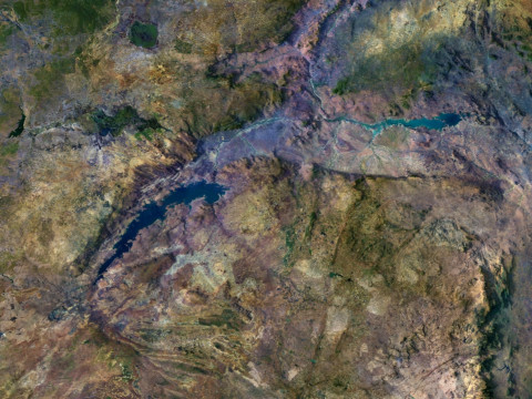
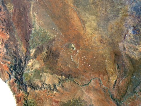
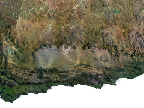
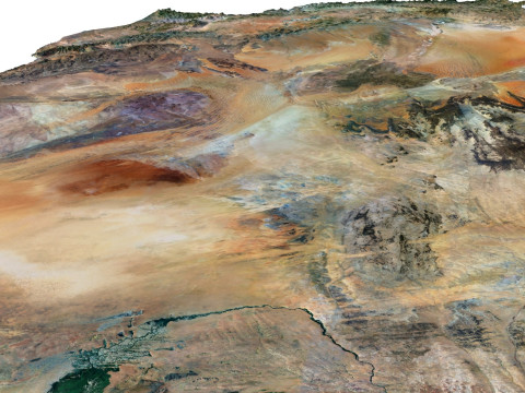
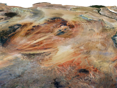
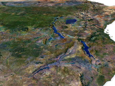
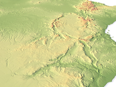
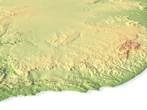
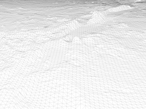
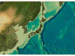
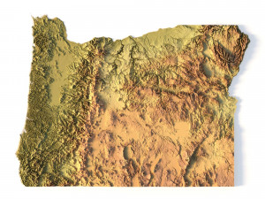
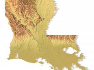
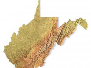
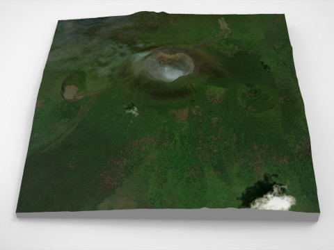
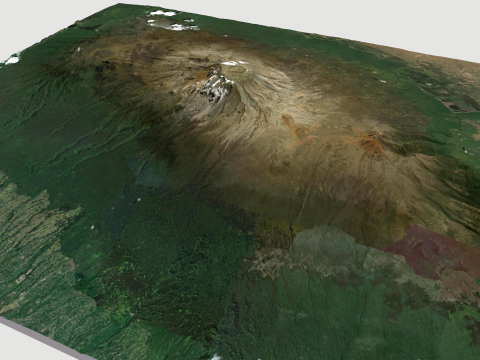
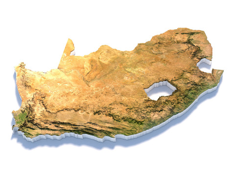
Explore the dynamic relief of the African continent with our three-dimensional model. From majestic mountains to expansive plains, open valleys, and scenic coastlines, our model provides a detailed depiction of the diversity of landscapes across this remarkable continent.
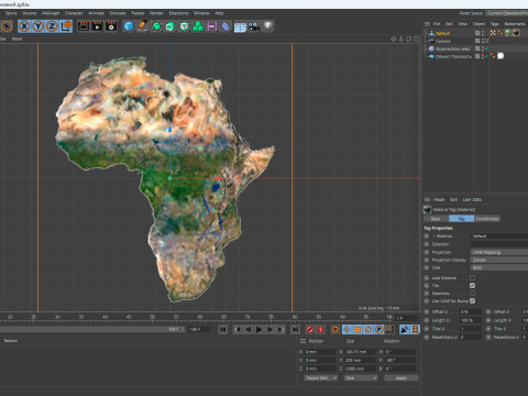
Africa Terrain 3D Map 3D Model
3D models
- Format: C4D
- File size (unzipped): 457 MB
- Polygons: 7 9** 024
- Vertices: 3 998 016
- Geometry: Polygonal Tris only
- Model size: 183.75 mm x 205 mm x 0.995 mm
- Projection: Mercator
- Base: Open
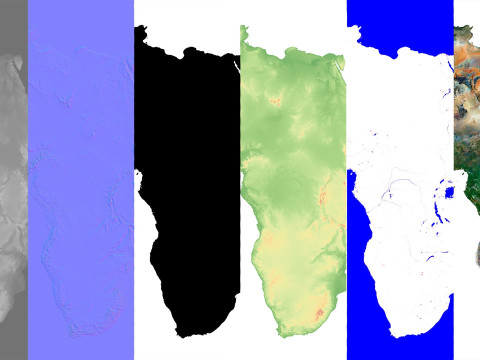
Textures
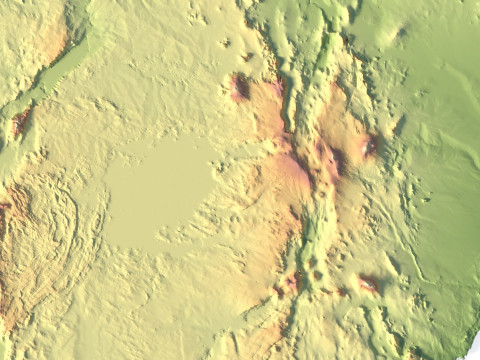
- Height Map TIF 7344*8193*16b - You can use this map in the displacement channel instead of the polygonal mesh.
- Normal Map TIF 7344*8193*48b - Use this map to reveal fine details of the relief.
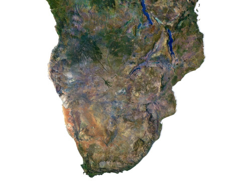
- Satellite Map TIF 14700*16400*48b
- Water Mask TIF 14700*16400*48b - Use this map for masking in the Reflection channel to get glare from the water surface.
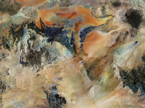
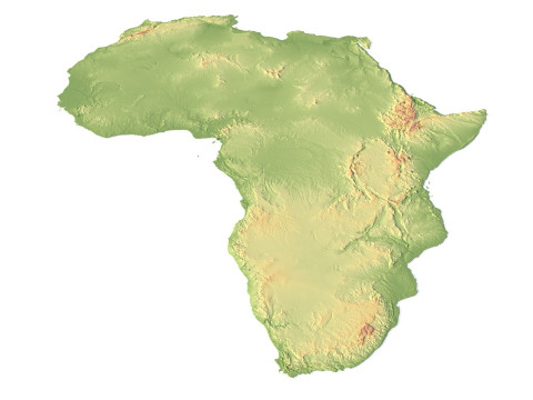
- Pseudo-color Map 14700*16400*48b - Use this map to get elevation information based on the color shade.
- Boundary Mask TIF 14700*16400*48b - Use this map as a mask for your background.
Other models can be made on request.
Modifications, conversion to OBJ, FBX, STL and other formats, more detailed models and better textures on request.
Shustrik-Maps.com – Premium 3D Models for Terrain, Maps & Beyond
High-Quality STL Files for 3D Printing & CNC
Daha fazla formata mı ihtiyaç duyuyorsunuz?
Farklı bir formata ihtiyaç duyuyorsanız lütfen destek ekibimize bir talep açarak ihtiyacınızı belirtiniz. 3D modelleri şu formatlara dönüştürebiliriz: .stl, .c4d, .obj, .fbx, .ma/.mb, .3ds, .3dm, .dxf/.dwg, .max. .blend, .skp, .glb. 3d sahneleri dönüştürmüyoruz ve .step, .iges, .stp, .sldprt gibi formatlar.!Kullanım Bilgileri
Relief of Africa Explore its Diverse Terrain - Telifsiz bu 3B modeli, Temel veya Genişletilmiş Lisans uyarınca hem kişisel hem de ticari amaçlarla kullanabilirsiniz.Temel Lisans, dijital reklamlar, tasarım ve görselleştirme projeleri, ticari sosyal medya hesapları, yerel uygulamalar, web uygulamaları, video oyunları ve fiziksel veya dijital son ürünler (hem ücretsiz hem de satılan) dahil olmak üzere çoğu standart kullanım durumunu kapsar.
Genişletilmiş Lisans, Temel Lisans kapsamında verilen tüm hakları, kullanım sınırlaması olmaksızın içerir ve 3B modelin Telifsiz koşullar altında sınırsız ticari projede kullanılmasına olanak tanır.
Daha fazla oku
Para İade Garantisi sağlıyor musunuz?
Evet, sağlıyoruz. Bir ürün satın aldığınızda çözünürlükte ya da tanımda bir hata bulduğunuzda problemi en kısa sürede çözmeye çalışacağız. Hatayı düzeltemezsek siparişinizi iptal edeceğiz ve sipariş tarihiniz göz önünde bulundurularak paranız size 24 saat içinde iade edilecektir. Daha fazla detay için tıklayınızAnahtar Kelimeler
africa landscape terrain map relief topography continent geographic landscapes geological cartographyBu ürün için yorum bulunmamaktadır.

dae fbx mb obj stl png
deformer
Landscapes