English
 Español
 Deutsch
 日本語
日本語 Polska
 Français
 中國
中國 한국의
한국의 Українська
 Italiano
 Nederlands
 Türkçe
 Português
 Bahasa Indonesia
 Русский
 हिंदी
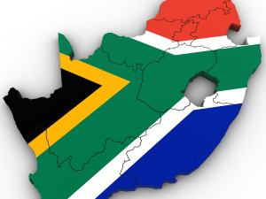
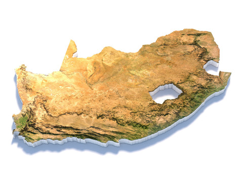
हिंदीRelief of Africa Explore its Diverse Terrain 3D 모델


$
36.80 USD
가지고 있는 아이템 $0.00 크레딧. 크레딧 구입

- 이용 가능한 포맷: Cinema4D (.c4d) 933.94 MB
렌더: Standard
- 폴리곤:7 988 024
- 버텍스:3 998 016
- 애니메이티드:No
- 텍스쳐드:
- 리그드:No
- 재료:
- 로우 폴리곤:No
- 컬렉션:No
- UVW 매핑:No
- 플러그인 사용 됨:No
- 프린트 준비:No
- 3D 스캔:No
- 성인용 콘텐츠:No
- PBR:No
- AI 훈련:No
- 지오메트리:Polygonal
- 언래핑 된 UVs:Unknown
- 조회:7330
- 날짜: 2024-05-24
- 아이템 ID:508213
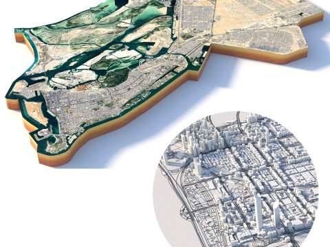
Relief of Africa Explore its Diverse Terrain 3D 모델 c4d, 발신 sychev23021983
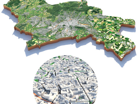
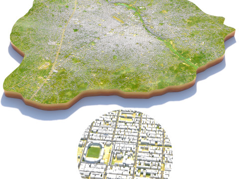
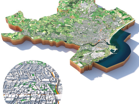
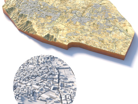
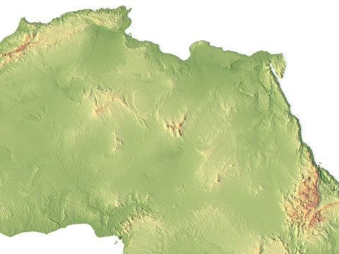
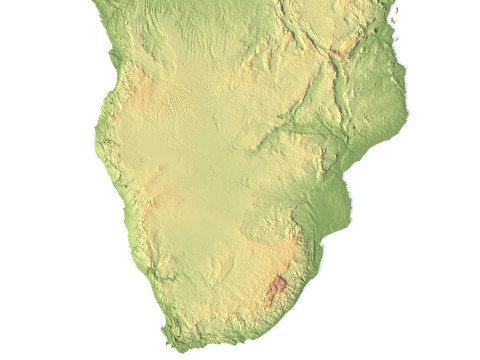
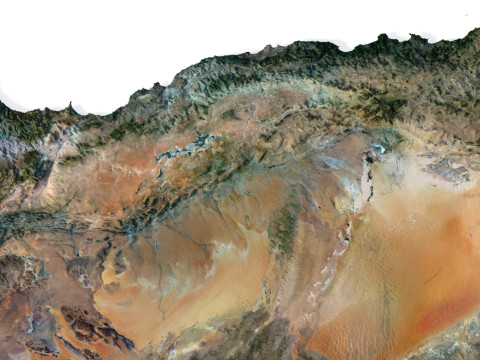
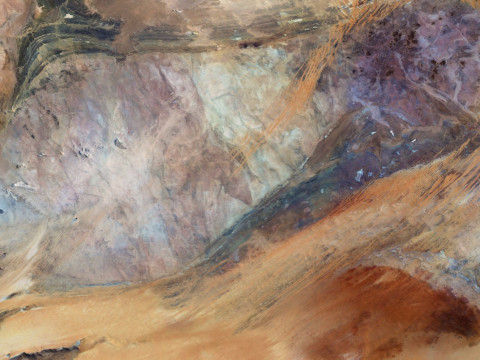
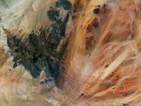
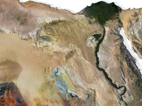
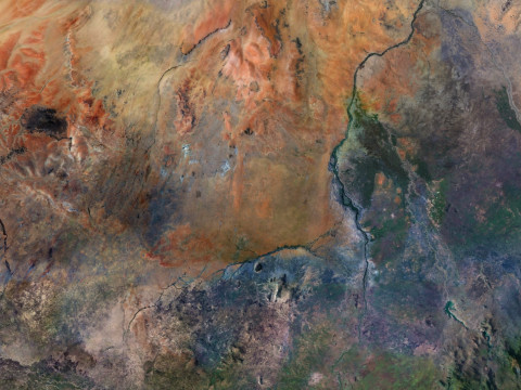
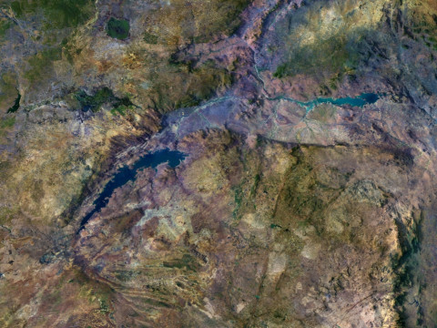
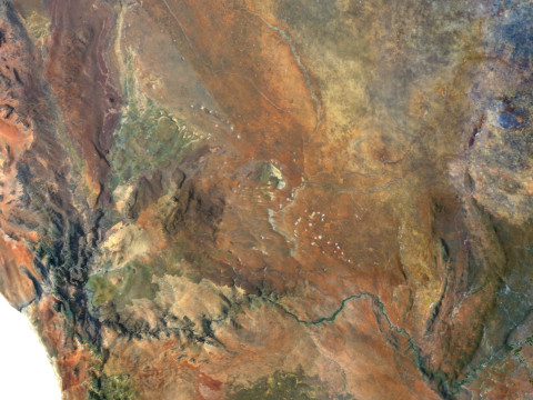
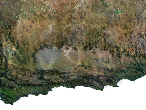
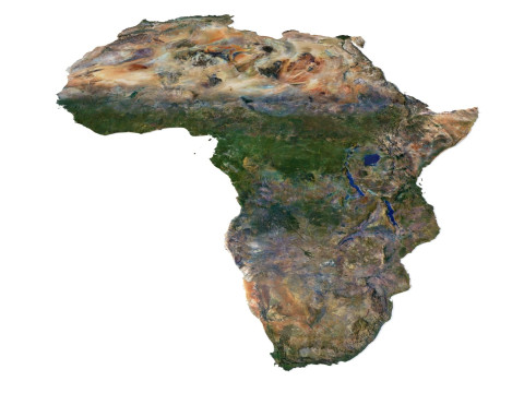
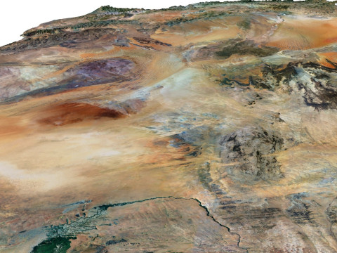
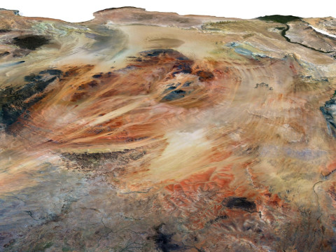
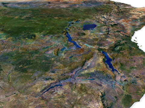
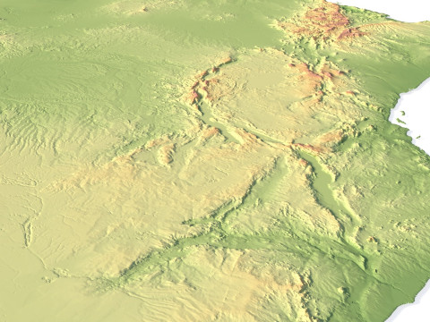
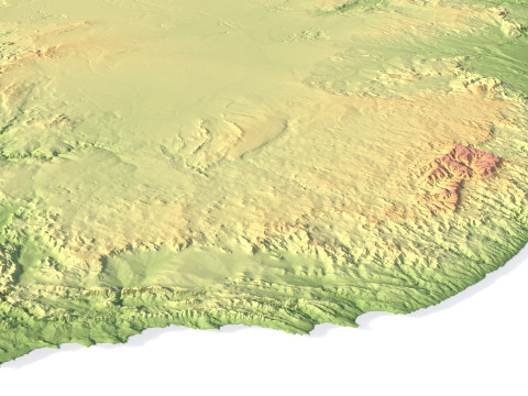
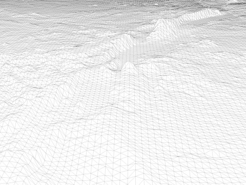
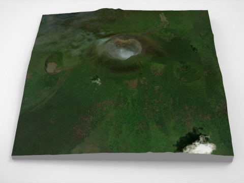
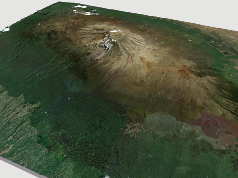
Explore the dynamic relief of the African continent with our three-dimensional model. From majestic mountains to expansive plains, open valleys, and scenic coastlines, our model provides a detailed depiction of the diversity of landscapes across this remarkable continent.
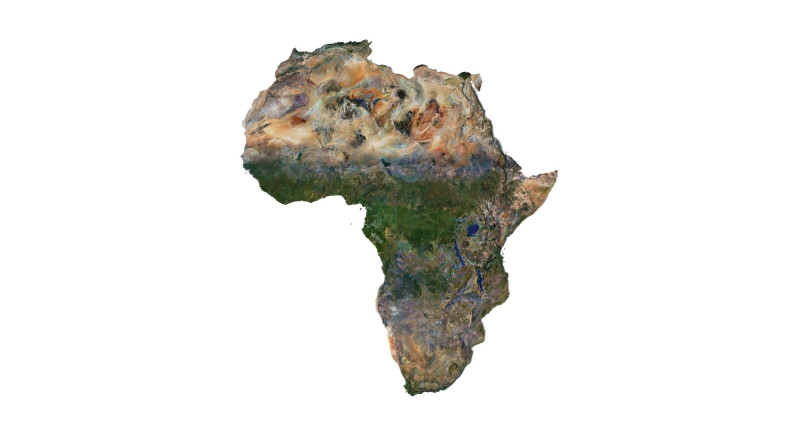
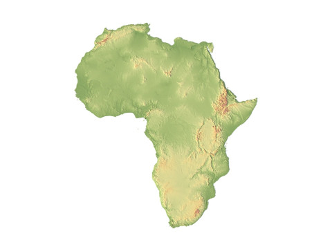
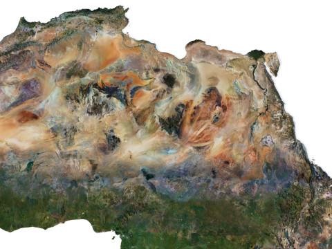
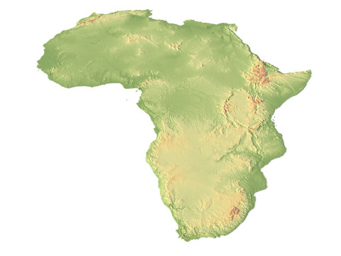
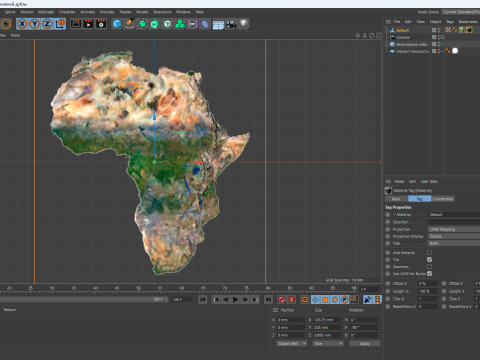
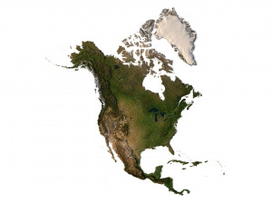
Africa Terrain 3D Map 3D Model
3D models
- Format: C4D
- File size (unzipped): 457 MB
- Polygons: 7 9** 024
- Vertices: 3 998 016
- Geometry: Polygonal Tris only
- Model size: 183.75 mm x 205 mm x 0.995 mm
- Projection: Mercator
- Base: Open
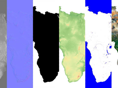
Textures
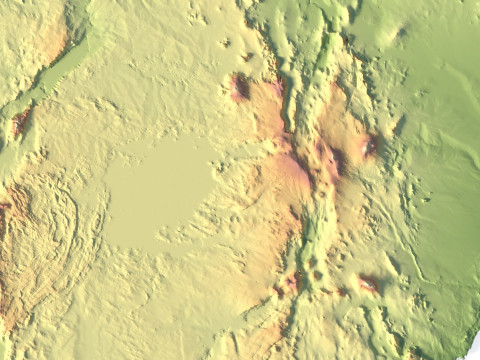
- Height Map TIF 7344*8193*16b - You can use this map in the displacement channel instead of the polygonal mesh.
- Normal Map TIF 7344*8193*48b - Use this map to reveal fine details of the relief.
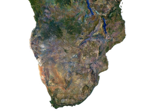
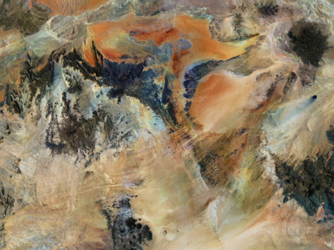
- Satellite Map TIF 14700*16400*48b
- Water Mask TIF 14700*16400*48b - Use this map for masking in the Reflection channel to get glare from the water surface.
- Pseudo-color Map 14700*16400*48b - Use this map to get elevation information based on the color shade.
- Boundary Mask TIF 14700*16400*48b - Use this map as a mask for your background.
Other models can be made on request.
Modifications, conversion to OBJ, FBX, STL and other formats, more detailed models and better textures on request.
Shustrik-Maps.com – Premium 3D Models for Terrain, Maps & Beyond
High-Quality STL Files for 3D Printing & CNC
다른 포맷이 필요하세요?
다른 포맷이 필요하시면, 새로운 지원 티켓을 열어 요청하세요. 저희는 3D 모델을 다음으로 변환할 수 있습니다: .stl, .c4d, .obj, .fbx, .ma/.mb, .3ds, .3dm, .dxf/.dwg, .max. .blend, .skp, .glb. 우리는 3D 장면을 변환하지 않습니다 .step, .iges, .stp, .sldprt와 같은 형식도 포함됩니다.!사용 정보
Relief of Africa Explore its Diverse Terrain - 기본 또는 확장 라이선스에 따라 이 로열티 프리 3D 모델을 개인적 및 상업적 목적으로 사용할 수 있습니다.기본 라이선스는 디지털 광고, 디자인 및 시각화 프로젝트, 비즈니스 소셜 미디어 계정, 네이티브 앱, 웹 앱, 비디오 게임, 그리고 물리적 또는 디지털 최종 제품(무료 및 유료 모두)을 포함한 대부분의 표준 사용 사례를 포괄합니다.
확장 라이선스는 기본 라이선스에 따라 부여된 모든 권리를 포함하며 사용 제한이 없으며, 로열티 프리 조건 하에 3D 모델을 상업적 프로젝트에 무제한으로 사용할 수 있습니다.
더 보기
환불이 보장되나요?
네, 환불을 보장합니다. 작품 구입 후 렌더나 설명에서 오류를 발견하시면, 저희는 최대한 빨리 해당 문제를 수정 할 것입니다. 저희가 해당 오류를 수정 할 수 없는 경우, 저희는 귀하의 주문을 취소하며 아이템 다운로드 24 시간 내에 금액을 환불해드립니다. 더 자세한 정보는 여기를 참조하세요키워드
africa landscape terrain map relief topography continent geographic landscapes geological cartography이 아이템에 대한 코멘트 없음.

dae fbx mb obj stl png
deformer
Landscapes