English
 Español
 Deutsch
 日本語
日本語 Polska
 Français
 中國
中國 한국의
한국의 Українська
 Italiano
 Nederlands
 Türkçe
 Português
 Bahasa Indonesia
 Русский
 हिंदी
हिंदीRelief of Africa Explore its Diverse Terrain Modelo 3D


-20%
stl
sychev23021983
Terrain
$
36.80 USD
Tienes usted $0.00 Créditos. Comprar Créditos

- Formatos disponibles: Cinema4D (.c4d) 933.94 MB
Render: Standard
- Polígonos:7 988 024
- Vértices:3 998 016
- Animados:No
- Texturas:
- Articulados:No
- Materiales:
- Low-poly:No
- Colección:No
- Mapas UVW:No
- Plugins Usados:No
- Listo para Imprimir:No
- 3D Scan:No
- Para adultos:No
- PBR:No
- AI Capacitación:No
- Geometría:Polygonal
- Desenvolver UVs:Unknown
- Vistas:7331
- Fecha: 2024-05-24
- ID de artículo:508213
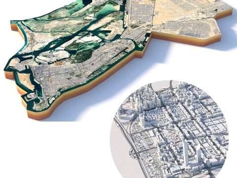
Relief of Africa Explore its Diverse Terrain Modelo 3D c4d, De sychev23021983
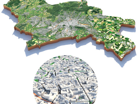
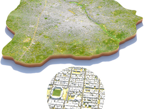
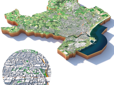
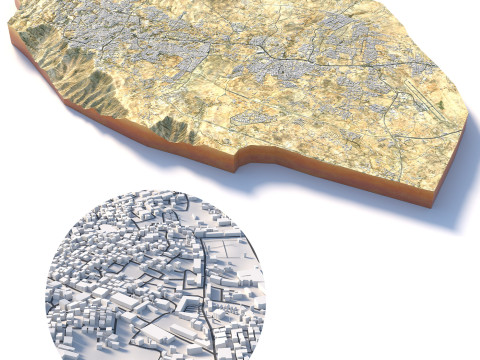
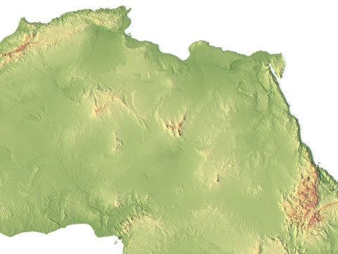
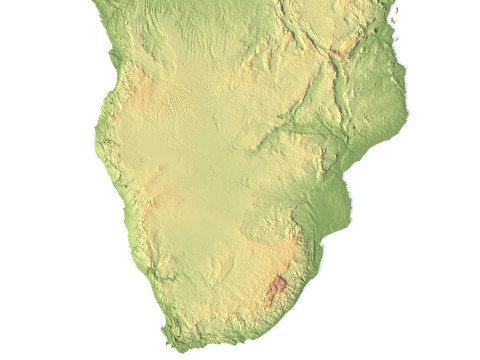
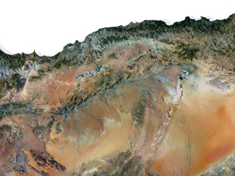
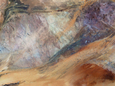
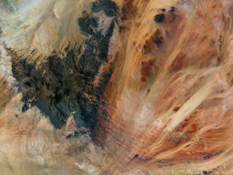
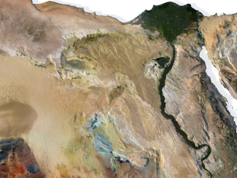
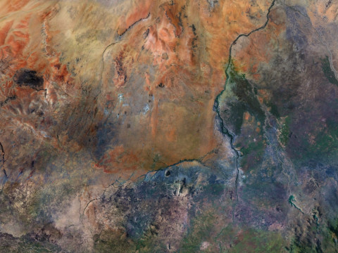
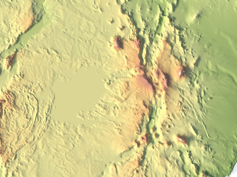
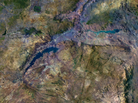
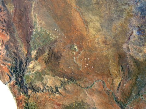
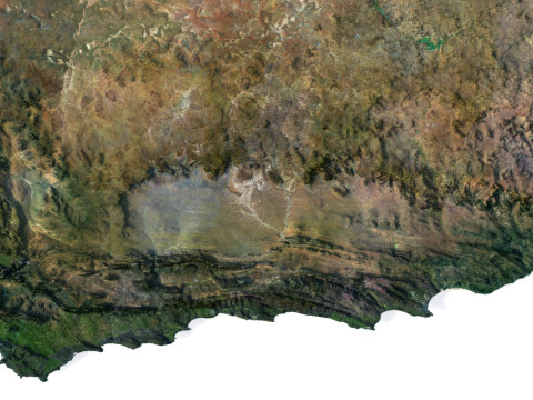
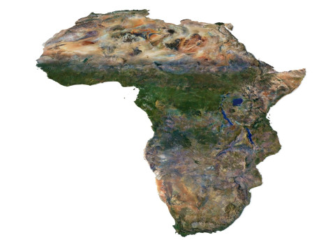
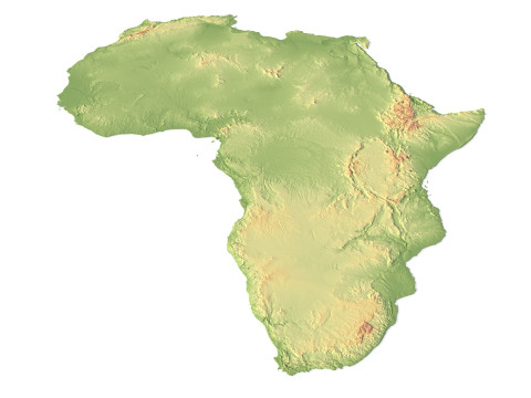
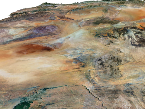
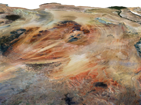
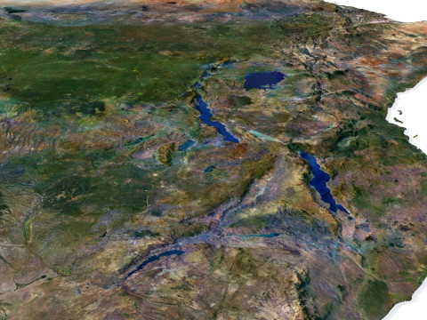
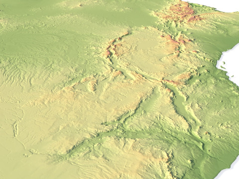
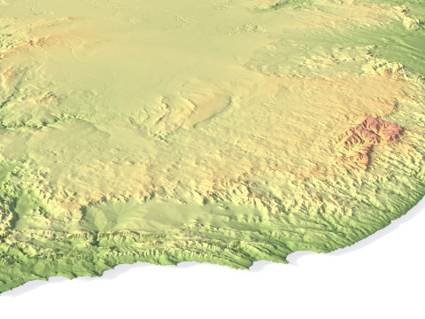
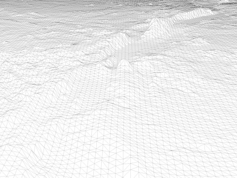
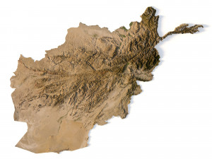
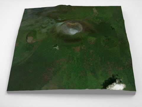
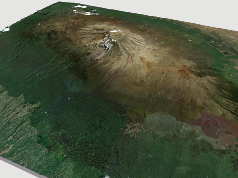
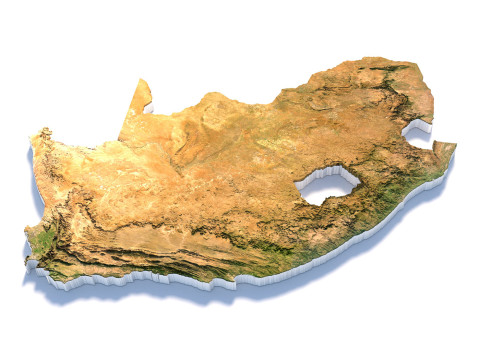
Explore the dynamic relief of the African continent with our three-dimensional model. From majestic mountains to expansive plains, open valleys, and scenic coastlines, our model provides a detailed depiction of the diversity of landscapes across this remarkable continent.
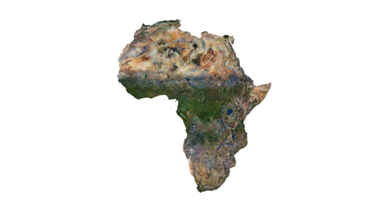
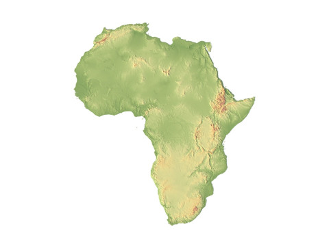
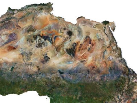
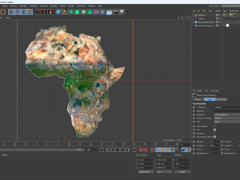
Africa Terrain 3D Map 3D Model
3D models
- Format: C4D
- File size (unzipped): 457 MB
- Polygons: 7 9** 024
- Vertices: 3 998 016
- Geometry: Polygonal Tris only
- Model size: 183.75 mm x 205 mm x 0.995 mm
- Projection: Mercator
- Base: Open
Textures
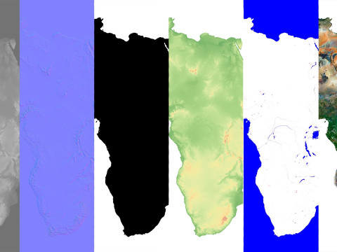
- Height Map TIF 7344*8193*16b - You can use this map in the displacement channel instead of the polygonal mesh.
- Normal Map TIF 7344*8193*48b - Use this map to reveal fine details of the relief.
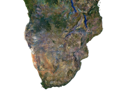
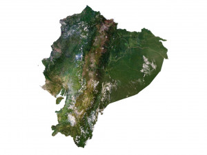
- Satellite Map TIF 14700*16400*48b
- Water Mask TIF 14700*16400*48b - Use this map for masking in the Reflection channel to get glare from the water surface.
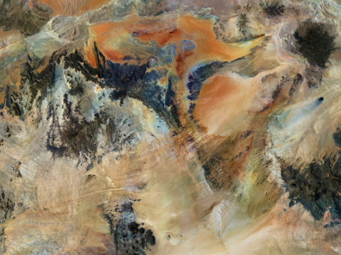
- Pseudo-color Map 14700*16400*48b - Use this map to get elevation information based on the color shade.
- Boundary Mask TIF 14700*16400*48b - Use this map as a mask for your background.
Other models can be made on request.
Modifications, conversion to OBJ, FBX, STL and other formats, more detailed models and better textures on request.
Shustrik-Maps.com – Premium 3D Models for Terrain, Maps & Beyond
High-Quality STL Files for 3D Printing & CNC
¿Necesita más formatos?
Si precisa un formato distinto, por favor, abra una consulta de Soporte y solicítelo. Podemos convertir modelos 3D a: .stl, .c4d, .obj, .fbx, .ma/.mb, .3ds, .3dm, .dxf/.dwg, .max. .blend, .skp, .glb. Nosotros no convertimos escenas 3d y formatos como .step, .iges, .stp, .sldprt.!Información de uso
Relief of Africa Explore its Diverse Terrain - Puede usar este modelo 3D libre de regalías tanto para fines personales como comerciales, de acuerdo con la Licencia Básica o Extendida.La Licencia Básica cubre la mayoría de los casos de uso estándar, incluyendo anuncios digitales, proyectos de diseño y visualización, cuentas empresariales en redes sociales, aplicaciones nativas, aplicaciones web, videojuegos y productos finales físicos o digitales (tanto gratuitos como comerciales).
La Licencia Extendida incluye todos los derechos otorgados bajo la Licencia Básica, sin limitaciones de uso, y permite que el modelo 3D se use en un número ilimitado de proyectos comerciales bajo las condiciones de la Licencia Libre de Regalías.
Leer más
¿Garantizáis la Devolución de Dinero?
Si. Si compras un producto y encuentras errores de rendimiento o descripción, intentaremos solucionar el problema lo antes posible. Si no lo logramos, cancelaremos tu pedido y tu dinero será devuelto en 24h, desde que el producto fué descargado. Lea más condiciones aquíPalabras clave
africa landscape terrain map relief topography continent geographic landscapes geological cartographyNo hay comentarios sobre este artículo.

dae fbx mb obj stl png
deformer
Landscapes