English
 Español
 Deutsch
 日本語
日本語 Polska
 Français
 中國
中國 한국의
한국의 Українська
 Italiano
 Nederlands
 Türkçe
 Português
 Bahasa Indonesia
 Русский
 हिंदी
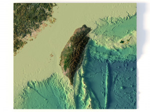
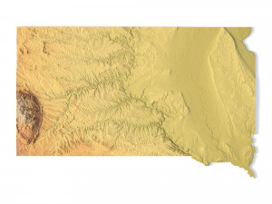
हिंदीModèle STL topographique de carte de l'Arizona Modèles 3D en vedette


- Demander l'assistance produit

- Formats disponibles:
- ID de produit:401995
- Date: 2022-06-14
- Collection:No
- Largeur en millimètres:257
- Hauteur en millimètres:4.7
- Profondeur en millimètres:304
- Prêt à imprimer:No
- 3D Balayage:No
- Contenu adulte:No
- PBR:No
- IA Formation:No
- Vus:2578
Description
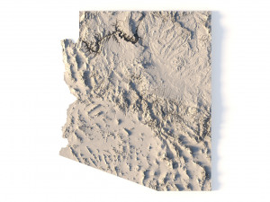
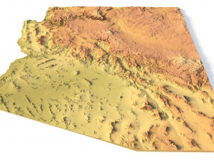
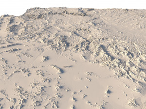
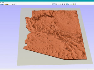
Create Detailed Arizona Topographic Maps with This 3D Model
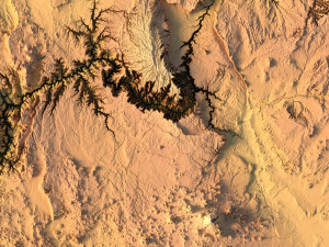
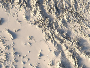
The Arizona Map Topographic STL model is designed to provide precise topography of Arizona’s terrain. Ideal for creating 3D topographic maps from wood, metal, plastic, or concrete, this model ensures detailed accuracy. Whether you’re into landscape visualization or need a reliable model for geospatial analysis and physical geography projects, this STL file is perfect for you.
• Format: STL
• Files size: 659 MB/ 329 MB
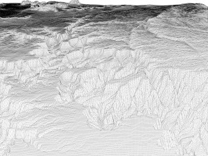
• Polygons: 13 841 070
• Vertices: 6 927 004
• Geometry: Polygonal Tris only
• Model size: 256.8 mm x 303.9 mm x 4.711 mm
• Distance between two neighboring vertices: ~ 0,1 mm
• Projection: Mercator
• Scaling factor X:Y:Z: 1:1:3
• Base: Open / Closed
Arizona Terrain Model: Features and Uses
• Compatible with FDM/SLA 3D printers for creating raised relief maps.
• Supports CNC machining for wood and metal terrain models.
• High-precision laser engraving for metal surfaces.
Avez besoin de plus de formats?
Si vous avea besoin d’\autre format veuillez ouvrir un billet d’\assistance et demandez le. Nous pouvons convertir les modèles de 3D en: .stl, .c4d, .obj, .fbx, .ma/.mb, .3ds, .3dm, .dxf/.dwg, .max. .blend, .skp, .glb. Conversion de format libreNous ne convertissons pas les scènes 3D et des formats tels que .step, .iges, .stp, .sldprt.!
Informations d'utilisation
Modèle STL topographique de carte de l'Arizona - Vous pouvez utiliser ce modèle 3D libre de droits à des fins personnelles et commerciales, conformément à la Licence de Base ou à la Licence Étendue.La Licence de Base couvre la plupart des cas d'utilisation courants, notamment les publicités numériques, les projets de conception et de visualisation, les comptes de réseaux sociaux professionnels, les applications natives, les applications web, les jeux vidéo et les produits finis physiques ou numériques (gratuits ou payants).
La Licence Étendue inclut tous les droits accordés par la Licence de Base, sans limitation d'utilisation, et autorise l'utilisation du modèle 3D dans un nombre illimité de projets commerciaux, dans des conditions de libre de droits.
En savoir plus
Fournissez-vous garantie de remboursement?
Oui. Si vous avez acheté un produit et trouvé une erreur dans le rend ou la description, nous allons essayer de résoudre le problème le plus tôt possible. Si nous ne pouvons pas corriger l'erreur, nous allons annuler votre commande et vous récupérer votre argent dans les 24 heures de téléchargement de l'élément. Lire la suite de conditions iciMots clés
Produits incidents de cet auteur