English
 Español
 Deutsch
 日本語
日本語 Polska
 Français
 中國
中國 한국의
한국의 Українська
 Italiano
 Nederlands
 Türkçe
 Português
 Bahasa Indonesia
 Русский
 हिंदी
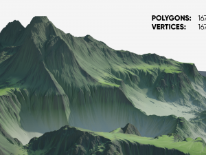
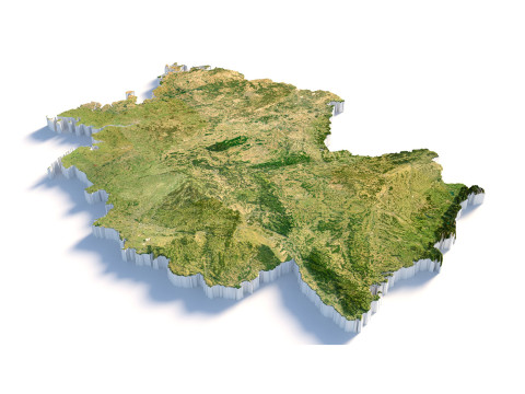
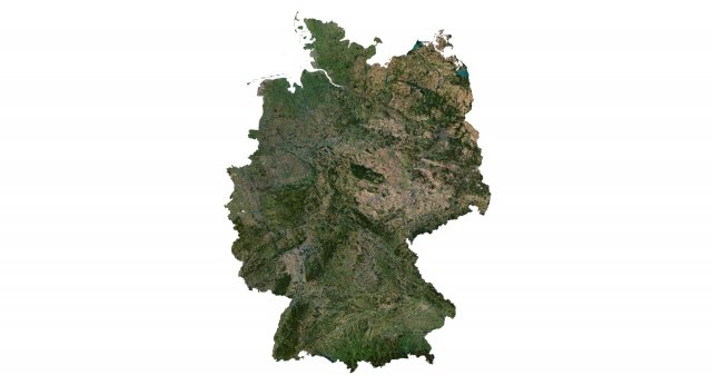
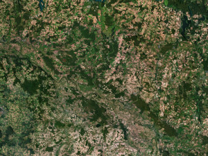
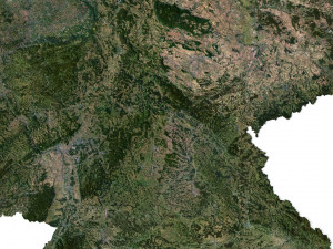
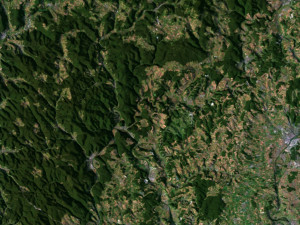
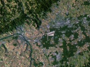
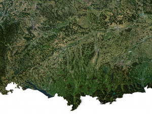
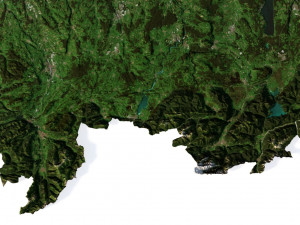
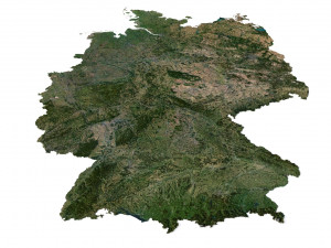
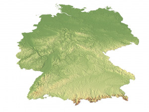
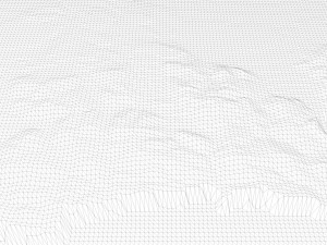
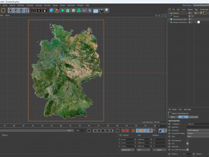
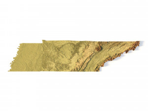
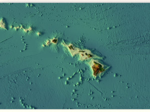
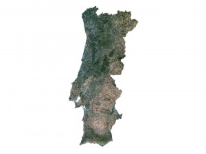
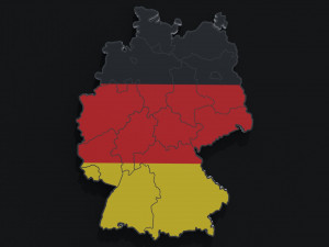
हिंदीGermany Terrain 3D Map Modèle 3D

BLACK FRIDAY
Early Access 50% OFF
$
36.80 USD
- Demander l'assistance produit

- Formats disponibles:
- ID de produit:453284
- Date: 2023-07-04
- Polygones:9 984 600
- Sommets:4 996 816
- Animé:No
- Textures:
- Installé:No
- Matériaux:
- Bas-poly:No
- Collection:No
- cartographie UVW:
- Plugins Utilisé:No
- Prêt à imprimer:No
- 3D Balayage:No
- Contenu adulte:No
- PBR:No
- Géométrie:Polygonal
- UVs non enveloppés:Unknown
- Vus:2653
Description
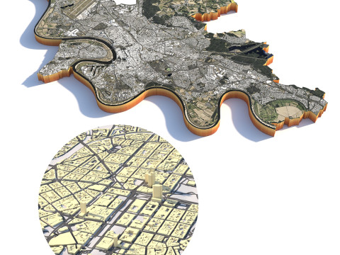
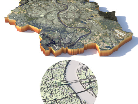
Format: C4DFile size (unzipped): 571 MB
Polygons: 9 984 600
Vertices: 4 996 816
Geometry: Polygonal Tris only
Model size: 1350 mm x 1800 mm x 7.659 mm
Projection: Mercator
Base: Open
UV layer: Yes (frontal)
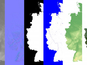
Textures
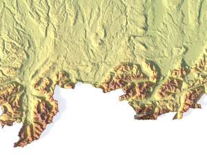
Height Map TIF 6145*8193*16b - You can use this map in the displacement channel instead of the polygonal mesh.
Normal Map TIF 6145*8193*48b - Use this map to reveal fine details of the relief.
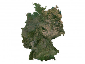
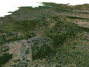
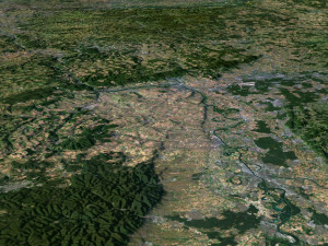
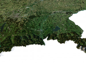
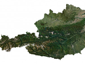
Satellite Map TIF 10800*14400*48b
Water Mask TIF 10800*14400*48b - Use this map for masking in the Reflection channel to get glare from the water surface.
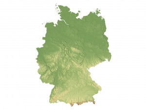
Pseudo-color Map 10800*14400*48b - Use this map to get elevation information based on the color shade.
Boundary Mask TIF 10800*14400*48b - Use this map as a mask for your background.
Other models can be made on request.
Modifications, conversion to OBJ, FBX, STL and other formats, more detailed models and better textures on request. Prêt à imprimer: Non
Avez besoin de plus de formats?
Si vous avea besoin d’\autre format veuillez ouvrir un billet d’\assistance et demandez le. Nous pouvons convertir les modèles de 3D en: .stl, .c4d, .obj, .fbx, .ma/.mb, .3ds, .3dm, .dxf/.dwg, .max. .blend, .skp, .glb. Conversion de format libreNous ne convertissons pas les scènes 3D et des formats tels que .step, .iges, .stp, .sldprt.!
Informations d'utilisation
Germany Terrain 3D Map - Vous pouvez utiliser ce modèle 3D libre de droits à des fins personnelles et commerciales, conformément à la Licence de Base ou à la Licence Étendue.La Licence de Base couvre la plupart des cas d'utilisation courants, notamment les publicités numériques, les projets de conception et de visualisation, les comptes de réseaux sociaux professionnels, les applications natives, les applications web, les jeux vidéo et les produits finis physiques ou numériques (gratuits ou payants).
La Licence Étendue inclut tous les droits accordés par la Licence de Base, sans limitation d'utilisation, et autorise l'utilisation du modèle 3D dans un nombre illimité de projets commerciaux, dans des conditions de libre de droits.
En savoir plus
Fournissez-vous garantie de remboursement?
Oui. Si vous avez acheté un produit et trouvé une erreur dans le rend ou la description, nous allons essayer de résoudre le problème le plus tôt possible. Si nous ne pouvons pas corriger l'erreur, nous allons annuler votre commande et vous récupérer votre argent dans les 24 heures de téléchargement de l'élément. Lire la suite de conditions iciMots clés
Produits incidents de cet auteur


-20%
obj c4d stl
sychev23021983
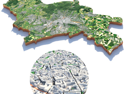
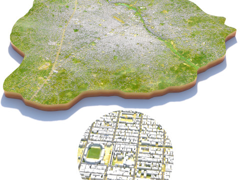
Landscapes
$31.20
$39.00
Aucun commentaires sur ce produit.

-50%

dae fbx mb obj stl png
deformer
Landscapes