English
 Español
 Deutsch
 日本語
日本語 Polska
 Français
 中國
中國 한국의
한국의 Українська
 Italiano
 Nederlands
 Türkçe
 Português
 Bahasa Indonesia
 Русский
 हिंदी
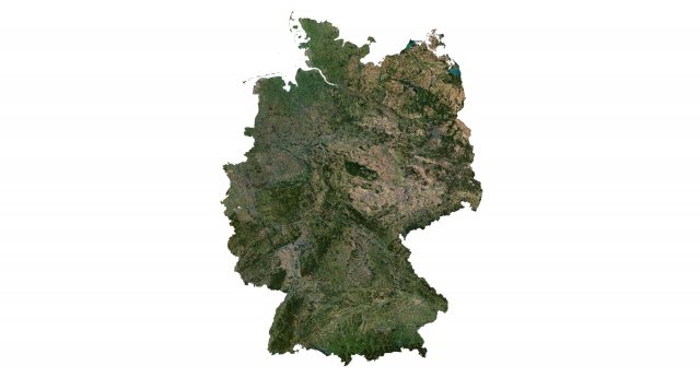
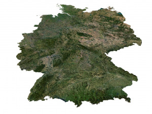
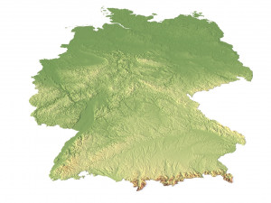
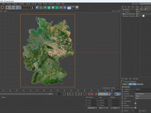
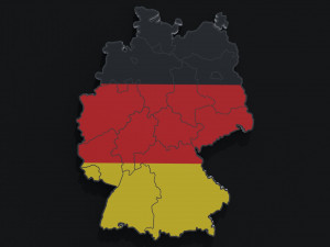
हिंदीGermany Terrain 3D Map 3Dモデル

WEEKEND SALE ENDS
$
36.80
を持っています $0.00 クレジット. クレジットを購入する

- 利用可能フォーマット: Image Textures (.tif) 905.46 MB
レンダー: StandardCinema4D (.c4d) 142.56 MB
レンダー: Standard
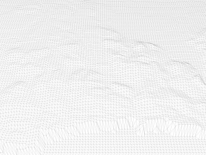
- 多角形:9 984 600
- 頂点:4 996 816
- アニメーション:No
- テクスチャー加工:
- 装飾:No
- 素材:
- 低ポリ:No
- コレクション:No
- UVW マッピング:
- 使用中プラグイン:No
- 印刷 準備:No
- 3D スキャン:No
- 成人コンテンツ:No
- PBR:No
- ジオメトリ:Polygonal
- 展開済 UVs:Unknown
- ビュー:2464
- 日付: 2023-07-04
- アイテム ID:453284
Format: C4D
File size (unzipped): 571 MB
Polygons: 9 984 600
Vertices: 4 996 816
Geometry: Polygonal Tris only
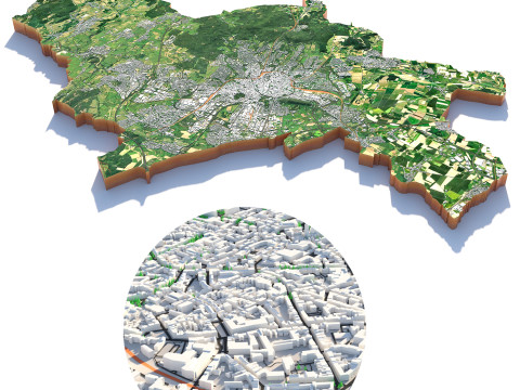
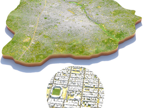
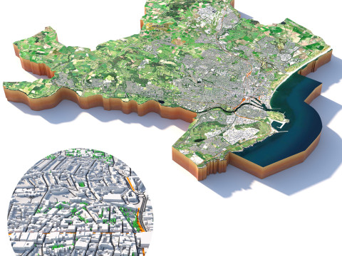
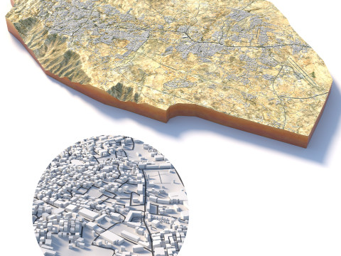
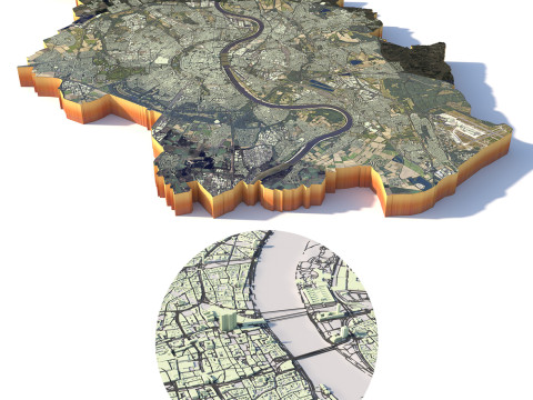
Model size: 1350 mm x 1800 mm x 7.659 mm
Projection: Mercator
Base: Open
UV layer: Yes (frontal)
Textures
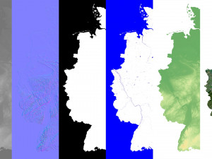
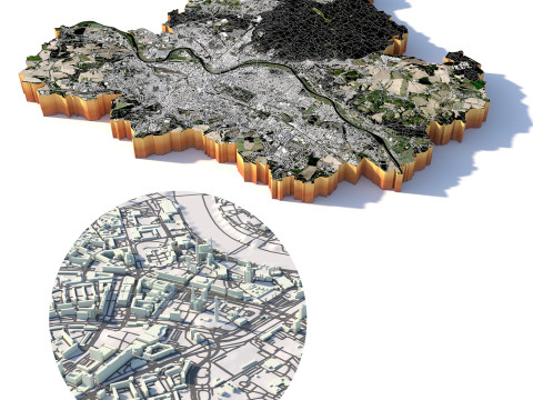
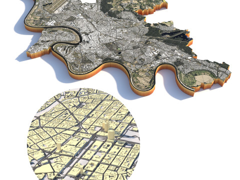
Height Map TIF 6145*8193*16b - You can use this map in the displacement channel instead of the polygonal mesh.
Normal Map TIF 6145*8193*48b - Use this map to reveal fine details of the relief.
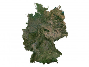
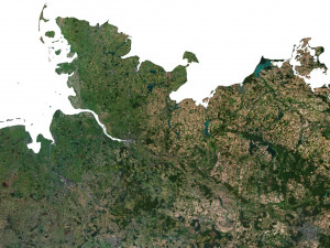
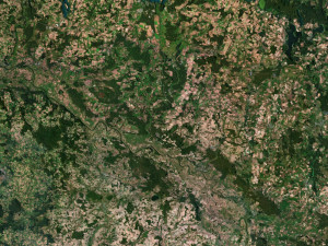
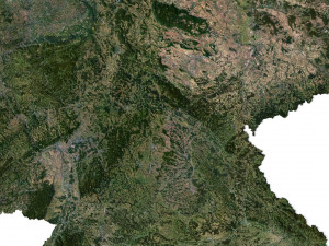
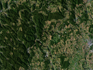
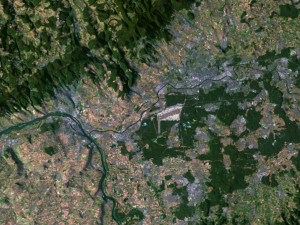
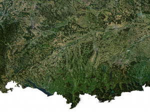
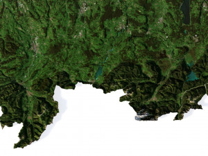
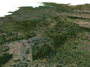
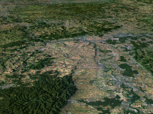
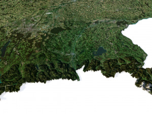
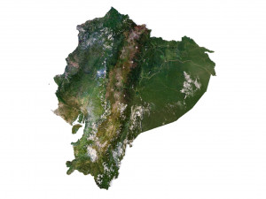
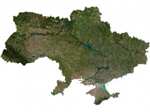
Satellite Map TIF 10800*14400*48b
Water Mask TIF 10800*14400*48b - Use this map for masking in the Reflection channel to get glare from the water surface.
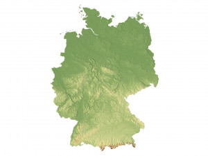
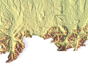
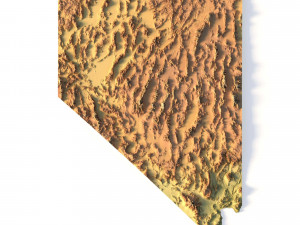
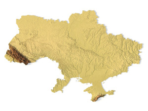
Pseudo-color Map 10800*14400*48b - Use this map to get elevation information based on the color shade.
Boundary Mask TIF 10800*14400*48b - Use this map as a mask for your background.
Other models can be made on request.
Modifications, conversion to OBJ, FBX, STL and other formats, more detailed models and ***ter textures on request. 印刷 準備: いいえ
詳細を読むFile size (unzipped): 571 MB
Polygons: 9 984 600
Vertices: 4 996 816
Geometry: Polygonal Tris only
Model size: 1350 mm x 1800 mm x 7.659 mm
Projection: Mercator
Base: Open
UV layer: Yes (frontal)
Textures
Height Map TIF 6145*8193*16b - You can use this map in the displacement channel instead of the polygonal mesh.
Normal Map TIF 6145*8193*48b - Use this map to reveal fine details of the relief.
Satellite Map TIF 10800*14400*48b
Water Mask TIF 10800*14400*48b - Use this map for masking in the Reflection channel to get glare from the water surface.
Pseudo-color Map 10800*14400*48b - Use this map to get elevation information based on the color shade.
Boundary Mask TIF 10800*14400*48b - Use this map as a mask for your background.
Other models can be made on request.
Modifications, conversion to OBJ, FBX, STL and other formats, more detailed models and ***ter textures on request. 印刷 準備: いいえ
フォーマットが必要ですか?
異なるフォーマットが必要な場合、サポートチケットを開き、注文をしてください。3Dモデルをこれらに変換できます: .stl, .c4d, .obj, .fbx, .ma/.mb, .3ds, .3dm, .dxf/.dwg, .max. .blend, .skp, .glb. 3D シーンは変換しません .step、.iges、.stp、.sldprt などの形式。!
異なるフォーマットが必要な場合、サポートチケットを開き、注文をしてください。3Dモデルをこれらに変換できます: .stl, .c4d, .obj, .fbx, .ma/.mb, .3ds, .3dm, .dxf/.dwg, .max. .blend, .skp, .glb. 3D シーンは変換しません .step、.iges、.stp、.sldprt などの形式。!
Germany Terrain 3D Map 3Dモデル tif, c4d, から sychev23021983
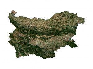
germany europe map landscape terrain country relief geography continent mountainこのアイテムにコメントはありません。

-50%

dae fbx mb obj stl png
deformer
Landscapes