English
 Español
 Deutsch
 日本語
日本語 Polska
 Français
 中國
中國 한국의
한국의 Українська
 Italiano
 Nederlands
 Türkçe
 Português
 Bahasa Indonesia
 Русский
 हिंदी
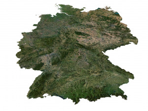
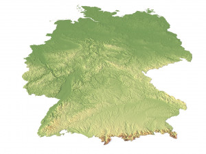
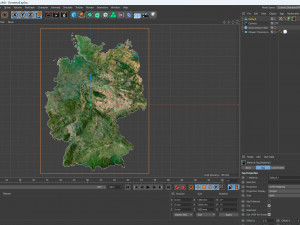
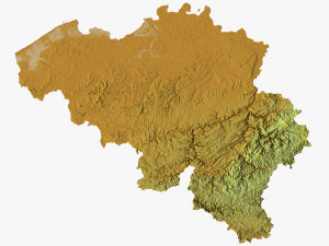
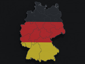
हिंदीGermany Terrain 3D Map Modelo 3D

-20%
stl
sychev23021983
Terrain
HALLOWEEN
PRE SALE 50% OFF
$
36.80 USD
Você tem $0.00 Créditos. Comprar créditos

- Formatos disponíveis: Image Textures (.tif) 905.46 MB
Tornar: StandardCinema4D (.c4d) 142.56 MB
Tornar: Standard
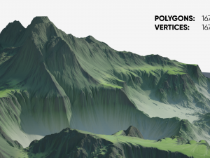
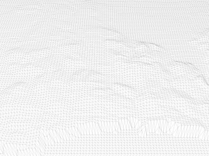
- Polígonos:9 984 600
- Vértices:4 996 816
- Animados:No
- Textura:
- Equipados:No
- Materiais:
- Low-poly:No
- Coleção:No
- Mapeamento UVW:
- Plugins Utilizados:No
- Pronto para impressão:No
- Scan 3D:No
- Conteúdo adulto:No
- PBR:No
- Geometria:Polygonal
- UVs não embalados:Unknown
- Visualizações:2561
- Data: 2023-07-04
- ID do Item:453284
Format: C4D
File size (unzipped): 571 MB
Polygons: 9 984 600
Vertices: 4 996 816
Geometry: Polygonal Tris only
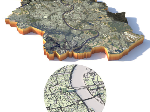
Model size: 1350 mm x 1800 mm x 7.659 mm
Projection: Mercator
Base: Open
UV layer: Yes (frontal)
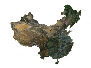
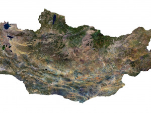
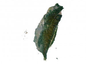
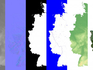
Textures
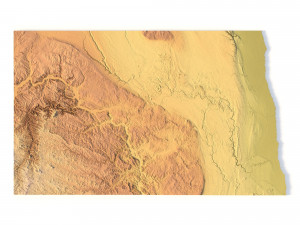
Height Map TIF 6145*8193*16b - You can use this map in the displacement channel instead of the polygonal mesh.
Normal Map TIF 6145*8193*48b - Use this map to reveal fine details of the relief.
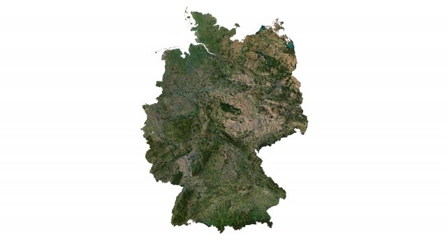
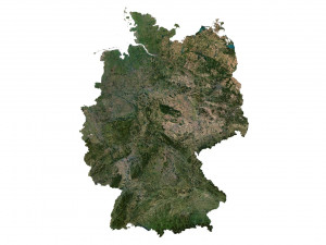
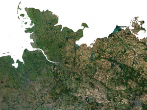
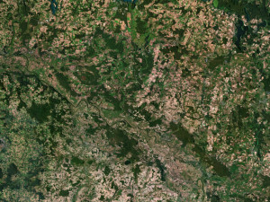
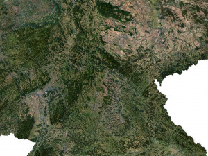
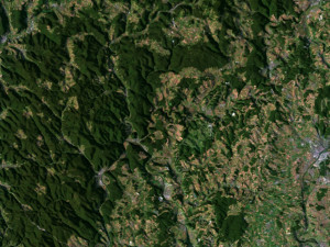
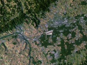
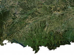
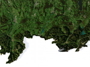
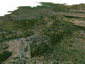
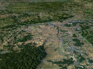
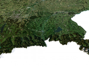
Satellite Map TIF 10800*14400*48b
Water Mask TIF 10800*14400*48b - Use this map for masking in the Reflection channel to get glare from the water surface.
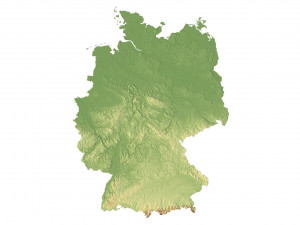
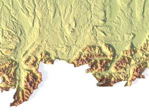
Pseudo-color Map 10800*14400*48b - Use this map to get elevation information based on the color shade.
Boundary Mask TIF 10800*14400*48b - Use this map as a mask for your background.
Other models can be made on request.
Modifications, conversion to OBJ, FBX, STL and other formats, more detailed models and better textures on request. Pronto para impressão: Não
Leia maisFile size (unzipped): 571 MB
Polygons: 9 984 600
Vertices: 4 996 816
Geometry: Polygonal Tris only
Model size: 1350 mm x 1800 mm x 7.659 mm
Projection: Mercator
Base: Open
UV layer: Yes (frontal)
Textures
Height Map TIF 6145*8193*16b - You can use this map in the displacement channel instead of the polygonal mesh.
Normal Map TIF 6145*8193*48b - Use this map to reveal fine details of the relief.
Satellite Map TIF 10800*14400*48b
Water Mask TIF 10800*14400*48b - Use this map for masking in the Reflection channel to get glare from the water surface.
Pseudo-color Map 10800*14400*48b - Use this map to get elevation information based on the color shade.
Boundary Mask TIF 10800*14400*48b - Use this map as a mask for your background.
Other models can be made on request.
Modifications, conversion to OBJ, FBX, STL and other formats, more detailed models and better textures on request. Pronto para impressão: Não
Precisa de mais formatos?
Se precisar de um formato diferente, por favor abra um novo Support Ticket e solicite isso. Podemos converter modelos 3D para: .stl, .c4d, .obj, .fbx, .ma/.mb, .3ds, .3dm, .dxf/.dwg, .max. .blend, .skp, .glb. Não convertemos cenas 3D e formatos como .step, .iges, .stp, .sldprt.!
Se precisar de um formato diferente, por favor abra um novo Support Ticket e solicite isso. Podemos converter modelos 3D para: .stl, .c4d, .obj, .fbx, .ma/.mb, .3ds, .3dm, .dxf/.dwg, .max. .blend, .skp, .glb. Não convertemos cenas 3D e formatos como .step, .iges, .stp, .sldprt.!
Germany Terrain 3D Map Modelo 3D tif, c4d, De sychev23021983
germany europe map landscape terrain country relief geography continent mountainNão há comentários para este item.

-50%

dae fbx mb obj stl png
deformer
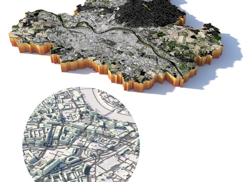
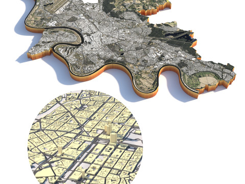
Landscapes