English
 Español
 Deutsch
 日本語
日本語 Polska
 Français
 中國
中國 한국의
한국의 Українська
 Italiano
 Nederlands
 Türkçe
 Português
 Bahasa Indonesia
 Русский
 हिंदी
हिंदीmiami cityscape Modèle 3D


$
85.00
Vous avez $0.00 Crédits. Acheter Credits

- Formats disponibles: Wavefront OBJ (.obj) 4.89 MB
Render: Standard
- Polygones:116714
- Sommets:60943
- Animé:No
- Textures:
- Installé:No
- Matériaux:
- Prêt à imprimer:No
- Géométrie:Polygonal
- Vus:4395
- Date: 2013-09-12
- ID de produit:74462
miami is a city located on the atlantic coast in southeastern florida and the county seat of miami-dade county. the 42nd largest city in the united states, with a population of 413,892, it is the most populous metropolis in the southern united states after washington, d.c.
miami is a major center and a leader in finance, commerce, culture, media, entertainment, the arts, and international trade.
downtown miami and south florida are home to the largest concentration of international banks in the united states, and many large national and international companies. the civic center is a major center for hospitals, research institutes, medical centers, and biotechnology industries. for more than two decades, the port of miami, known as the \"cruise capital of the world,\" has been the number one cruise passenger port in the world. it accommodates some of the world's largest cruise ships and operations, and is the busiest port in both passenger traffic and cruise lines.
miami and its suburbs are located on a broad plain ***ween the florida everglades to the west and biscayne bay to the east, which also extends from florida bay north to lake okeechobee. the elevation of the area never rises above 40 ft (12 m) and averages at around 6 ft (1.8 m) above mean sea level in most neighborhoods, especially near the coast. the highest undulations are found along the coastal miami rock ridge, whose substrate underlies most of the eastern miami metropolitan region. the main portion of the city lies on the shores of biscayne bay which contains several hundred natural and artificially created barrier islands, the largest of which contains miami beach and south beach. the gulf stream, a warm ocean current, runs northward just 15 miles (24 km) off the coast, allo***g the city's climate to stay warm and mild all year.
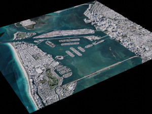
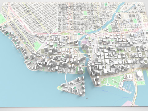
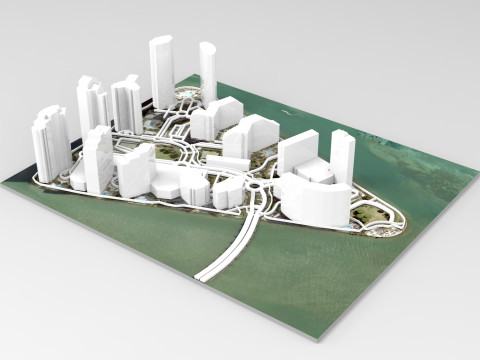
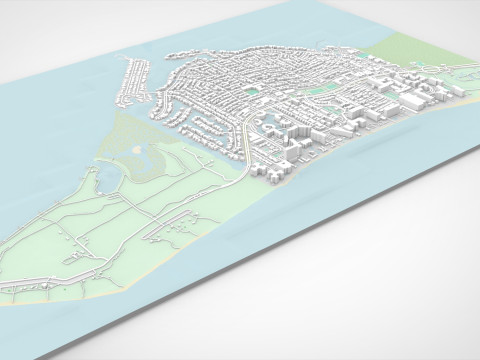
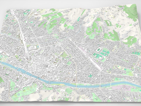
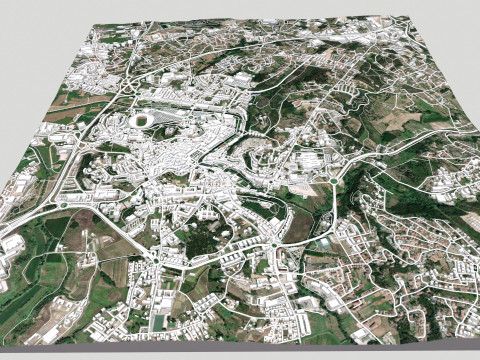
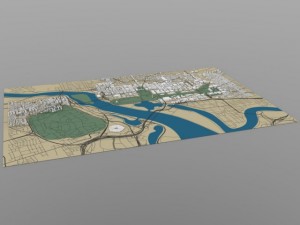
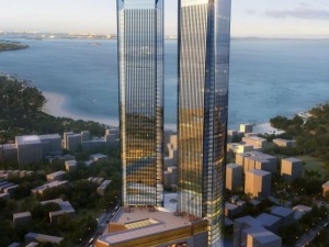
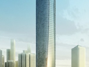
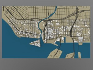
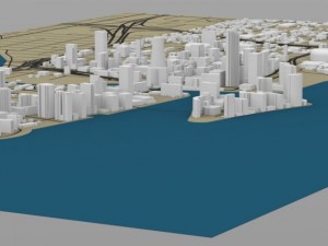
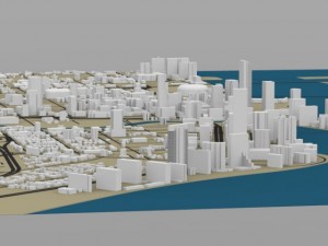
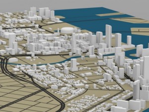
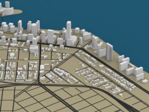
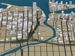
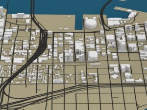
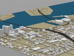
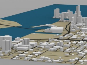
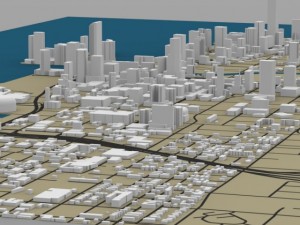
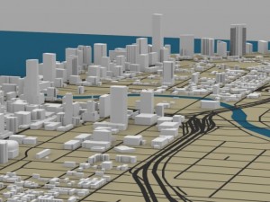
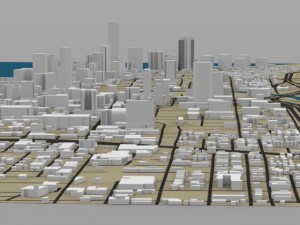
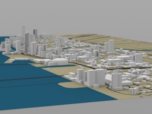
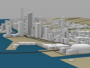
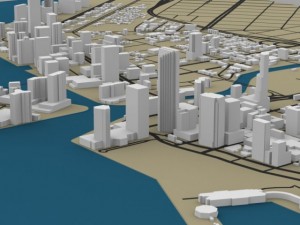
this digital model shows the cityscape of downtown miami, florida with many of its famous buildings.
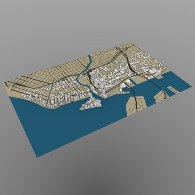
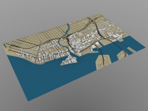
all of the (white) buildings are modelled, but the terrain (green, brown, and blue) is a texture map/ not modelled.
note: this model is meant for distance and overview shots.
product features (wavefront obj):
- approx 116714 polygons
- built with 3-sided polygons and no non-planar polygons.
- includes grouping information: the buildings are separated into individual and clustered groups.
- this version includes an mtl file, which your software program should read to colorize the model.
- the model has basic uv mapping.
- the model includes one texture (in jpg format) for the terrain
- the buildings are not textured. Prêt à imprimer: Non
En savoir plusmiami is a major center and a leader in finance, commerce, culture, media, entertainment, the arts, and international trade.
downtown miami and south florida are home to the largest concentration of international banks in the united states, and many large national and international companies. the civic center is a major center for hospitals, research institutes, medical centers, and biotechnology industries. for more than two decades, the port of miami, known as the \"cruise capital of the world,\" has been the number one cruise passenger port in the world. it accommodates some of the world's largest cruise ships and operations, and is the busiest port in both passenger traffic and cruise lines.
miami and its suburbs are located on a broad plain ***ween the florida everglades to the west and biscayne bay to the east, which also extends from florida bay north to lake okeechobee. the elevation of the area never rises above 40 ft (12 m) and averages at around 6 ft (1.8 m) above mean sea level in most neighborhoods, especially near the coast. the highest undulations are found along the coastal miami rock ridge, whose substrate underlies most of the eastern miami metropolitan region. the main portion of the city lies on the shores of biscayne bay which contains several hundred natural and artificially created barrier islands, the largest of which contains miami beach and south beach. the gulf stream, a warm ocean current, runs northward just 15 miles (24 km) off the coast, allo***g the city's climate to stay warm and mild all year.
this digital model shows the cityscape of downtown miami, florida with many of its famous buildings.
all of the (white) buildings are modelled, but the terrain (green, brown, and blue) is a texture map/ not modelled.
note: this model is meant for distance and overview shots.
product features (wavefront obj):
- approx 116714 polygons
- built with 3-sided polygons and no non-planar polygons.
- includes grouping information: the buildings are separated into individual and clustered groups.
- this version includes an mtl file, which your software program should read to colorize the model.
- the model has basic uv mapping.
- the model includes one texture (in jpg format) for the terrain
- the buildings are not textured. Prêt à imprimer: Non
Avez besoin de plus de formats?
Si vous avea besoin d’\autre format veuillez ouvrir un billet d’\assistance et demandez le. Nous pouvons convertir les modèles de 3D en: .stl, .c4d, .obj, .fbx, .ma/.mb, .3ds, .3dm, .dxf/.dwg, .max. .blend, .skp, .glb. Nous ne convertissons pas les scènes 3D et des formats tels que .step, .iges, .stp, .sldprt.!
Si vous avea besoin d’\autre format veuillez ouvrir un billet d’\assistance et demandez le. Nous pouvons convertir les modèles de 3D en: .stl, .c4d, .obj, .fbx, .ma/.mb, .3ds, .3dm, .dxf/.dwg, .max. .blend, .skp, .glb. Nous ne convertissons pas les scènes 3D et des formats tels que .step, .iges, .stp, .sldprt.!
miami cityscape Modèle 3D obj, De Digimation
city cityscape skyline buildings miami floridaAucun commentaires sur ce produit.