
 English
 Español
 Deutsch
 日本語
日本語 Polska
 Français
 中國
中國 한국의
한국의 Українська
 Italiano
 Nederlands
 Türkçe
 Português
 Bahasa Indonesia
 Русский
 हिंदी
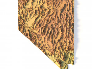
हिंदीTopographic California Map STL Model Model Cetak 3D


- Format yang tersedia: Stereolithography (.stl) 546.53 MB
- Koleksi:No
- Lebar dalam milimeter:457
- Tinggi dalam milimeter:5.4
- Kedalaman dalam milimeter:529
- Siap Cetak:No
- Pindai 3D:No
- Konten Dewasa:No
- PBR:No
- AI Pelatihan:No
- Tampilan:2557
- Tanggal: 2022-06-17
- ID Barang:402257
Topographic California Map STL Model Model Cetak 3D stl, Dari sychev23021983
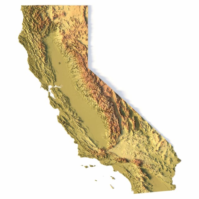
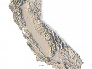
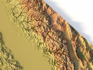
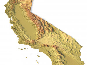
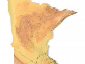
Create Detailed California Terrain Models with This 3D STL File
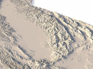
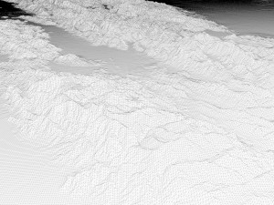
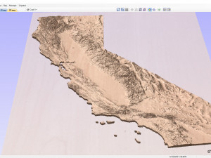
The Topographic California Map STL model provides a high-precision 3D terrain representation of the state. Whether you’re crafting topographic maps for landform visualization or working on professional geographic representation projects, this model captures the intricate elevation map details of California’s mountain ranges, valleys, and coastal features. Ideal for both hobbyists and professionals using 3D printers, CNC machines, and laser engravers.
- Files size: 1GB / 493 MB
- Model size: 114.35 mm x 132.2 mm x 1.341 mm
- Polygons: 14 394 280
- Vertices: 7 210 433
- Geometry: Polygonal Tris only
- Projection: Mercator
- Scaling factor: X - 0,0000001; Y - 0,0000001; Z - 0,0000003
- Base: Open/Closed
Key Features of the Topographic California Map STL Model
Compatible with FDM/SLA 3D printing for creating physical models of the terrain.
Designed for CNC machining on wood and metal materials.
Supports high-precision laser engraving for fine surface detailing on metals.
Perlu lebih banyak format?
Jika Anda membutuhkan format yang berbeda, silakan buka Tiket Dukungan baru dan minta itu. Kita dapat mengonversi model 3D menjadi: .stl, .c4d, .obj, .fbx, .ma/.mb, .3ds, .3dm, .dxf/.dwg, .max. .blend, .skp, .glb. Kami tidak mengonversi adegan 3d dan format seperti .step, .iges, .stp, .sldprt.!Informasi Penggunaan
Topographic California Map STL Model - Anda dapat menggunakan model 3D bebas royalti ini untuk keperluan pribadi dan komersial sesuai dengan Lisensi Dasar atau Diperpanjang.Lisensi Dasar mencakup sebagian besar kasus penggunaan standar, termasuk iklan digital, proyek desain dan visualisasi, akun media sosial bisnis, aplikasi asli, aplikasi web, permainan video, dan produk akhir fisik atau digital (baik gratis maupun berbayar).
Lisensi Diperpanjang mencakup semua hak yang diberikan berdasarkan Lisensi Dasar, tanpa batasan penggunaan, dan memungkinkan model 3D untuk digunakan dalam proyek komersial tanpa batas dengan ketentuan Bebas Royalti.
Baca lebih lanjut


