English
 Español
 Deutsch
 日本語
日本語 Polska
 Français
 中國
中國 한국의
한국의 Українська
 Italiano
 Nederlands
 Türkçe
 Português
 Bahasa Indonesia
 Русский
 हिंदी
हिंदीTopographic California Map STL Model 3D 프린트 모델


- 작성자에게 제품 지원 요청

- 이용 가능한 포맷:
- 아이템 ID:402257
- 날짜: 2022-06-17
- 컬렉션:No
- 밀리미터 폭:457
- 밀리미터 넓이:5.4
- 밀리미터 깊이:529
- 프린트 준비:No
- 3D 스캔:No
- 성인용 콘텐츠:No
- PBR:No
- AI 훈련:No
- 조회:2617
설명
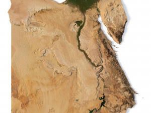
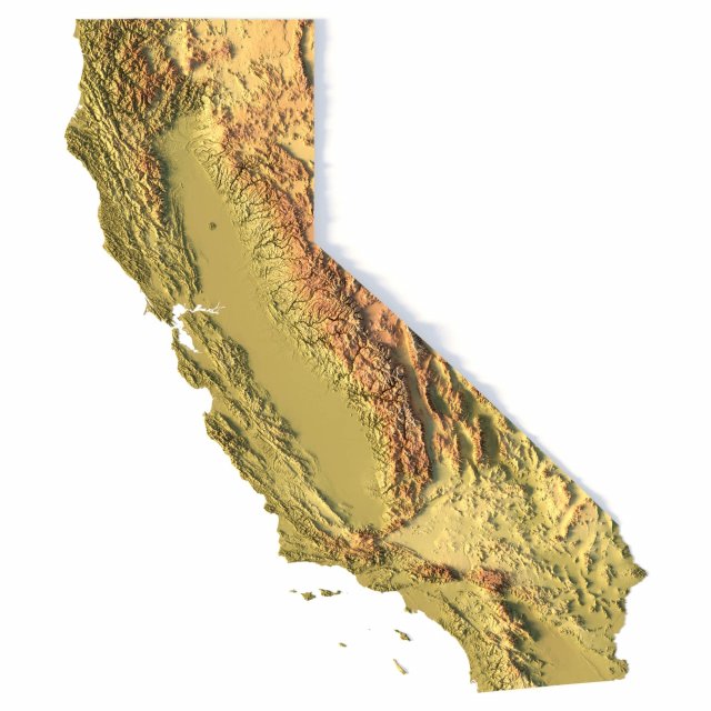
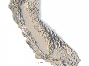
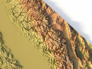
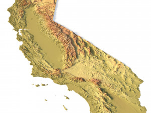
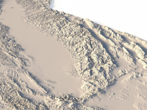
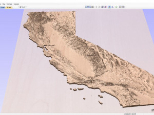
Create Detailed California Terrain Models with This 3D STL File
The Topographic California Map STL model provides a high-precision 3D terrain representation of the state. Whether you’re crafting topographic maps for landform visualization or working on professional geographic representation projects, this model captures the intricate elevation map details of California’s mountain ranges, valleys, and coastal features. Ideal for both hobbyists and professionals using 3D printers, CNC machines, and laser engravers.
- Files size: 1GB / 493 MB
- Model size: 114.35 mm x 132.2 mm x 1.341 mm
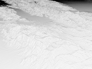
- Polygons: 14 394 280
- Vertices: 7 210 433
- Geometry: Polygonal Tris only
- Projection: Mercator
- Scaling factor: X - 0,0000001; Y - 0,0000001; Z - 0,0000003
- Base: Open/Closed
Key Features of the Topographic California Map STL Model
Compatible with FDM/SLA 3D printing for creating physical models of the terrain.
Designed for CNC machining on wood and metal materials.
Supports high-precision laser engraving for fine surface detailing on metals.
다른 포맷이 필요하세요?
다른 포맷이 필요하시면, 새로운 지원 티켓을 열어 요청하세요. 저희는 3D 모델을 다음으로 변환할 수 있습니다: .stl, .c4d, .obj, .fbx, .ma/.mb, .3ds, .3dm, .dxf/.dwg, .max. .blend, .skp, .glb. 자유 형식 변환우리는 3D 장면을 변환하지 않습니다 .step, .iges, .stp, .sldprt와 같은 형식도 포함됩니다.!
사용 정보
Topographic California Map STL Model - 기본 또는 확장 라이선스에 따라 이 로열티 프리 3D 모델을 개인적 및 상업적 목적으로 사용할 수 있습니다.기본 라이선스는 디지털 광고, 디자인 및 시각화 프로젝트, 비즈니스 소셜 미디어 계정, 네이티브 앱, 웹 앱, 비디오 게임, 그리고 물리적 또는 디지털 최종 제품(무료 및 유료 모두)을 포함한 대부분의 표준 사용 사례를 포괄합니다.
확장 라이선스는 기본 라이선스에 따라 부여된 모든 권리를 포함하며 사용 제한이 없으며, 로열티 프리 조건 하에 3D 모델을 상업적 프로젝트에 무제한으로 사용할 수 있습니다.
더 보기
환불이 보장되나요?
네, 환불을 보장합니다. 작품 구입 후 렌더나 설명에서 오류를 발견하시면, 저희는 최대한 빨리 해당 문제를 수정 할 것입니다. 저희가 해당 오류를 수정 할 수 없는 경우, 저희는 귀하의 주문을 취소하며 아이템 다운로드 24 시간 내에 금액을 환불해드립니다. 더 자세한 정보는 여기를 참조하세요키워드
이 저작자의 랜덤 아이템