English
 Español
 Deutsch
 日本語
日本語 Polska
 Français
 中國
中國 한국의
한국의 Українська
 Italiano
 Nederlands
 Türkçe
 Português
 Bahasa Indonesia
 Русский
 हिंदी
हिंदीlower manhattan cityscape 3D 모델


$
29.99
가지고 있는 아이템 $0.00 크레딧. 크레딧 구입

- 이용 가능한 포맷: 3D Studio (.3ds) 3.26 MBWavefront OBJ (.obj) 5.06 MB
- 폴리곤:55430
- 버텍스:82331
- 애니메이티드:No
- 텍스쳐드:
- 리그드:No
- 재료:
- 로우 폴리곤:No
- 컬렉션:No
- UVW 매핑:
- 플러그인 사용 됨:No
- 프린트 준비:No
- 3D 스캔:No
- 성인용 콘텐츠:No
- PBR:No
- 지오메트리:Polygonal
- 언래핑 된 UVs:Overlapping
- 조회:2757
- 날짜: 2021-02-06
- 아이템 ID:335143
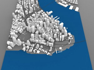
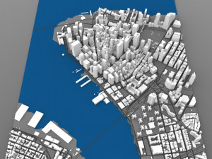
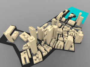
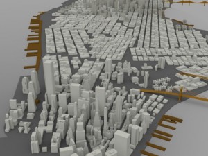
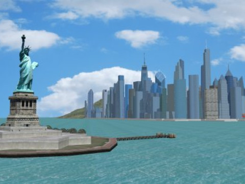
manhattan is one of the five boroughs of new york city, geographically smallest but most densely populated in the city. located primarily on the island of manhattan at the mouth of the hudson river, the borough is conterminous with new york county, an original county of the u.s. state of new york.
the city of new york originated at the southern tip of manhattan and expanded northward.
manhattan is loosely divided into downtown (lower manhattan), midtown (midtown manhattan), and uptown (upper manhattan), with fifth avenue dividing manhattan's east and west sides. manhattan island is bounded by the hudson river to the west and the east river to the east. to the north, the harlem river divides manhattan island from the bronx and the mainland united states.
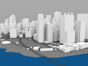
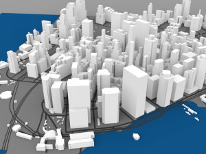
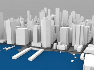
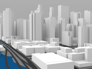
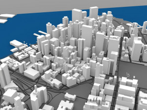
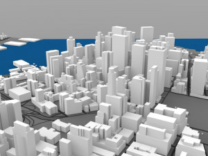
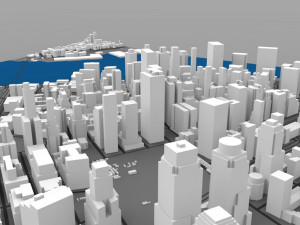
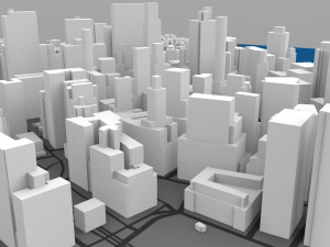
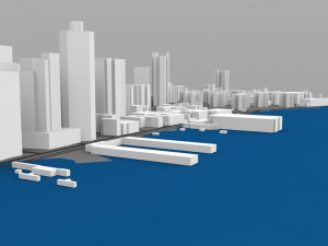
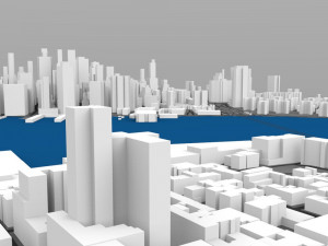
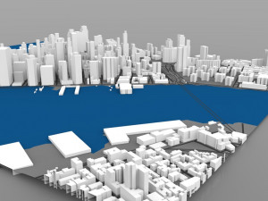
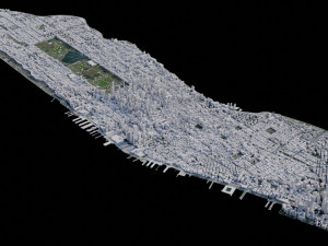
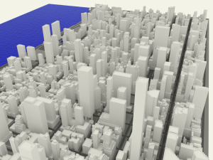
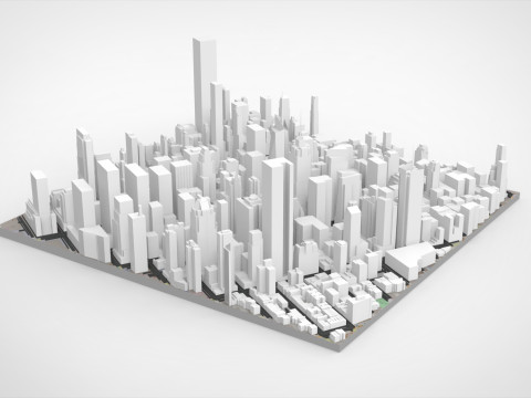
this digital model shows the lower/ downtown section of manhattan with many of its famous buildings.
note: this model is meant for distance and overview shots; the streets may become blurry when viewed close-up.
product features:
- approx 55,430 polygons.
- made entirely with 3-point polygons/ triangles.
- all of the buildings are modelled, but they do not have individual materials.
- the model includes the follo***g groups:
-- approximately 480 separate buildings.
-- terrain/ landscape.
-- (the model is not rigged since the buildings aren't moveable parts.)
- the model has 2 materials: buildings and environment.
- the model is uv mapped and the "environment" material uses 5700x4250 pixel texture map to show the streets and water.
- the buildings are not textured.
original model by digimation model bank, sold here with full permission. 프린트 준비: 아니오
더 보기the city of new york originated at the southern tip of manhattan and expanded northward.
manhattan is loosely divided into downtown (lower manhattan), midtown (midtown manhattan), and uptown (upper manhattan), with fifth avenue dividing manhattan's east and west sides. manhattan island is bounded by the hudson river to the west and the east river to the east. to the north, the harlem river divides manhattan island from the bronx and the mainland united states.
this digital model shows the lower/ downtown section of manhattan with many of its famous buildings.
note: this model is meant for distance and overview shots; the streets may become blurry when viewed close-up.
product features:
- approx 55,430 polygons.
- made entirely with 3-point polygons/ triangles.
- all of the buildings are modelled, but they do not have individual materials.
- the model includes the follo***g groups:
-- approximately 480 separate buildings.
-- terrain/ landscape.
-- (the model is not rigged since the buildings aren't moveable parts.)
- the model has 2 materials: buildings and environment.
- the model is uv mapped and the "environment" material uses 5700x4250 pixel texture map to show the streets and water.
- the buildings are not textured.
original model by digimation model bank, sold here with full permission. 프린트 준비: 아니오
다른 포맷이 필요하세요?
다른 포맷이 필요하시면, 새로운 지원 티켓을 열어 요청하세요. 저희는 3D 모델을 다음으로 변환할 수 있습니다: .stl, .c4d, .obj, .fbx, .ma/.mb, .3ds, .3dm, .dxf/.dwg, .max. .blend, .skp, .glb. 우리는 3D 장면을 변환하지 않습니다 .step, .iges, .stp, .sldprt와 같은 형식도 포함됩니다.!
다른 포맷이 필요하시면, 새로운 지원 티켓을 열어 요청하세요. 저희는 3D 모델을 다음으로 변환할 수 있습니다: .stl, .c4d, .obj, .fbx, .ma/.mb, .3ds, .3dm, .dxf/.dwg, .max. .blend, .skp, .glb. 우리는 3D 장면을 변환하지 않습니다 .step, .iges, .stp, .sldprt와 같은 형식도 포함됩니다.!
lower manhattan cityscape 3D 모델 3ds, obj, 발신 VanishingPoint
cityscape york city skyline exterior architecture buildings manhattan이 아이템에 대한 코멘트 없음.

max max max max
3DOriginal
Cityscapes