English
 Español
 Deutsch
 日本語
日本語 Polska
 Français
 中國
中國 한국의
한국의 Українська
 Italiano
 Nederlands
 Türkçe
 Português
 Bahasa Indonesia
 Русский
 हिंदी
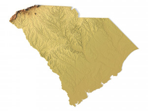
हिंदीAlabama Topographic Map STL Model 3D 프린트 모델

- 작성자에게 제품 지원 요청

- 이용 가능한 포맷:
- 아이템 ID:401623
- 날짜: 2022-06-11
- 컬렉션:No
- 밀리미터 폭:159
- 밀리미터 넓이:1
- 밀리미터 깊이:251
- 프린트 준비:No
- 3D 스캔:No
- 성인용 콘텐츠:No
- PBR:No
- AI 훈련:No
- 조회:2497
설명
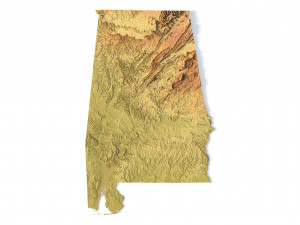
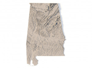
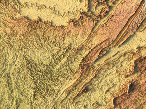
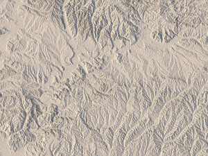
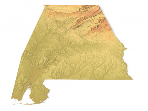
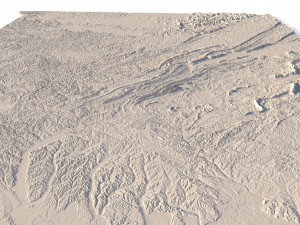
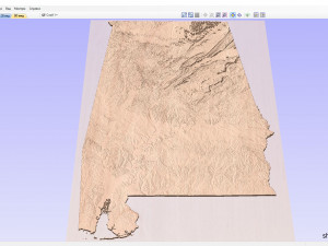
Create Detailed Topography with this 3D STL Model
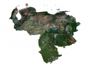
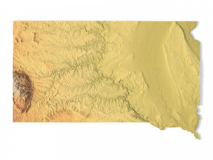
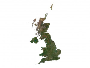
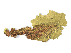
This Alabama topographic map STL model is perfect for those who need a high-precision terrain model. Whether you’re a professional in geospatial analysis, an enthusiast in 3D printing, or someone interested in landscape representation, this model will help bring the natural features of Alabama to life.
• Format: STL
• Files size: 801 MB/419 MB
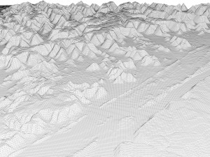
• Polygons: 16 815 236
• Vertices: 8 419 743
• Geometry: Polygonal Tris only
• Model size: 159.48 mm x 251.** mm x 0.991 mm
• Projection: Mercator
• Scaling factor X:Y:Z: 1:1:3
• Base: Open/Closed
Key Features of the Alabama Topographic Map STL
• Supports FDM/SLA 3D printers for plastic or photopolymer models.
• Compatible with CNC machines for wood or metal terrain models.
• Precise 3D laser engraving for metal surface detailing.
다른 포맷이 필요하세요?
다른 포맷이 필요하시면, 새로운 지원 티켓을 열어 요청하세요. 저희는 3D 모델을 다음으로 변환할 수 있습니다: .stl, .c4d, .obj, .fbx, .ma/.mb, .3ds, .3dm, .dxf/.dwg, .max. .blend, .skp, .glb. 자유 형식 변환우리는 3D 장면을 변환하지 않습니다 .step, .iges, .stp, .sldprt와 같은 형식도 포함됩니다.!
사용 정보
Alabama Topographic Map STL Model - 기본 또는 확장 라이선스에 따라 이 로열티 프리 3D 모델을 개인적 및 상업적 목적으로 사용할 수 있습니다.기본 라이선스는 디지털 광고, 디자인 및 시각화 프로젝트, 비즈니스 소셜 미디어 계정, 네이티브 앱, 웹 앱, 비디오 게임, 그리고 물리적 또는 디지털 최종 제품(무료 및 유료 모두)을 포함한 대부분의 표준 사용 사례를 포괄합니다.
확장 라이선스는 기본 라이선스에 따라 부여된 모든 권리를 포함하며 사용 제한이 없으며, 로열티 프리 조건 하에 3D 모델을 상업적 프로젝트에 무제한으로 사용할 수 있습니다.
더 보기