English
 Español
 Deutsch
 日本語
日本語 Polska
 Français
 中國
中國 한국의
한국의 Українська
 Italiano
 Nederlands
 Türkçe
 Português
 Bahasa Indonesia
 Русский
 हिंदी
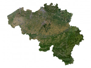
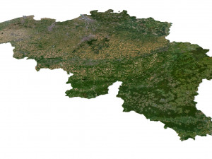
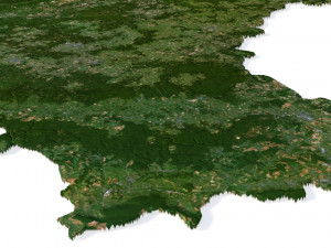
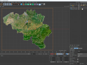
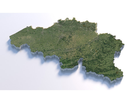
हिंदीBelgium Terrain 3D Map 3D 모델


-20%
obj c4d stl
sychev23021983
Landscapes
$31.20
$39.00
WEEKEND SALE ENDS
$
36.80
가지고 있는 아이템 $0.00 크레딧. 크레딧 구입

- 이용 가능한 포맷: Cinema4D (.c4d) 754.69 MB
렌더: Standard
- 폴리곤:9 984 600
- 버텍스:4 996 816
- 애니메이티드:No
- 텍스쳐드:
- 리그드:No
- 재료:
- 로우 폴리곤:No
- 컬렉션:No
- UVW 매핑:No
- 플러그인 사용 됨:No
- 프린트 준비:No
- 3D 스캔:No
- 성인용 콘텐츠:No
- PBR:No
- 지오메트리:Polygonal
- 언래핑 된 UVs:Unknown
- 조회:2653
- 날짜: 2023-07-17
- 아이템 ID:454914
Format: C4D
File size (unzipped): 571 MB
Polygons: 9 984 600
Vertices: 4 996 816
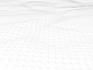
Geometry: Polygonal Tris only
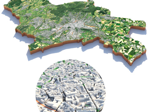
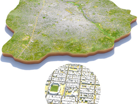
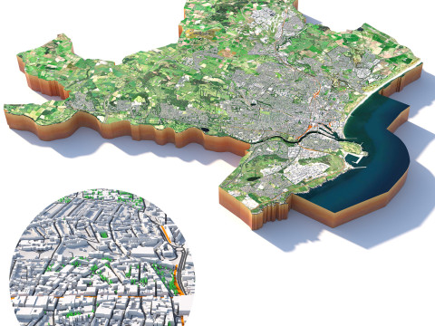
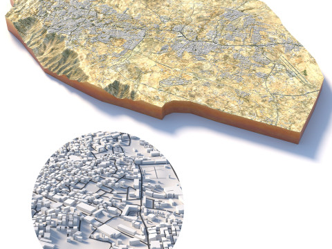
Model size: 1450 mm x 1187.5 mm x 5.116 mm
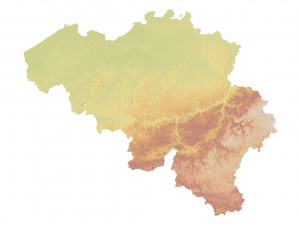
Projection: Mercator
Base: Open
UV layer: Yes (frontal)
Textures
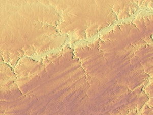
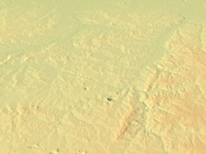
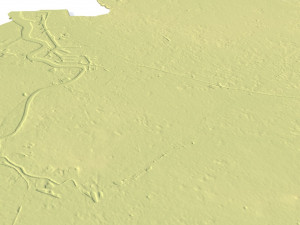
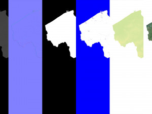
Height Map TIF 8192*6709*16b - You can use this map in the displacement channel instead of the polygonal mesh.
Normal Map TIF 8192*6709*48b - Use this map to reveal fine details of the relief.
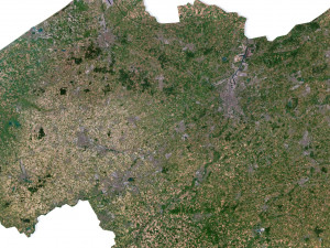
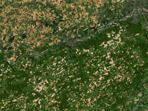
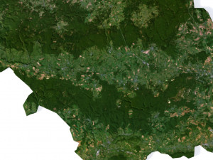
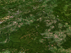
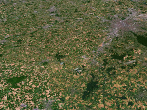
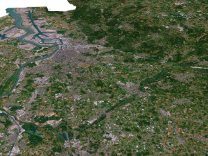
Satellite Map TIF 11600*9500*24b
Water Mask TIF 11600*9500*24b - Use this map for masking in the Reflection channel to get glare from the water surface.
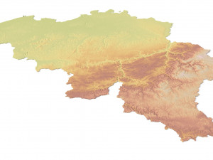
Pseudo-color Map 11600*9500*24b - Use this map to get elevation information based on the color shade.
Boundary Mask TIF 11600*9500*24b - Use this map as a mask for your background.
Other models can be made on request.
Modifications, conversion to OBJ, FBX, STL and other formats, more detailed models and ***ter textures on request. 프린트 준비: 아니오
더 보기File size (unzipped): 571 MB
Polygons: 9 984 600
Vertices: 4 996 816
Geometry: Polygonal Tris only
Model size: 1450 mm x 1187.5 mm x 5.116 mm
Projection: Mercator
Base: Open
UV layer: Yes (frontal)
Textures
Height Map TIF 8192*6709*16b - You can use this map in the displacement channel instead of the polygonal mesh.
Normal Map TIF 8192*6709*48b - Use this map to reveal fine details of the relief.
Satellite Map TIF 11600*9500*24b
Water Mask TIF 11600*9500*24b - Use this map for masking in the Reflection channel to get glare from the water surface.
Pseudo-color Map 11600*9500*24b - Use this map to get elevation information based on the color shade.
Boundary Mask TIF 11600*9500*24b - Use this map as a mask for your background.
Other models can be made on request.
Modifications, conversion to OBJ, FBX, STL and other formats, more detailed models and ***ter textures on request. 프린트 준비: 아니오
다른 포맷이 필요하세요?
다른 포맷이 필요하시면, 새로운 지원 티켓을 열어 요청하세요. 저희는 3D 모델을 다음으로 변환할 수 있습니다: .stl, .c4d, .obj, .fbx, .ma/.mb, .3ds, .3dm, .dxf/.dwg, .max. .blend, .skp, .glb. 우리는 3D 장면을 변환하지 않습니다 .step, .iges, .stp, .sldprt와 같은 형식도 포함됩니다.!
다른 포맷이 필요하시면, 새로운 지원 티켓을 열어 요청하세요. 저희는 3D 모델을 다음으로 변환할 수 있습니다: .stl, .c4d, .obj, .fbx, .ma/.mb, .3ds, .3dm, .dxf/.dwg, .max. .blend, .skp, .glb. 우리는 3D 장면을 변환하지 않습니다 .step, .iges, .stp, .sldprt와 같은 형식도 포함됩니다.!
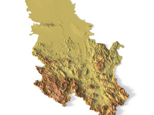
Belgium Terrain 3D Map 3D 모델 c4d, 발신 sychev23021983
belgium europe map landscape terrain country relief geography continent mountain이 아이템에 대한 코멘트 없음.

-50%

dae fbx mb obj stl png
deformer
Landscapes