English
 Español
 Deutsch
 日本語
日本語 Polska
 Français
 中國
中國 한국의
한국의 Українська
 Italiano
 Nederlands
 Türkçe
 Português
 Bahasa Indonesia
 Русский
 हिंदी
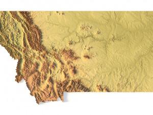
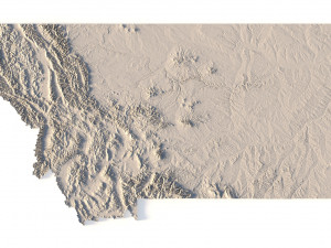
हिंदीMontana Topographic Map STL Model 3D 프린트 모델


- 이용 가능한 포맷: Stereolithography (.stl) 691.95 MB
- 컬렉션:No
- 밀리미터 폭:534
- 밀리미터 넓이:4.8
- 밀리미터 깊이:300
- 프린트 준비:
- 3D 스캔:No
- 성인용 콘텐츠:No
- PBR:No
- AI 훈련:No
- 조회:3184
- 날짜: 2022-06-17
- 아이템 ID:402318
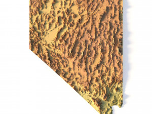
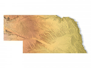
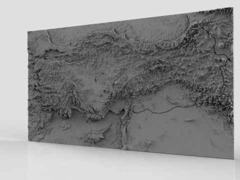
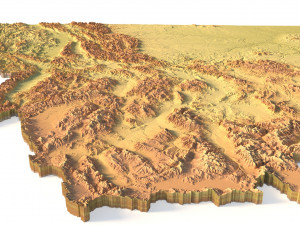
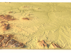
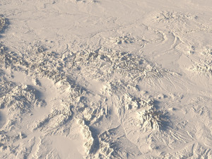
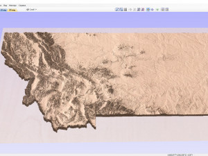
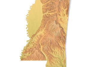
Create Detailed Montana Terrain Models with This High-Resolution 3D STL
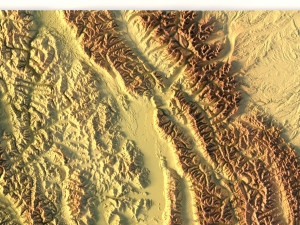
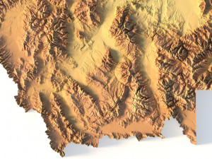
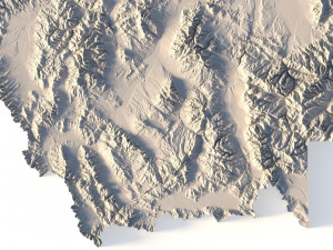
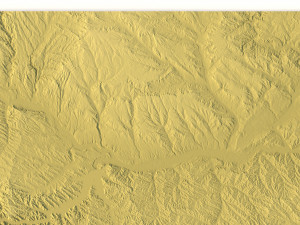
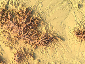
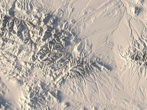
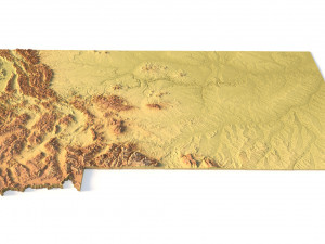
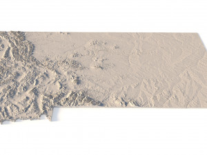
The Montana Topographic Map STL model provides a high-resolution representation of the state’s rugged topography and diverse geographic features. This 3D model is ideal for crafting physical relief maps from materials such as wood, metal, plastic, or concrete. Whether for landform visualization, educational projects, or professional GIS applications, this model delivers precise elevation data for accurate terrain modeling. Ideal for use with 3D printers, CNC machines, and laser engravers.
- File size: 1.21 GB / 623 MB
- Model size: 534.6 mm x 300.5 mm x 4.758 mm
- Resolution: 0.1 mm
- Projection: Mercator
- Datum: Google maps (sphere radius 6378137)
- EPSG code: 3857
- Scaling factor: X – 0.0000004; Y – 0.0000004; Z – 0.0000012
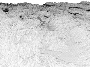
- Number of polygons: 26 181 818
- Number of vertices: 13 100 753
- Polygonal mesh: Triangles only
- Base: Open / Closed
Features of the Montana Topographic STL Model
Detailed elevation data showcasing Montana’s mountains, valleys, and plains.
Compatible with FDM/SLA 3D printers for creating high-quality terrain models.
Designed for CNC machining to craft relief maps from wood or metal.
Supports high-precision laser engraving for metal surface detailing.
다른 포맷이 필요하시면, 새로운 지원 티켓을 열어 요청하세요. 저희는 3D 모델을 다음으로 변환할 수 있습니다: .stl, .c4d, .obj, .fbx, .ma/.mb, .3ds, .3dm, .dxf/.dwg, .max. .blend, .skp, .glb. 우리는 3D 장면을 변환하지 않습니다 .step, .iges, .stp, .sldprt와 같은 형식도 포함됩니다.!
Montana Topographic Map STL Model 3D 프린트 모델 stl, 발신 sychev23021983
montana usa state country america art map