English
 Español
 Deutsch
 日本語
日本語 Polska
 Français
 中國
中國 한국의
한국의 Українська
 Italiano
 Nederlands
 Türkçe
 Português
 Bahasa Indonesia
 Русский
 हिंदी
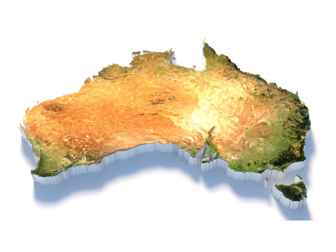
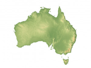
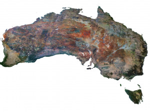
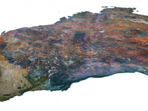
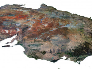
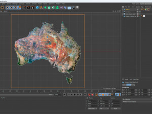
हिंदीAustralia Terrain 3D Map 3D Модель


- Доступні формати: Cinema4D (.c4d) 524.85 MB
Рендер: StandardWavefront OBJ (.obj) 489.39 MB
- Полігони:7 992 002
- Вершини:4 000 000
- Анімована:No
- Текстури:
- Скелет:No
- Матеріали:
- Лоу-полі:No
- Колекція:No
- UVW зображення:
- Плагіни:No
- Готовність до друку:No
- 3D Скан:No
- Зміст для дорослих:No
- PBR:No
- ШІ Навчання:No
- Геометрія:Polygonal
- Розгорнуті UVs:Unknown
- Перегляди:2472
- Дата: 2023-07-05
- ID Товару:453343
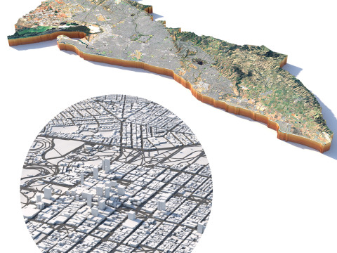
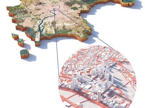
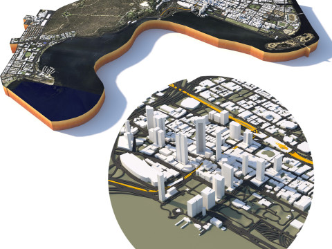
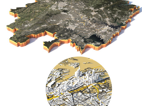
Format: C4D/OBJ
File size (unzipped): 457 MB
Polygons: 7 992 002
Vertices: 4 000 000
Geometry: Polygonal Tris only
Model size: 1000 mm x 1000 mm x 3.436 mm
Projection: Mercator
Base: Open
UV layer: Yes (frontal)
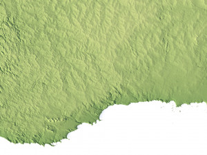
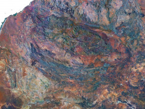
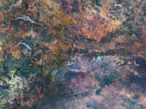
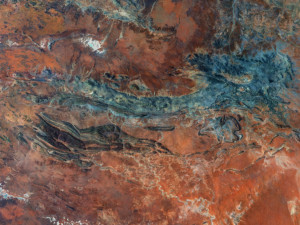
Textures
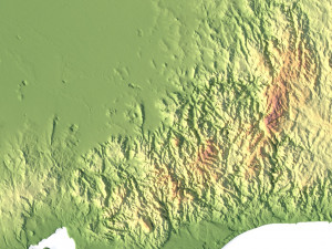
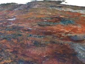
Height Map TIF 8193*8193*16b - You can use this map in the displacement channel instead of the polygonal mesh.
Normal Map TIF 8193*8193*48b - Use this map to reveal fine details of the relief.
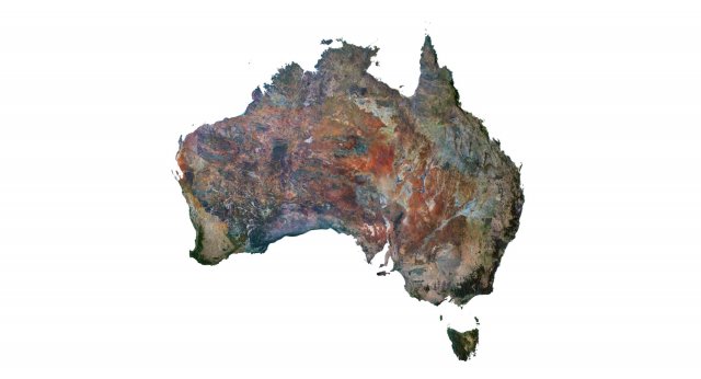
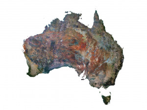
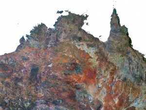
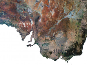
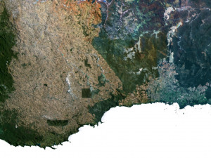
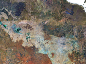
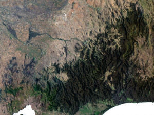
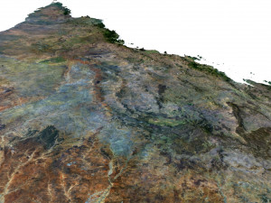
Satellite Map TIF 8193*8193*48b
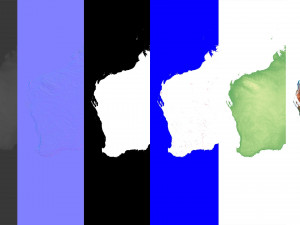
Water Mask TIF 8193*8193*48b - Use this map for masking in the Reflection channel to get glare from the water surface.
Pseudo-color Map 8193*8193*48b - Use this map to get elevation information based on the color shade.
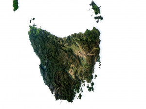
Boundary Mask TIF 8193*8193*48b - Use this map as a mask for your background.
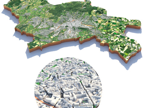
Other models can be made on request.
Modifications, conversion to OBJ, FBX, STL and other formats, more detailed models and ***ter textures on request.
Якщо вам потрібен інший формат, будь ласка, зробіть запит за допомогою тікета підтримки. Ми можемо конвертувати 3D моделі: .stl, .c4d, .obj, .fbx, .ma/.mb, .3ds, .3dm, .dxf/.dwg, .max. .blend, .skp, .glb. Ми не конвертуємо 3d сцени і такі формати, як .step, .iges, .stp, .sldprt тощо!
Australia Terrain 3D Map 3D Модель c4d, obj, від sychev23021983
australia map landscape terrain country relief geography continent mountain