English
 Español
 Deutsch
 日本語
日本語 Polska
 Français
 中國
中國 한국의
한국의 Українська
 Italiano
 Nederlands
 Türkçe
 Português
 Bahasa Indonesia
 Русский
 हिंदी
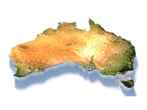
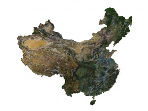
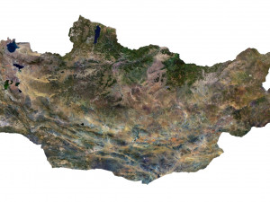
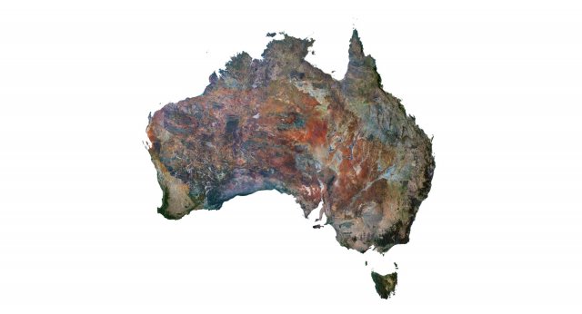
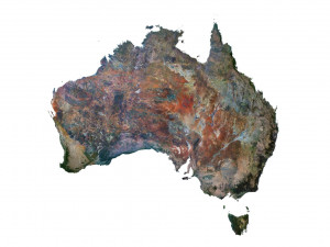
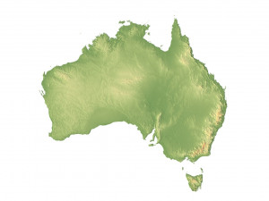
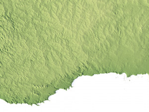
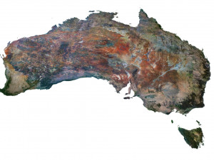
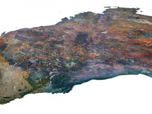
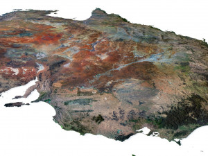
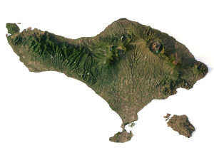
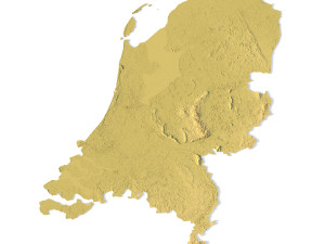
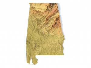
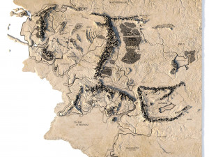
हिंदीAustralia Terrain 3D Map 3Dモデル


- 利用可能フォーマット: Cinema4D (.c4d) 524.85 MB
レンダー: StandardWavefront OBJ (.obj) 489.39 MB
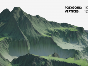
- 多角形:7 992 002
- 頂点:4 000 000
- アニメーション:No
- テクスチャー加工:
- 装飾:No
- 素材:
- 低ポリ:No
- コレクション:No
- UVW マッピング:
- 使用中プラグイン:No
- 印刷 準備:No
- 3D スキャン:No
- 成人コンテンツ:No
- PBR:No
- AIトレーニング:No
- ジオメトリ:Polygonal
- 展開済 UVs:Unknown
- ビュー:2416
- 日付: 2023-07-05
- アイテム ID:453343
Format: C4D/OBJ
File size (unzipped): 457 MB
Polygons: 7 992 002
Vertices: 4 000 000
Geometry: Polygonal Tris only
Model size: 1000 mm x 1000 mm x 3.436 mm
Projection: Mercator
Base: Open
UV layer: Yes (frontal)
Textures
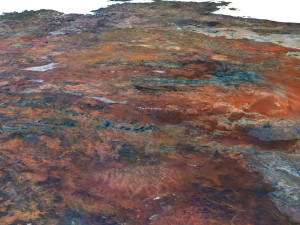
Height Map TIF 8193*8193*16b - You can use this map in the displacement channel instead of the polygonal mesh.
Normal Map TIF 8193*8193*48b - Use this map to reveal fine details of the relief.
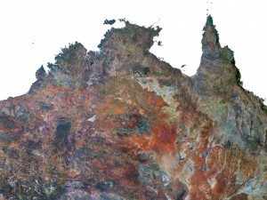
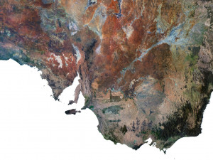
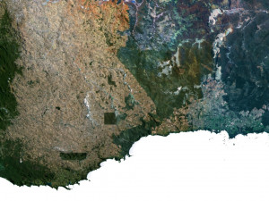
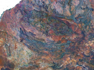
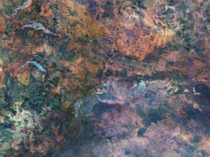
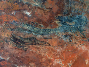
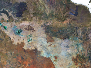
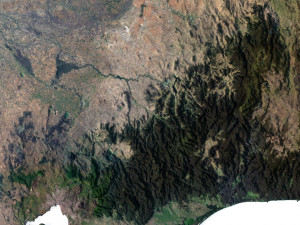
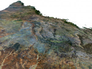
Satellite Map TIF 8193*8193*48b
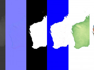
Water Mask TIF 8193*8193*48b - Use this map for masking in the Reflection channel to get glare from the water surface.
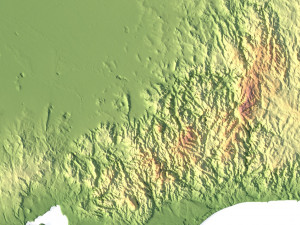
Pseudo-color Map 8193*8193*48b - Use this map to get elevation information based on the color shade.
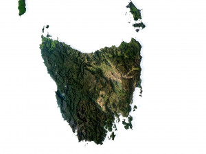
Boundary Mask TIF 8193*8193*48b - Use this map as a mask for your background.
Other models can be made on request.
Modifications, conversion to OBJ, FBX, STL and other formats, more detailed models and better textures on request.
異なるフォーマットが必要な場合、サポートチケットを開き、注文をしてください。3Dモデルをこれらに変換できます: .stl, .c4d, .obj, .fbx, .ma/.mb, .3ds, .3dm, .dxf/.dwg, .max. .blend, .skp, .glb. 3D シーンは変換しません .step、.iges、.stp、.sldprt などの形式。!
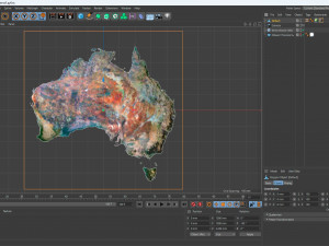
Australia Terrain 3D Map 3Dモデル c4d, obj, から sychev23021983
australia map landscape terrain country relief geography continent mountain