English
 Español
 Deutsch
 日本語
日本語 Polska
 Français
 中國
中國 한국의
한국의 Українська
 Italiano
 Nederlands
 Türkçe
 Português
 Bahasa Indonesia
 Русский
 हिंदी
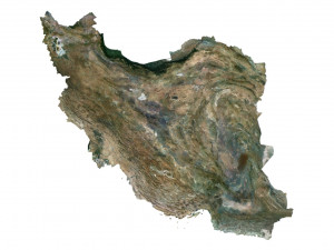
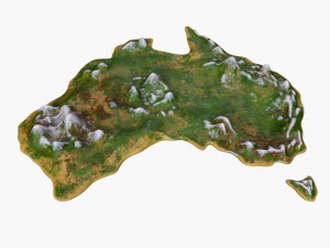
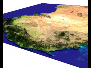
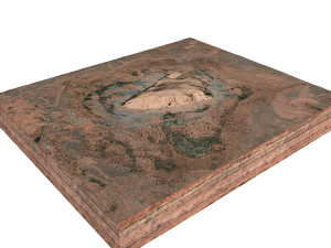
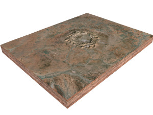
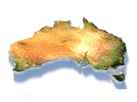
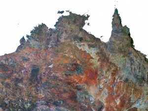
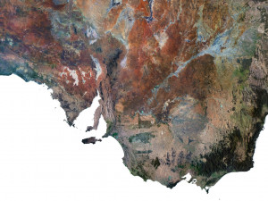
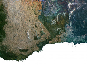
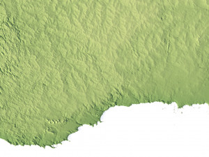
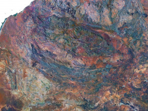
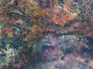
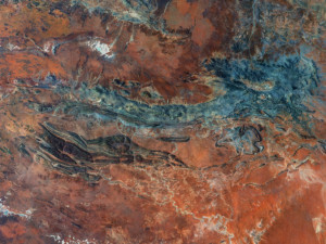
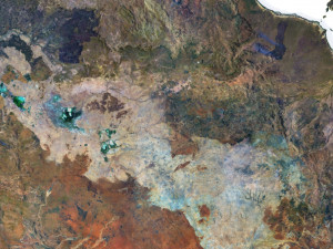
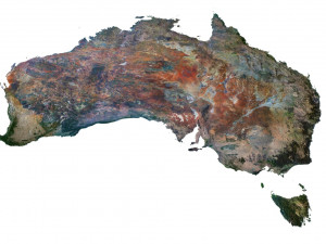
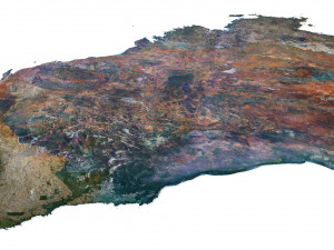
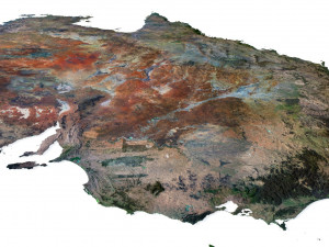
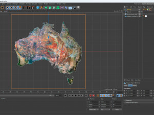
हिंदीMappa 3D del terreno dell'Australia Modello 3D


- Richiedi supporto per il prodotto

- Formati disponibili:
- ID Oggetto:453343
- Data: 2023-07-05
- Pligoni:7 992 002
- Vertici:4 000 000
- Animato:No
- Textured:
- Rigged:No
- Materiali:
- Low-poly:No
- Collezione:No
- Mapping UVW:
- Plugins Utilizzati:No
- Stampa Pronta:No
- 3D Scan:No
- Per adulti:No
- PBR:No
- AI Formazione:No
- Geometria:Polygonal
- UVs Aperti:Unknown
- Visualizzazioni:2621
Descrizione
Format: C4D/OBJ
File size (unzipped): 457 MB
Polygons: 7 992 002
Vertices: 4 000 000
Geometry: Polygonal Tris only
Model size: 1000 mm x 1000 mm x 3.436 mm
Projection: Mercator
Base: Open
UV layer: Yes (frontal)
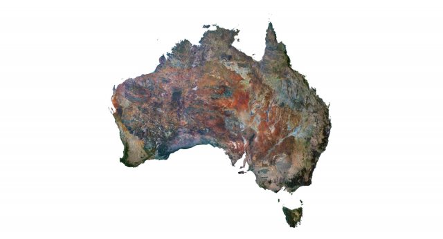
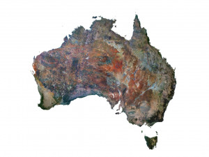
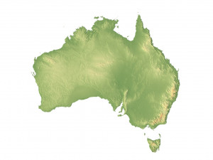
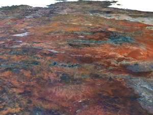
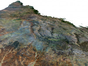
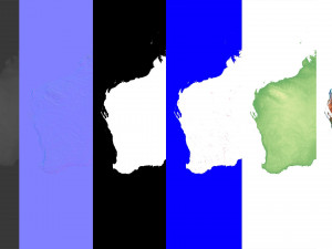
Textures
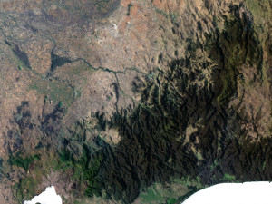
Height Map TIF 8193*8193*16b - You can use this map in the displacement channel instead of the polygonal mesh.
Normal Map TIF 8193*8193*48b - Use this map to reveal fine details of the relief.
Satellite Map TIF 8193*8193*48b
Water Mask TIF 8193*8193*48b - Use this map for masking in the Reflection channel to get glare from the water surface.
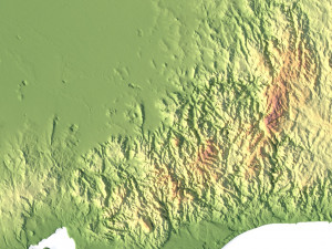
Pseudo-color Map 8193*8193*48b - Use this map to get elevation information based on the color shade.
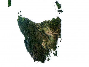
Boundary Mask TIF 8193*8193*48b - Use this map as a mask for your background.
Other models can be made on request.
Modifications, conversion to OBJ, FBX, STL and other formats, more detailed models and better textures on request.
Hai bisogno di ulteriori formati?
Se hai bisogno di diversi formati, aprire un nuovo Ticket i Supporto e una richiesta per questo. Convertiamo modelli 3D a: .stl, .c4d, .obj, .fbx, .ma/.mb, .3ds, .3dm, .dxf/.dwg, .max. .blend, .skp, .glb. Conversione di formato gratuitaNon convertiamo scene 3d e formati come .step, .iges, .stp, .sldprt.!
Informazioni sull'utilizzo
Mappa 3D del terreno dell'Australia - È possibile utilizzare questo modello 3D royalty-free sia per scopi personali che commerciali, in conformità con la licenza base o estesa.La licenza base copre la maggior parte dei casi d'uso standard, tra cui pubblicità digitale, progetti di design e visualizzazione, account aziendali sui social media, app native, app web, videogiochi e prodotti finali fisici o digitali (sia gratuiti che venduti).
La licenza estesa include tutti i diritti concessi dalla licenza base, senza limitazioni d'uso, e consente l'utilizzo del modello 3D in un numero illimitato di progetti commerciali secondo i termini royalty-free.
Leggi ulteriori
Offrite la garanzia di rimborso?
Sì, la offriamo. Se hai acquistato un prodotto e hai riscontrato degli errori nei renders o nella descrizione, proveremo a risolvere al più presto il problema. Se non possiamo correggere l'errore, annulleremo l'ordine e ti restituiremo i soldi entro 24 ore dal download dell'oggetto. Leggi le condizioni quiParole chiave
Oggetti casuali dall'autore