English
 Español
 Deutsch
 日本語
日本語 Polska
 Français
 中國
中國 한국의
한국의 Українська
 Italiano
 Nederlands
 Türkçe
 Português
 Bahasa Indonesia
 Русский
 हिंदी
हिंदीscale relief topographic world map Modelo 3D


-50%
3ds c4d ma max mb obj jpg ma stl
isak009
Mathematical art
-50%
stl c4d obj jpg max stl
isak009
Astronomy and Physics
SALE ENDS
$
12.50
Tienes usted $0.00 Créditos. Comprar Créditos

- Formatos disponibles: Cinema4D (.c4d) 4.45 MB
Render: StandardAutodesk FBX (.fbx) 13.02 MB
Render: Mental RayAutodesk 3DS MAX (.max) 2.36 MB
Render: Mental RayWavefront OBJ (.obj) 6.62 MB
Render: StandardStereolithography (.stl) 9.62 MB
Render: StandardImage Textures (.jpg) 1.66 MB
- Polígonos:516960
- Vértices:258482
- Animados:No
- Texturas:No
- Articulados:No
- Materiales:
- Low-poly:No
- Colección:No
- Mapas UVW:No
- Plugins Usados:No
- Listo para Imprimir:No
- 3D Scan:No
- Para adultos:No
- PBR:No
- Geometría:Polygonal
- Desenvolver UVs:Unknown
- Vistas:3027
- Fecha: 2020-09-26
- ID de artículo:313922
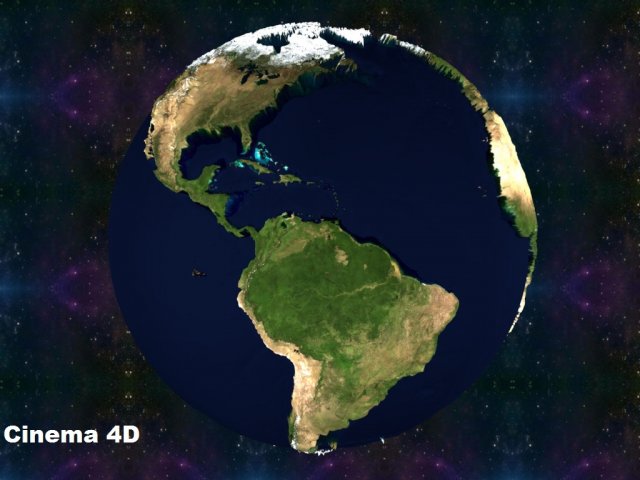
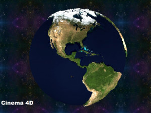
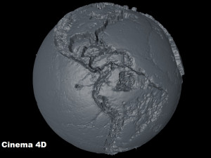
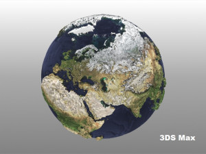
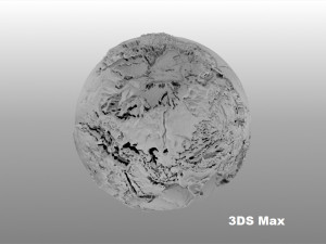
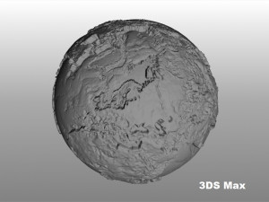
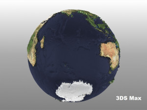
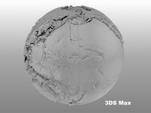
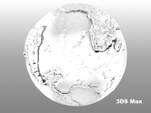
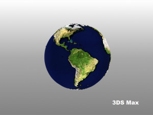
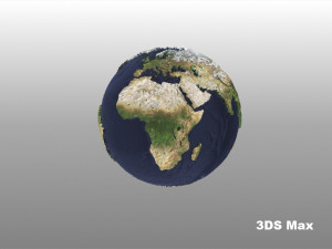
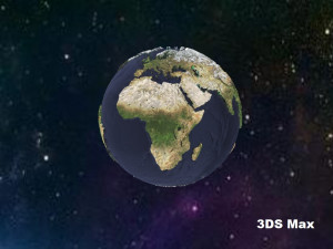
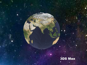
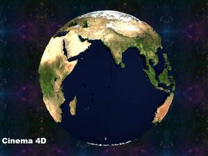
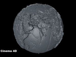
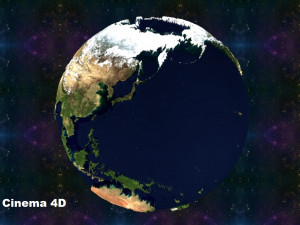
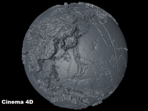
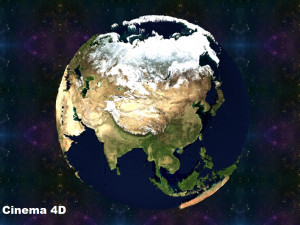
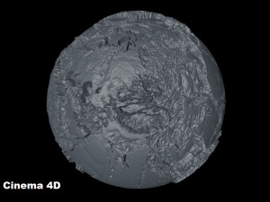
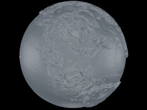
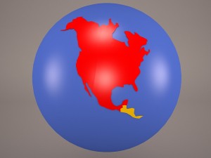
this 3d model is a representation to scale of the terrestrial globe, as you may have noticed, the dimensions represent the continents according to their real size and proporsions. since many maps tend to exaggerate the dimensions of some countries or islands for example greenland that always seems bigger than africa, which is not true, since africa is 14 times bigger. that is why i have dedicated myself to making several models of the terrestrial globe. in this model you can also see the relief and you will see that the files weigh several megabytes since it required too many vertices (258482) and polygons (516960) to make a portrait as close to reality, although i have added a textures (downloaded from the nasa page), to simulate the color; i have also added the renderings both with and without texture, so that you will notice that it is done in detail.
enjoy it. Listo para Imprimir: No
Leer másenjoy it. Listo para Imprimir: No
¿Necesita más formatos?
Si precisa un formato distinto, por favor, abra una consulta de Soporte y solicítelo. Podemos convertir modelos 3D a: .stl, .c4d, .obj, .fbx, .ma/.mb, .3ds, .3dm, .dxf/.dwg, .max. .blend, .skp, .glb. Nosotros no convertimos escenas 3d y formatos como .step, .iges, .stp, .sldprt.!
Si precisa un formato distinto, por favor, abra una consulta de Soporte y solicítelo. Podemos convertir modelos 3D a: .stl, .c4d, .obj, .fbx, .ma/.mb, .3ds, .3dm, .dxf/.dwg, .max. .blend, .skp, .glb. Nosotros no convertimos escenas 3d y formatos como .step, .iges, .stp, .sldprt.!
scale relief topographic world map Modelo 3D c4d, fbx, max, obj, stl, jpg, De isak009
relief topographic maps map mapping scaleNo hay comentarios sobre este artículo.


-50%
tga tga tga tga tga tga fbx max ma
boneytoes
Other
$14.49
$28.99