
 English
 Español
 Deutsch
 日本語
日本語 Polska
 Français
 한국의
한국의 Українська
 Italiano
 Nederlands
 Türkçe
 Português
 Bahasa Indonesia
 Русский
 中國
中國 हिंदी
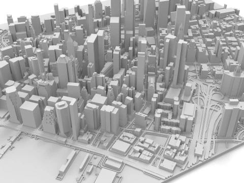
हिंदीTerrain 3D Druckmodelle
Wir haben 395 Artikel Lizenzfrei 3D Modelle. Sie befinden sich in der Kategorie „3D-druckbare Gelände“, einer brandneuen Sammlung von 3D-druckbaren Geländemodellen verschiedener Art. Laden Sie hier ein ausgezeichnetes 3D-druckbares Geländemodell herunter. Alle 3D-druckbaren Geländemodelle sind in allen 3D-Formaten verfügbar: .obj, .stl, .iges, .3dm, .skp, .fbx und .blend usw. Wenden Sie sich an unseren Support, um das gewünschte Format zu erhalten. Alle 3D-druckbaren Geländemodelle wurden von professionellen Künstlern erstellt. Sie werden von ihrer Vielfalt und Schönheit beeindruckt sein. Sehen Sie sich die gesamte Kategorie an und finden Sie genau das, was Sie für Ihren 3D-Druck benötigen. Weitere Modelle finden Sie in den Kategorien 3D-Druckmodelle für die Wissenschaft und 3D-Druckmodelle für die Kunst.
 sychev23021983Terrain
 sychev23021983Terrain
 sychev23021983Terrain
 sychev23021983Terrain
 sychev23021983Terrain
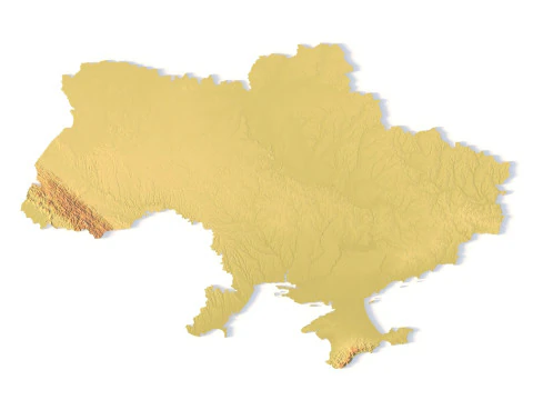 sychev23021983Terrain
 sychev23021983Terrain
 sychev23021983Terrain
 sychev23021983Terrain
 sychev23021983Terrain
 sychev23021983Terrain
 sychev23021983Terrain
 sychev23021983Terrain
 sychev23021983Terrain
 sychev23021983Terrain
 sychev23021983Terrain
 sychev23021983Terrain
 sychev23021983Terrain
 sychev23021983Terrain
 sychev23021983Terrain
 sychev23021983Terrain
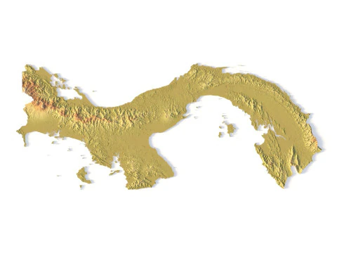 sychev23021983Terrain
 sychev23021983Terrain
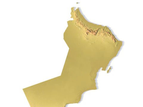 sychev23021983Terrain
 sychev23021983Terrain
 sychev23021983Terrain
 sychev23021983Terrain
 sychev23021983Terrain
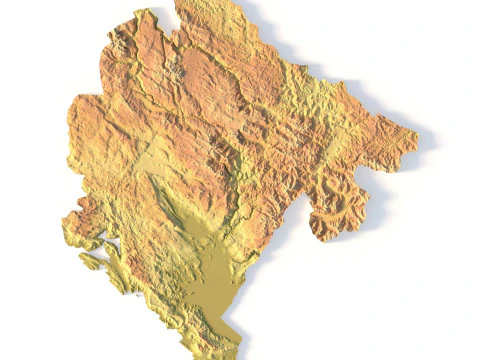 sychev23021983Terrain
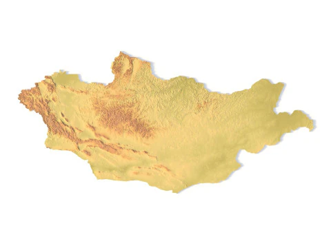 sychev23021983Terrain
 sychev23021983Terrain
 sychev23021983Terrain
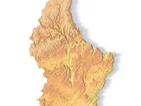 sychev23021983Terrain
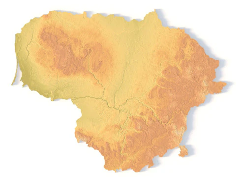 sychev23021983Terrain
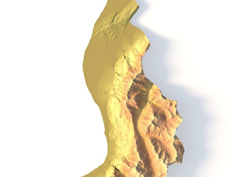 sychev23021983Terrain
 sychev23021983Terrain
 sychev23021983Terrain
 sychev23021983Terrain
 sychev23021983Terrain
 sychev23021983Terrain
 sychev23021983Terrain
 sychev23021983Terrain
 sychev23021983Terrain
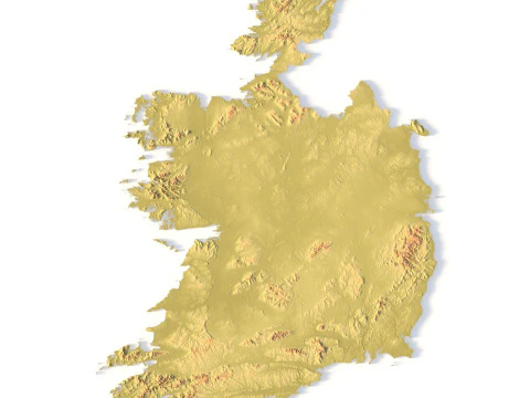 sychev23021983Terrain
 sychev23021983Terrain
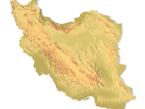 sychev23021983Terrain
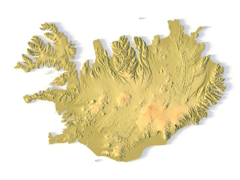 sychev23021983Terrain
 sychev23021983Terrain
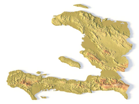 sychev23021983Terrain
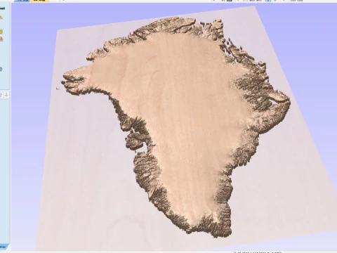 sychev23021983Terrain
 sychev23021983Terrain
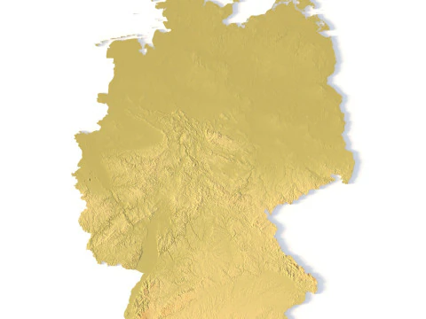 sychev23021983Terrain
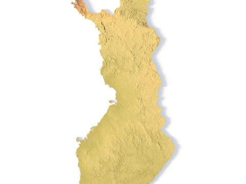 sychev23021983Terrain
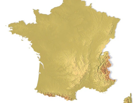 sychev23021983Terrain
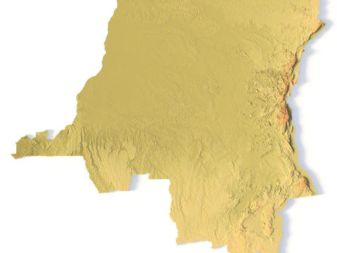 sychev23021983Terrain
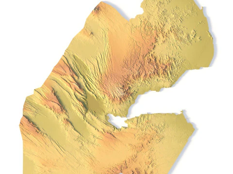 sychev23021983Terrain
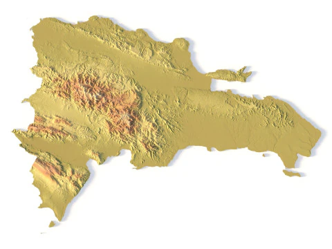 sychev23021983Terrain
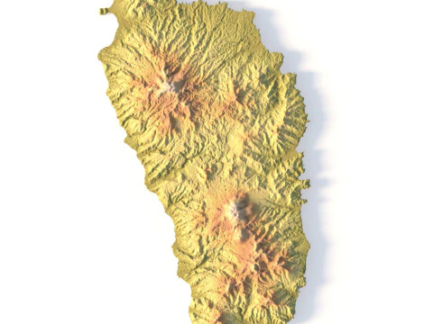 sychev23021983Terrain
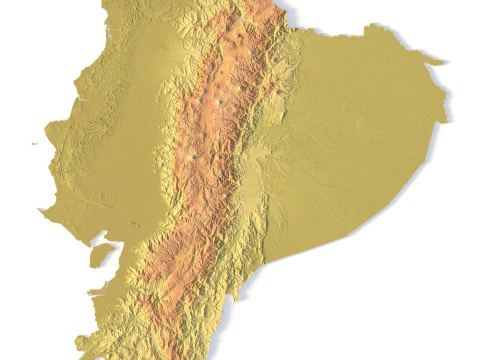 sychev23021983Terrain
 sychev23021983Terrain
 sychev23021983Terrain
 sychev23021983Terrain
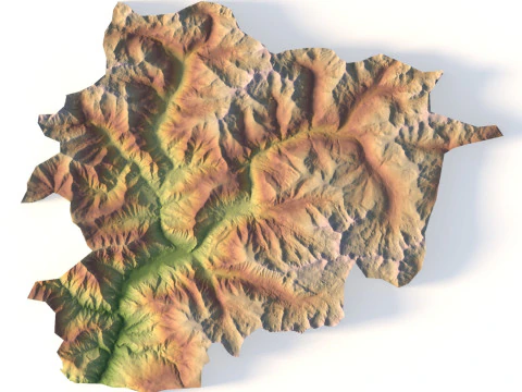 sychev23021983Terrain


Angesagte Suchanfragen 3D Modelle:
Skulptur 3D Modelle Charaktere 3D Modelle Küche 3D Modelle Pferd 3D Modelle Außenbereich 3D Modelle Telefon und Handy 3D Modelle Gemüse 3D Modelle Schmuck 3D Modelle Spielzeug 3D Modelle Medizinisch 3D Modelle Helikopter 3D Modelle Schwere Waffen 3D Modelle LKW 3D Modelle Anatomie 3D ModelleWelche Arten von physischen Landschaften und Topografien sind verfügbar?
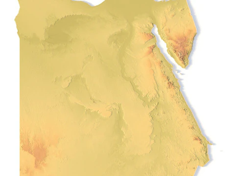
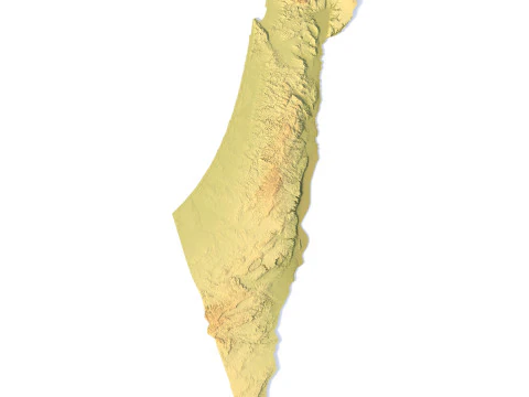
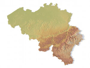
Die Kategorie „Gelände“ für den 3D-Druck ist eine Bibliothek physischer Geografie mit detaillierten Nachbildungen realer Gebirgsketten, Inseln und Flussgebiete. Im Jahr 2026 bieten wir hochauflösende topografische Modelle an, die aus Satellitendaten und geologischen Vermessungen abgeleitet wurden. Diese Modelle sind unverzichtbar für Pädagogen, Geologen und Hobbyisten, die physische Dioramen oder Architekturmodelle bauen. Jedes Gelände ist mit einer soliden Basis und einer vielfältigen Geometrie gestaltet, um einen erfolgreichen Druck zu gewährleisten. Ob Sie ein Modell des Mount Everest oder eine individuell gestaltete Fantasieinsel benötigen – diese Kategorie bietet die hochauflösenden Dateien, die erforderlich sind, um die Erdoberfläche mit absoluter Präzision in die physische Welt zu übertragen.
Wie sind diese Modelle für einen erfolgreichen 3D-Druck optimiert?
Zuverlässigkeit beim Drucken ist eine Hauptanforderung an 2026-Geländemodelle, und unsere Sammlung zeichnet sich durch wasserdichte Geometrie aus, die speziell für FDM- und Harzdrucker entwickelt wurde. Wir stellen sicher, dass die Modelle eine flache, stabile Basis haben, damit sie leicht auf dem Druckbett haften. Der vertikale Maßstab ist oft leicht übertrieben, um sicherzustellen, dass Bergrücken und Täler auch bei kleineren physischen Maßstäben deutlich sichtbar sind. Wir stellen die Modelle mit optimierter Polygonanz bereit, um sicherzustellen, dass sie schnell gesliced werden können, ohne dass feine geologische Details verloren gehen. Dies gewährleistet, dass Ihre physischen Geländemodelle langlebig, detailreich und einfach zu drucken sind und bietet eine professionelle Lösung für jedes physische Landschafts- oder Diorama-Projekt.
Kann ich diese Modelle für die Architektur- und Standortplanung verwenden?
Auf jeden Fall. Unsere 2026-Geländemodelle dienen als hervorragende Grundlage für architektonische Standortmodelle. Durch den Druck der physischen Topografie eines Baugeländes können Architekten die Wechselwirkung zwischen ihrem Entwurf und der natürlichen Landschaft besser visualisieren. Diese Modelle sind maßstabsgetreu aufgebaut und ermöglichen eine präzise Platzierung von Gebäuden und Infrastruktur. Diese physische Darstellung ist von unschätzbarem Wert für die Präsentation von Konzepten gegenüber Kunden und lokalen Planungsbehörden, da sie ein klares und professionelles Verständnis dafür vermittelt, wie sich ein Projekt in seine Umgebung einfügt. Es ist ein unverzichtbares Werkzeug für den modernen Architektur-Workflow, das die Lücke zwischen digitalem Entwurf und physischer Realität schließt.
Gibt es Modelle der Unterwasser-Bathymetrie und des Meeresbodens?
Ja, unter Berücksichtigung der erweiterten geologischen Daten von 2026 bieten wir Modelle von Unterwasserlandschaften an, einschließlich Ozeangräben und Kontinentalsockeln. Diese bathymetrischen Modelle ermöglichen die physische Darstellung der Welt unter den Wellen, was für marinebiologische Studien und Umweltbildung unerlässlich ist. Diese Modelle zeichnen sich durch denselben hohen Detaillierungsgrad wie unsere terrestrischen Gelände aus und zeigen die komplexen Canyons und Grate des Meeresbodens. Sie bieten eine einzigartige und professionelle visuelle Hilfe zum Verständnis der ozeanischen Geografie und ermöglichen es den Nutzern, die verborgenen Strukturen der weiten und geheimnisvollen Unterwasserlandschaften unseres Planeten in den Händen zu halten und zu untersuchen.
Welche Druckeinstellungen eignen sich am besten für detaillierte Geländemodelle?
Um die feinen Details eines 3D-Geländes im Jahr 2026 zu erfassen, empfehlen wir eine geringe Schichthöhe (0,1 mm oder weniger), um sichtbare Stufen an den Hängen zu minimieren. Bei Harzdruckern werden durch die Verwendung einer hochauflösenden Einstellung alle Felsvorsprünge und Grate mit unglaublicher Klarheit erfasst. Beim Drucken mit PLA kann die Verwendung eines matten Filaments dazu beitragen, Schichtlinien zu verbergen und die geologischen Details besser sichtbar zu machen. Wir empfehlen die Verwendung einer hohen Fülldichte für eine lange Lebensdauer, insbesondere bei Bildungsmodellen, die häufig in die Hand genommen werden. Diese Einstellungen sorgen dafür, dass Ihre physischen Geländedrucke professionell aussehen und die komplexe Schönheit der Natur in einer greifbaren, physischen Form genau wiedergeben.