English
 Español
 Deutsch
 日本語
日本語 Polska
 Français
 中國
中國 한국의
한국의 Українська
 Italiano
 Nederlands
 Türkçe
 Português
 Bahasa Indonesia
 Русский
 हिंदी
हिंदीModelo STL topográfico del mapa de Colorado Modelo de impresión 3D


- Solicitar soporte de producto

- Formatos disponibles:
- ID de artículo:402258
- Fecha: 2022-06-17
- Colección:No
- Anchura en milímetros:312
- Altura en milímetros:5.4
- Profundidad en milímetros:229
- Listo para Imprimir:No
- 3D Scan:No
- Para adultos:No
- PBR:No
- AI Capacitación:No
- Vistas:2535
Descripción
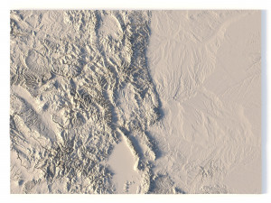
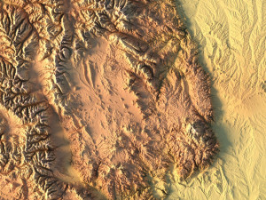
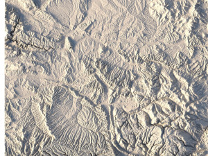
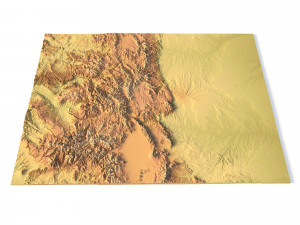
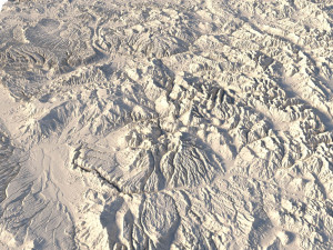
Create Detailed Colorado Terrain Models with This 3D STL
The Colorado Map Topographic STL model provides highly detailed terrain models of the state’s iconic landscape. Ideal for creating raised relief maps from materials like wood, metal, plastic, or concrete, this STL file is perfect for professionals and hobbyists interested in outdoor recreation, geospatial analysis, or landscape visualization. Whether for personal use or professional applications, this model brings the state’s varied landforms to life with precision elevation data.
- File size: 680 MB / 339 MB
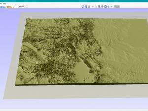
- Model size: 312.4 mm x 228.9 mm x 5.374 mm
- Projection: Mercator
- Scaling factor: X — 1; Y — 1; Z — 3
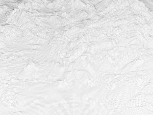
- Polygons: 14 265 976
- Vertices: 7 138 442
- Geometry: Polygonal Tris only
- Base: Open / Closed
Features of the Colorado Topographic STL Model
Compatible with FDM/SLA 3D printing for creating physical models of the terrain.
Designed for CNC machines to carve terrain models from wood or metal.
High-resolution laser engraving for metal surfaces with precise topographic details.
¿Necesita más formatos?
Si precisa un formato distinto, por favor, abra una consulta de Soporte y solicítelo. Podemos convertir modelos 3D a: .stl, .c4d, .obj, .fbx, .ma/.mb, .3ds, .3dm, .dxf/.dwg, .max. .blend, .skp, .glb. Conversión de formato libreNosotros no convertimos escenas 3d y formatos como .step, .iges, .stp, .sldprt.!
Información de uso
Modelo STL topográfico del mapa de Colorado - Puede usar este modelo 3D libre de regalías tanto para fines personales como comerciales, de acuerdo con la Licencia Básica o Extendida.La Licencia Básica cubre la mayoría de los casos de uso estándar, incluyendo anuncios digitales, proyectos de diseño y visualización, cuentas empresariales en redes sociales, aplicaciones nativas, aplicaciones web, videojuegos y productos finales físicos o digitales (tanto gratuitos como comerciales).
La Licencia Extendida incluye todos los derechos otorgados bajo la Licencia Básica, sin limitaciones de uso, y permite que el modelo 3D se use en un número ilimitado de proyectos comerciales bajo las condiciones de la Licencia Libre de Regalías.
Leer más
¿Garantizáis la Devolución de Dinero?
Si. Si compras un producto y encuentras errores de rendimiento o descripción, intentaremos solucionar el problema lo antes posible. Si no lo logramos, cancelaremos tu pedido y tu dinero será devuelto en 24h, desde que el producto fué descargado. Lea más condiciones aquíPalabras clave
Artículos al azar de este autor
Mostrar todos los artículos añadidos por sychev23021983