English
 Español
 Deutsch
 日本語
日本語 Polska
 Français
 中國
中國 한국의
한국의 Українська
 Italiano
 Nederlands
 Türkçe
 Português
 Bahasa Indonesia
 Русский
 हिंदी
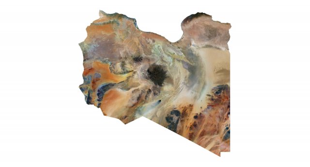
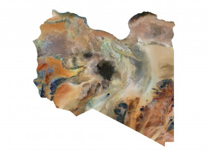
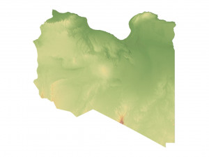
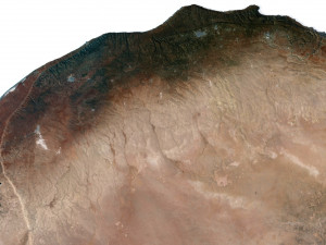
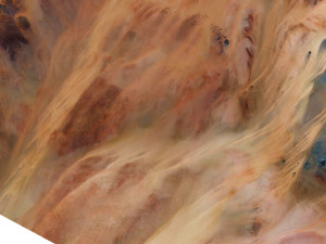
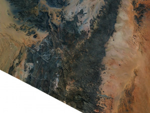
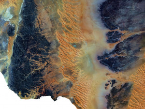
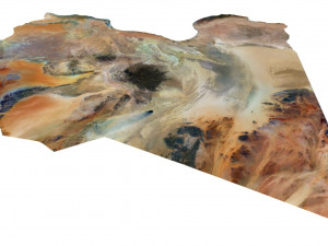
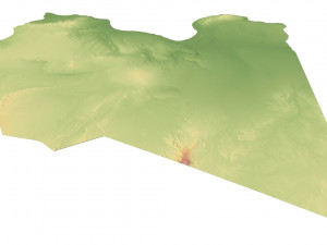
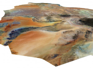
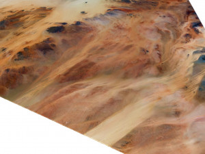
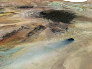
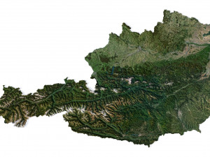
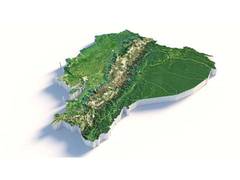
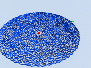
हिंदीMapa 3D del terreno de Libia Modelo 3D
BLACK FRIDAY
Early Access 50% OFF
$
36.80 USD
onclick="showLoginForm('Login');return false; ga('send', {'hitType': 'event', 'eventCategory': 'ShoppingCart', 'eventAction': 'checkout', 'eventLabel': 'CheckoutCredit' });"> Comprar con Créditos
Tienes usted $0.00 Créditos. Comprar Créditos
- Solicitar soporte de producto

- Formatos disponibles:
- ID de artículo:462809
- Fecha: 2023-09-01
- Polígonos:9 990 450
- Vértices:4 999 696
- Animados:No
- Texturas:
- Articulados:No
- Materiales:
- Low-poly:No
- Colección:No
- Mapas UVW:No
- Plugins Usados:No
- Listo para Imprimir:No
- 3D Scan:No
- Para adultos:No
- PBR:No
- Geometría:Polygonal
- Desenvolver UVs:Unknown
- Vistas:2349
Descripción
Format: C4DFile size (unzipped): 572 MB
Polygons: 9 990 450
Vertices: 4 999 696
Geometry: Polygonal Tris only
Model size: 1287.5 mm x 1287.5 mm x 3.857 mm
Projection: Mercator
Base: Open
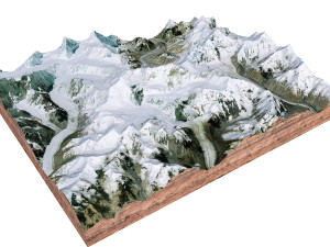
Textures
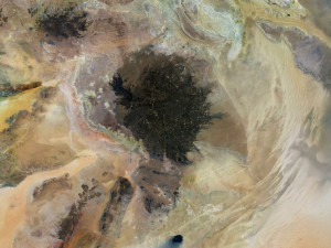
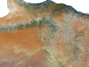
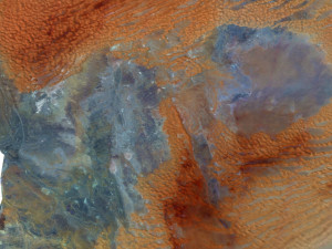
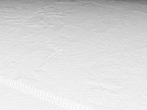
Height Map TIF 8192*8192*16b - You can use this map in the displacement channel instead of the polygonal mesh.
Normal Map TIF 8192*8192*48b - Use this map to reveal fine details of the relief.
Satellite Map TIF 10300*10300*48b
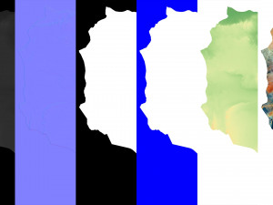
Water Mask TIF 10300*10300*48b - Use this map for masking in the Reflection channel to get glare from the water surface.
Pseudo-color Map 10300*10300*48b - Use this map to get elevation information based on the color shade.
Boundary Mask TIF 10300*10300*48b - Use this map as a mask for your background.
Other models can be made on request.
Modifications, conversion to OBJ, FBX, STL and other formats, more detailed models and better textures on request. Listo para Imprimir: No
¿Necesita más formatos?
Si precisa un formato distinto, por favor, abra una consulta de Soporte y solicítelo. Podemos convertir modelos 3D a: .stl, .c4d, .obj, .fbx, .ma/.mb, .3ds, .3dm, .dxf/.dwg, .max. .blend, .skp, .glb. Conversión de formato libreNosotros no convertimos escenas 3d y formatos como .step, .iges, .stp, .sldprt.!
Información de uso
Mapa 3D del terreno de Libia - Puede usar este modelo 3D libre de regalías tanto para fines personales como comerciales, de acuerdo con la Licencia Básica o Extendida.La Licencia Básica cubre la mayoría de los casos de uso estándar, incluyendo anuncios digitales, proyectos de diseño y visualización, cuentas empresariales en redes sociales, aplicaciones nativas, aplicaciones web, videojuegos y productos finales físicos o digitales (tanto gratuitos como comerciales).
La Licencia Extendida incluye todos los derechos otorgados bajo la Licencia Básica, sin limitaciones de uso, y permite que el modelo 3D se use en un número ilimitado de proyectos comerciales bajo las condiciones de la Licencia Libre de Regalías.
Leer más
¿Garantizáis la Devolución de Dinero?
Si. Si compras un producto y encuentras errores de rendimiento o descripción, intentaremos solucionar el problema lo antes posible. Si no lo logramos, cancelaremos tu pedido y tu dinero será devuelto en 24h, desde que el producto fué descargado. Lea más condiciones aquíPalabras clave
Artículos al azar de este autor
No hay comentarios sobre este artículo.
-50%
obj stl max c4d png 3ds c4d fbx
zames1992
Landscapes
$9.50
$19.00
3dm 3ds max dxf fbx obj stl
turbocg
Landscapes
-50%
tzd
Landscapes