English
 Español
 Deutsch
 日本語
日本語 Polska
 Français
 中國
中國 한국의
한국의 Українська
 Italiano
 Nederlands
 Türkçe
 Português
 Bahasa Indonesia
 Русский
 हिंदी
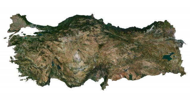
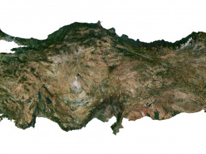
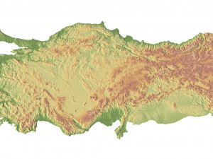
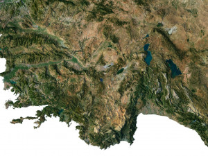
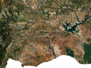
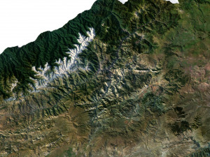
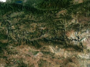
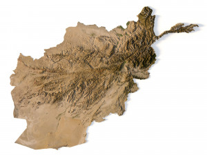
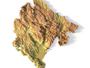
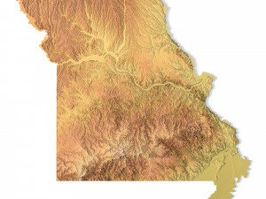
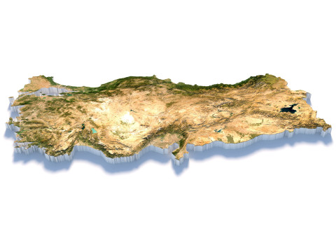
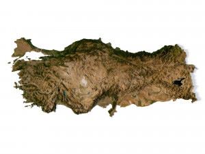
हिंदीTurkey Terrain 3D Map Modelo 3D
$
36.80
Tienes usted $0.00 Créditos. Comprar Créditos

- Formatos disponibles: Cinema4D (.c4d) 964.24 MB
Render: StandardImage Textures (.tif) 42.19 MB
Render: Standard
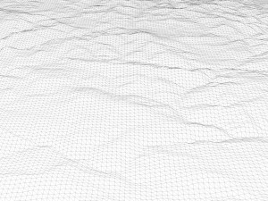
- Polígonos:9 984 352
- Vértices:4 997 025
- Animados:No
- Texturas:
- Articulados:No
- Materiales:
- Low-poly:No
- Colección:No
- Mapas UVW:
- Plugins Usados:No
- Listo para Imprimir:No
- 3D Scan:No
- Para adultos:No
- PBR:No
- Geometría:Polygonal
- Desenvolver UVs:Unknown
- Vistas:5384
- Fecha: 2023-07-04
- ID de artículo:453273
Format: C4D
File size (unzipped): 571 MB
Polygons: 9 984 352
Vertices: 4 997 025
Geometry: Polygonal Tris only
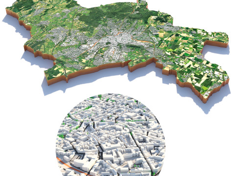
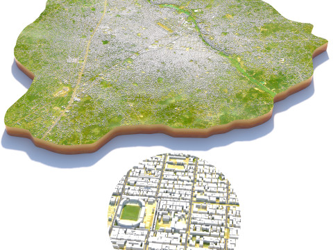
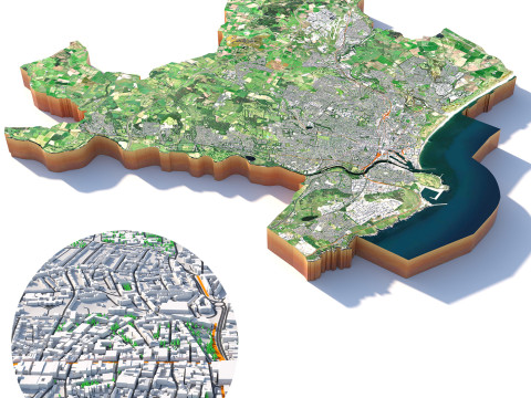
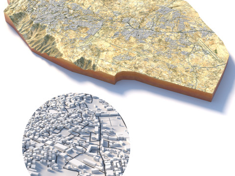
Model size: 1812.5 mm x 800 mm x 6.115 mm
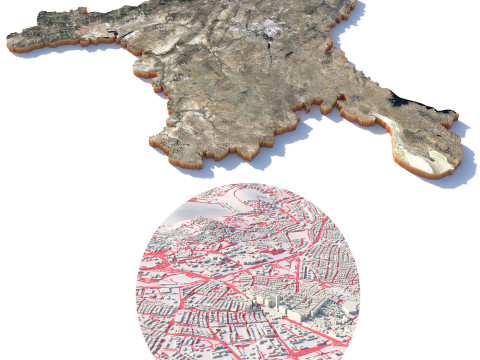
Projection: Mercator
Base: Open
UV layer: Yes (frontal)
Textures
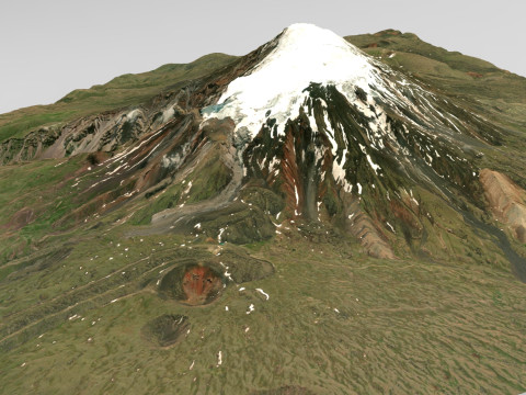
Height Map TIF 8193*3616*16b - You can use this map in the displacement channel instead of the polygonal mesh.
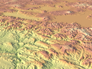
Normal Map TIF 8193*3616*48b - Use this map to reveal fine details of the relief.
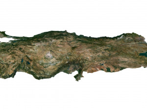
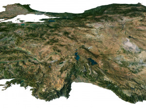
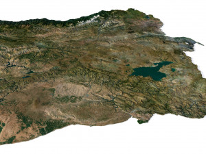
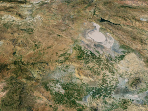
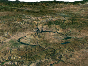
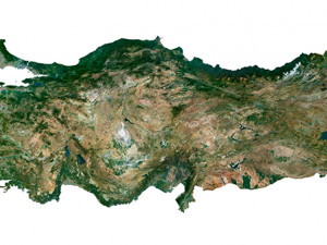
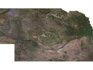
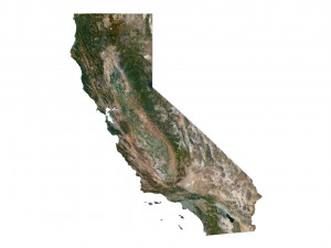
Satellite Map TIF 14500*6400*48b
Water Mask TIF 14500*6400*48b - Use this map for masking in the Reflection channel to get glare from the water surface.
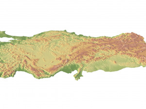
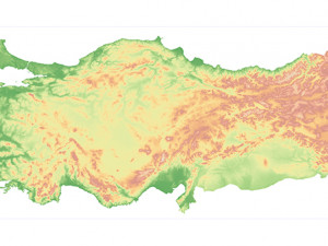
Pseudo-color Map 14500*6400*48b - Use this map to get elevation information based on the color shade.
Boundary Mask TIF 14500*6400*48b - Use this map as a mask for your background.
Other models can be made on request.
Modifications, conversion to OBJ, FBX, STL and other formats, more detailed models and ***ter textures on request Listo para Imprimir: No
Leer másFile size (unzipped): 571 MB
Polygons: 9 984 352
Vertices: 4 997 025
Geometry: Polygonal Tris only
Model size: 1812.5 mm x 800 mm x 6.115 mm
Projection: Mercator
Base: Open
UV layer: Yes (frontal)
Textures
Height Map TIF 8193*3616*16b - You can use this map in the displacement channel instead of the polygonal mesh.
Normal Map TIF 8193*3616*48b - Use this map to reveal fine details of the relief.
Satellite Map TIF 14500*6400*48b
Water Mask TIF 14500*6400*48b - Use this map for masking in the Reflection channel to get glare from the water surface.
Pseudo-color Map 14500*6400*48b - Use this map to get elevation information based on the color shade.
Boundary Mask TIF 14500*6400*48b - Use this map as a mask for your background.
Other models can be made on request.
Modifications, conversion to OBJ, FBX, STL and other formats, more detailed models and ***ter textures on request Listo para Imprimir: No
¿Necesita más formatos?
Si precisa un formato distinto, por favor, abra una consulta de Soporte y solicítelo. Podemos convertir modelos 3D a: .stl, .c4d, .obj, .fbx, .ma/.mb, .3ds, .3dm, .dxf/.dwg, .max. .blend, .skp, .glb. Nosotros no convertimos escenas 3d y formatos como .step, .iges, .stp, .sldprt.!
Si precisa un formato distinto, por favor, abra una consulta de Soporte y solicítelo. Podemos convertir modelos 3D a: .stl, .c4d, .obj, .fbx, .ma/.mb, .3ds, .3dm, .dxf/.dwg, .max. .blend, .skp, .glb. Nosotros no convertimos escenas 3d y formatos como .step, .iges, .stp, .sldprt.!
Turkey Terrain 3D Map Modelo 3D c4d, tif, De sychev23021983
turkey map landscape terrain country relief geography continent mountainNo hay comentarios sobre este artículo.


dae fbx mb obj stl png
deformer
Landscapes