English
 Español
 Deutsch
 日本語
日本語 Polska
 Français
 中國
中國 한국의
한국의 Українська
 Italiano
 Nederlands
 Türkçe
 Português
 Bahasa Indonesia
 Русский
 हिंदी
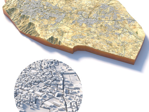
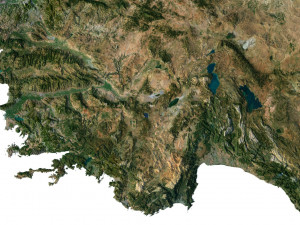
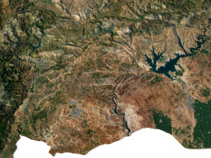
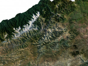
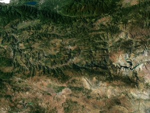
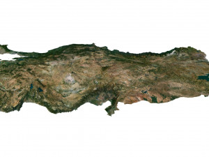
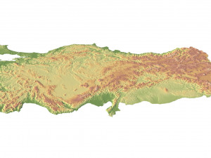
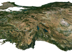
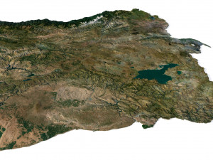
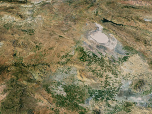
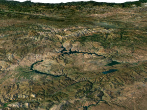
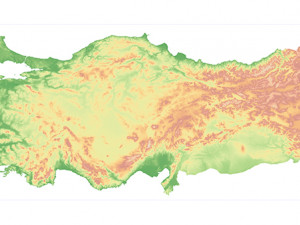
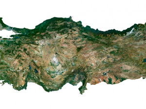
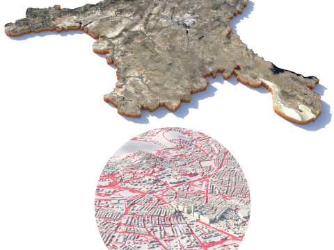
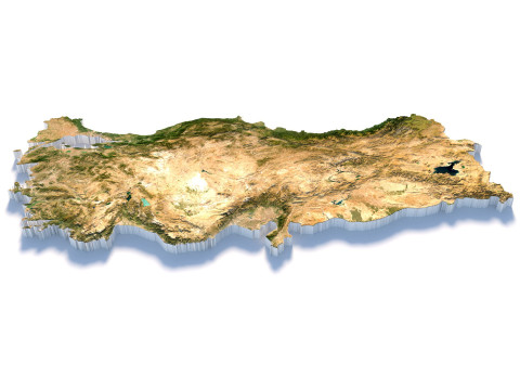
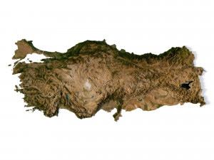
हिंदीTurkey Terrain 3D Map Model 3D
BLACK FRIDAY
Early Access 50% OFF
$
36.80 USD
- Poproś autora o wsparcie produktu

- Dostępne formaty:
- ID produktu:453273
- Data: 2023-07-04
- Wielokąty:9 984 352
- Wierzchołki:4 997 025
- Model animowany:No
- Tekstury:
- Oparty na szkielecie:No
- Materiał:
- Low-poly:No
- Kolekcja:No
- UVW mapping:
- Plugins Used:No
- Gotowy do wydruku:No
- 3D Scan:No
- Adult content:No
- PBR:No
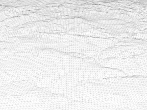
- Geometria:Polygonal
- Unwrapped UVs:Unknown
- Liczba wyświetleń:5518
Opis
Format: C4DFile size (unzipped): 571 MB
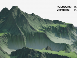
Polygons: 9 984 352
Vertices: 4 997 025
Geometry: Polygonal Tris only
Model size: 1812.5 mm x 800 mm x 6.115 mm
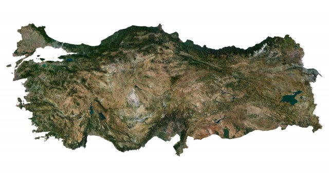
Projection: Mercator
Base: Open
UV layer: Yes (frontal)
Textures
Height Map TIF 8193*3616*16b - You can use this map in the displacement channel instead of the polygonal mesh.
Normal Map TIF 8193*3616*48b - Use this map to reveal fine details of the relief.
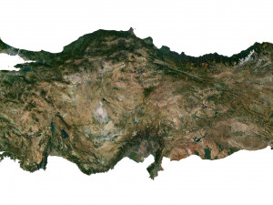
Satellite Map TIF 14500*6400*48b
Water Mask TIF 14500*6400*48b - Use this map for masking in the Reflection channel to get glare from the water surface.
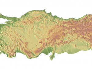
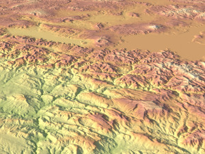
Pseudo-color Map 14500*6400*48b - Use this map to get elevation information based on the color shade.
Boundary Mask TIF 14500*6400*48b - Use this map as a mask for your background.
Other models can be made on request.
Modifications, conversion to OBJ, FBX, STL and other formats, more detailed models and better textures on request Gotowy do wydruku: Nie
Potrzebujesz plik w innym formacie?
Jeśli potrzebny Ci plik w innym formacie, zgłoś taką potrzebę przez opcję Support Ticket Konwertujemy produkty na następujące formaty: .stl, .c4d, .obj, .fbx, .ma/.mb, .3ds, .3dm, .dxf/.dwg, .max. .blend, .skp, .glb. Dowolna konwersja formatuNie konwertujemy scen 3D oraz formaty takie jak .step, .iges, .stp, .sldprt.!
Informacje o użytkowaniu
Turkey Terrain 3D Map - Możesz używać tego bezpłatnego modelu 3D zarówno do celów osobistych, jak i komercyjnych, zgodnie z Licencją Podstawową lub Rozszerzoną.Licencja Podstawowa obejmuje większość standardowych przypadków użycia, w tym reklamy cyfrowe, projekty projektowe i wizualizacyjne, firmowe konta w mediach społecznościowych, aplikacje natywne, aplikacje internetowe, gry wideo oraz fizyczne lub cyfrowe produkty końcowe (zarówno bezpłatne, jak i sprzedawane).
Licencja Rozszerzona obejmuje wszystkie prawa udzielone na mocy Licencji Podstawowej, bez ograniczeń użytkowania i pozwala na wykorzystanie modelu 3D w nieograniczonej liczbie projektów komercyjnych na warunkach bezpłatności.
Czytaj więcej
Czy zapewniacie gwarancję zwrotu pieniędzy?
Tak, robimy to. Jeśli zakupiłeś produkt i znalazłeś błąd w renderach lub opisie, postaramy się rozwiązać problem tak szybko, jak to możliwe. Jeżeli nie uda nam się naprawić błędu, anulujemy Twoje zamówienie i otrzymasz zwrot pieniędzy w ciągu 24 godzin od pobrania przedmiotu. Przeczytaj więcej warunków tutajSłowa kluczowe
Losowe produkty od projektanta

Brak komentarzy dla tego produktu.

-50%

dae fbx mb obj stl png
deformer
Landscapes