
 English
 Español
 Deutsch
 日本語
日本語 Polska
 Français
 中國
中國 한국의
한국의 Українська
 Italiano
 Nederlands
 Türkçe
 Português
 Bahasa Indonesia
 Русский
 हिंदी
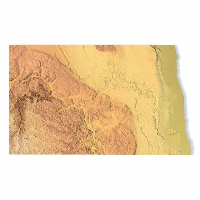
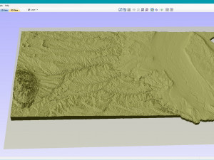
हिंदीNorth Dakota Topographic Map STL Model Model do druku 3D


- Dostępne formaty: Stereolithography (.stl) 478.20 MB
- Kolekcja:No
- Gotowy do wydruku:
- 3D Scan:No
- Adult content:No
- PBR:No
- AI Szkolenie:No
- Liczba wyświetleń:2060
- Data: 2022-06-17
- ID produktu:402337
North Dakota Topographic Map STL Model Model do druku 3D stl, Od sychev23021983
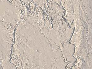
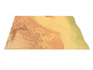
Create Detailed North Dakota Terrain Models with This High-Resolution 3D STL
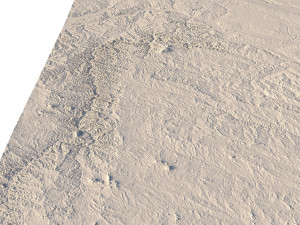
The North Dakota Topographic Map STL model provides a high-resolution depiction of the state’s unique topography and geographic features. This 3D model is ideal for creating physical relief maps from wood, metal, plastic, or concrete. Whether used for landform visualization, educational projects, or professional GIS applications, this model delivers accurate elevation data for detailed terrain modeling. Perfect for 3D printing, CNC machining, and laser engraving.
- File size: 932 MB / 475 MB
- Model size: 339.2 mm x 214.56 mm x 2.744 mm
- Resolution: 0,06 mm
- Projection: Mercator
- Scaling factor: X — 1; Y — 1; Z — 3
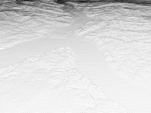
- Polygons: 19 545 662
- Vertices: 9 780 557
- Geometry: Polygonal Tris only
- Base: Open / Closed
Features of the North Dakota Topographic STL Model
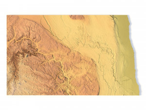
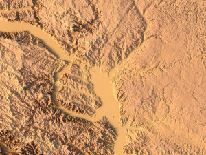
Accurate elevation data showcasing North Dakota’s plains, river valleys, and badlands.
Compatible with FDM/SLA 3D printers for high-quality terrain models.
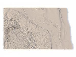
Designed for CNC machining to create detailed relief maps from wood or metal.
Supports high-precision laser engraving for metal surface detailing.
Potrzebujesz plik w innym formacie?
Jeśli potrzebny Ci plik w innym formacie, zgłoś taką potrzebę przez opcję Support Ticket Konwertujemy produkty na następujące formaty: .stl, .c4d, .obj, .fbx, .ma/.mb, .3ds, .3dm, .dxf/.dwg, .max. .blend, .skp, .glb. Nie konwertujemy scen 3D oraz formaty takie jak .step, .iges, .stp, .sldprt.!Informacje o użytkowaniu
North Dakota Topographic Map STL Model - Możesz używać tego bezpłatnego modelu 3D zarówno do celów osobistych, jak i komercyjnych, zgodnie z Licencją Podstawową lub Rozszerzoną.Licencja Podstawowa obejmuje większość standardowych przypadków użycia, w tym reklamy cyfrowe, projekty projektowe i wizualizacyjne, firmowe konta w mediach społecznościowych, aplikacje natywne, aplikacje internetowe, gry wideo oraz fizyczne lub cyfrowe produkty końcowe (zarówno bezpłatne, jak i sprzedawane).
Licencja Rozszerzona obejmuje wszystkie prawa udzielone na mocy Licencji Podstawowej, bez ograniczeń użytkowania i pozwala na wykorzystanie modelu 3D w nieograniczonej liczbie projektów komercyjnych na warunkach bezpłatności.
Czytaj więcej


