English
 Español
 Deutsch
 日本語
日本語 Polska
 Français
 中國
中國 한국의
한국의 Українська
 Italiano
 Nederlands
 Türkçe
 Português
 Bahasa Indonesia
 Русский
 हिंदी
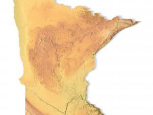
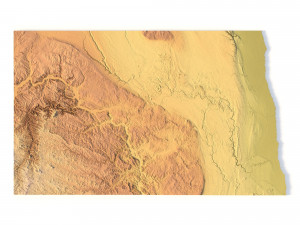
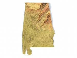
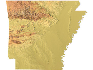
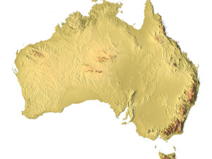
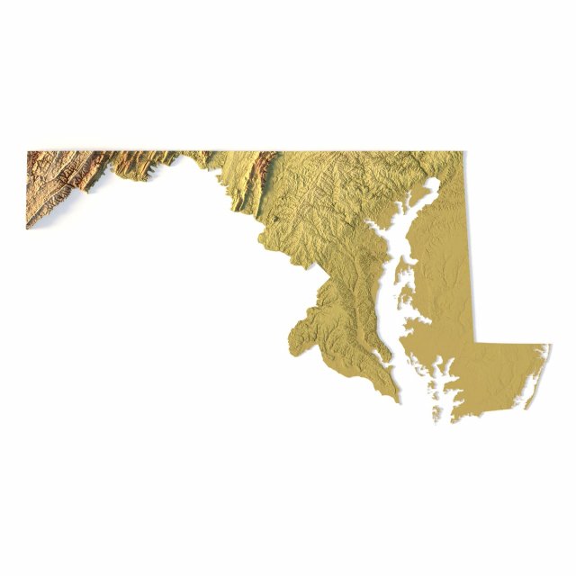
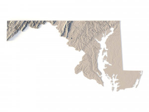
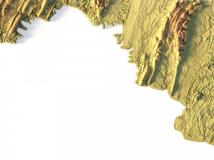
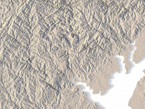
हिंदीModello STL della mappa topografica del Maryland Modello di stampa 3D

- Richiedi supporto per il prodotto

- Formati disponibili:
- ID Oggetto:402310
- Data: 2022-06-17
- Collezione:No
- Larghezza in millimetri:198
- Altezza in millimetri:1.4
- Profondità in millimetri:103
- Stampa Pronta:
- 3D Scan:No
- Per adulti:No
- PBR:No
- AI Formazione:No
- Visualizzazioni:2748
Descrizione
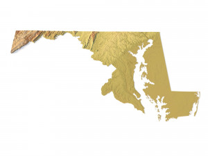
Create Detailed Maryland Terrain Models with This High-Resolution 3D STL
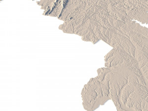
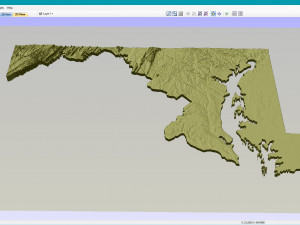
The Maryland Topographic Map STL model offers a high-resolution representation of the state’s diverse topography and geographic features. This 3D model is ideal for creating physical relief maps from materials such as wood, metal, plastic, or concrete. Whether used for landform visualization, educational projects, or professional GIS applications, this model provides precise elevation data for detailed terrain modeling. It’s perfect for 3D printing, CNC machining, and laser engraving.
- File size: 745 MB / 370 MB
- Model size: 197.61 mm x 103.41 mm x 1.352 mm
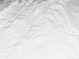
- Resolution: 0,03 mm
- Projection: Mercator
- Scaling factor: X — 1; Y — 1; Z — 3
- Polygons: 15 632 244
- Vertices: 7 852 008
- Geometry: Polygonal Tris only
- Base: Open / Closed
Features of the Maryland Topographic STL Model
Accurate elevation data showcasing Maryland’s diverse landforms, from coastal plains to mountainous regions.
Compatible with FDM/SLA 3D printers for creating high-quality terrain models.
Designed for CNC machining to craft detailed relief maps from wood or metal.
Supports high-precision laser engraving for metal surface detailing.
Hai bisogno di ulteriori formati?
Se hai bisogno di diversi formati, aprire un nuovo Ticket i Supporto e una richiesta per questo. Convertiamo modelli 3D a: .stl, .c4d, .obj, .fbx, .ma/.mb, .3ds, .3dm, .dxf/.dwg, .max. .blend, .skp, .glb. Conversione di formato gratuitaNon convertiamo scene 3d e formati come .step, .iges, .stp, .sldprt.!
Informazioni sull'utilizzo
Modello STL della mappa topografica del Maryland - È possibile utilizzare questo modello 3D royalty-free sia per scopi personali che commerciali, in conformità con la licenza base o estesa.La licenza base copre la maggior parte dei casi d'uso standard, tra cui pubblicità digitale, progetti di design e visualizzazione, account aziendali sui social media, app native, app web, videogiochi e prodotti finali fisici o digitali (sia gratuiti che venduti).
La licenza estesa include tutti i diritti concessi dalla licenza base, senza limitazioni d'uso, e consente l'utilizzo del modello 3D in un numero illimitato di progetti commerciali secondo i termini royalty-free.
Leggi ulteriori
Offrite la garanzia di rimborso?
Sì, la offriamo. Se hai acquistato un prodotto e hai riscontrato degli errori nei renders o nella descrizione, proveremo a risolvere al più presto il problema. Se non possiamo correggere l'errore, annulleremo l'ordine e ti restituiremo i soldi entro 24 ore dal download dell'oggetto. Leggi le condizioni quiParole chiave
Oggetti casuali dall'autore
Mostra tutti gli oggetti di sychev23021983