English
 Español
 Deutsch
 日本語
日本語 Français
 한국의
한국의 Nederlands
 Türkçe
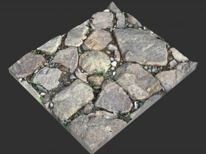
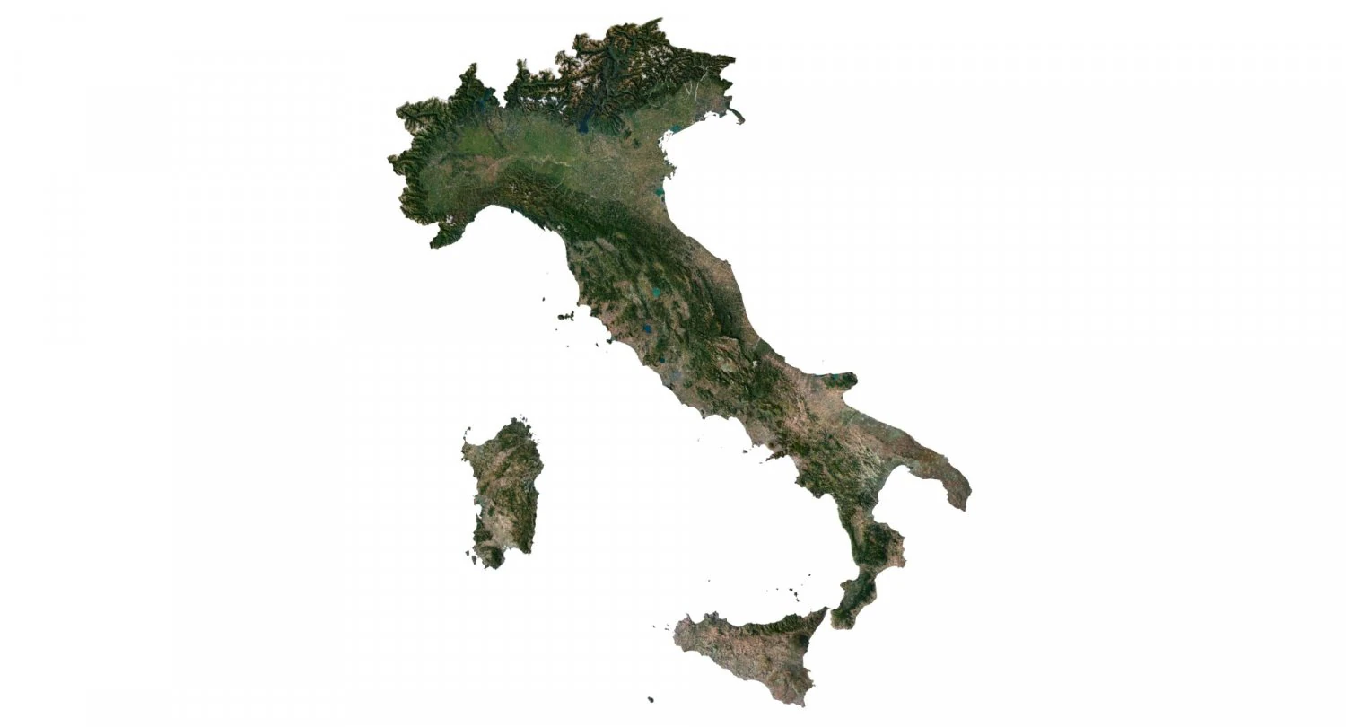
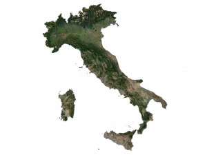
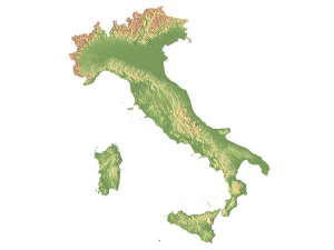
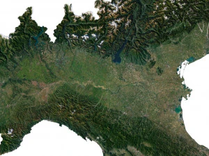
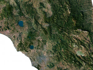
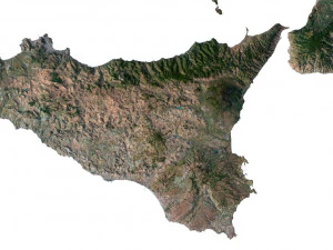
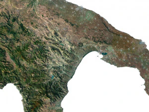
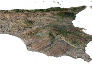
イタリア地形 3D 地図 3Dモデル
- 作者による製品サポートのリクエスト

- 利用可能フォーマット:
- アイテム ID:453341
- 日付: 2023-07-05
- 多角形:9 988 704
- 頂点:4 998 831
- アニメーション:No
- テクスチャー加工:Yes
- 装飾:No
- 素材:Yes
- 低ポリ:No
- コレクション:No
- UVW マッピング:Yes
- 使用中プラグイン:No
- 印刷 準備:No
- 3D スキャン:No
- 成人コンテンツ:No
- PBR:No
- AIトレーニング:No
- ジオメトリ:Polygonal
- 展開済 UVs:Unknown
- ビュー:4001
説明
Format: C4D/Blend 4.1.1
File size (unzipped): 457 MB/1.36 Gb
Polygons: 9 988 704
Vertices: 4 998 831
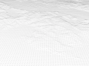
Geometry: Polygonal Tris only
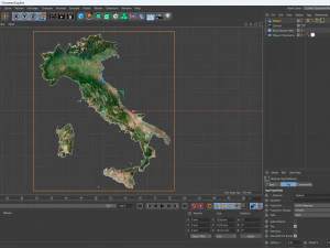
Model size: 1250 mm x 1412.5 mm x 3.519 mm
Projection: Mercator
Base: Open
UV layer: Yes (frontal)
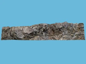
Textures
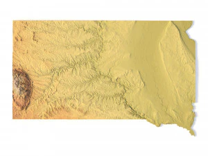
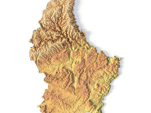
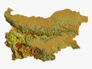
Height Map TIF 7250*8193*16b - You can use this map in the displacement channel instead of the polygonal mesh.
Normal Map TIF 7250*8193*48b - Use this map to reveal fine details of the relief.
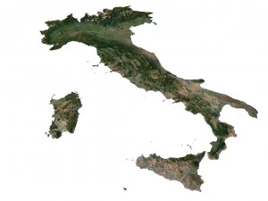
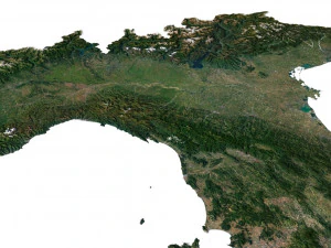
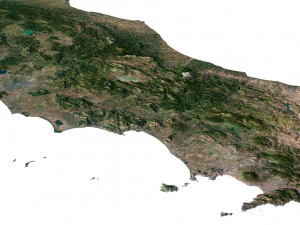
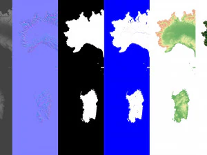
Satellite Map TIF 10000*11300*48b
Water Mask TIF 10000*11300*48b - Use this map for masking in the Reflection channel to get glare from the water surface.
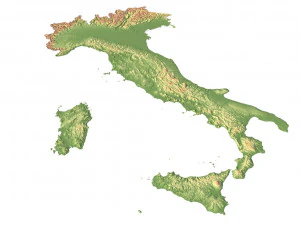
Pseudo-color Map 10000*11300*48b - Use this map to get elevation information based on the color shade.
Boundary Mask TIF 10000*11300*48b - Use this map as a mask for your background.
Other models can be made on request.
Modifications, conversion to OBJ, FBX, STL and other formats, more detailed models and better textures on request.
フォーマットが必要ですか?
異なるフォーマットが必要な場合、サポートチケットを開き、注文をしてください。3Dモデルをこれらに変換できます: .stl, .c4d, .obj, .fbx, .ma/.mb, .3ds, .3dm, .dxf/.dwg, .max. .blend, .skp, .glb. フリーフォーマット変換3D シーンは変換しません .step、.iges、.stp、.sldprt などの形式。!
使用情報
イタリア地形 3D 地図 - このロイヤリティフリーの3Dモデルは、基本ライセンスまたは拡張ライセンスに従って、個人および商用目的で使用できます。基本ライセンスは、デジタル広告、デザインおよび視覚化プロジェクト、ビジネスソーシャルメディアアカウント、ネイティブアプリ、ウェブアプリ、ビデオゲーム、物理またはデジタル最終製品(無料および有償)など、ほとんどの標準的な使用事例をカバーしています。
拡張ライセンスには、基本ライセンスで付与されるすべての権利が使用制限なしで含まれており、ロイヤリティフリーの条件の下で、3Dモデルを無制限の商用プロジェクトで使用できます。
詳細を読む