English
 Español
 Deutsch
 日本語
日本語 Polska
 Français
 中國
中國 한국의
한국의 Українська
 Italiano
 Nederlands
 Türkçe
 Português
 Bahasa Indonesia
 Русский
 हिंदी
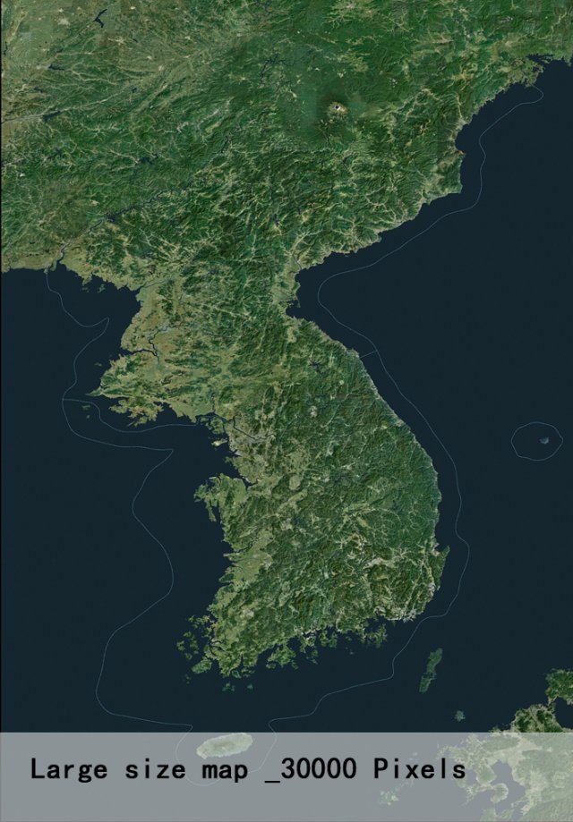
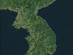
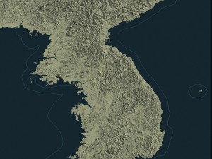
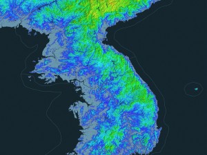
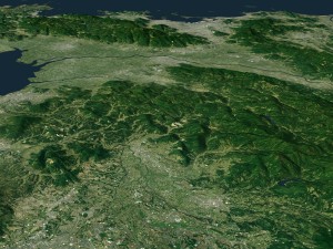
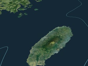
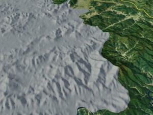
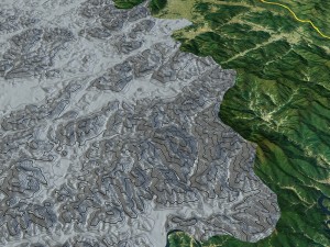
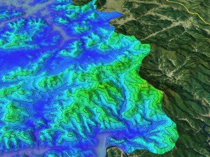
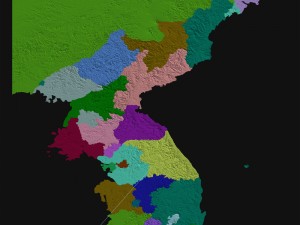
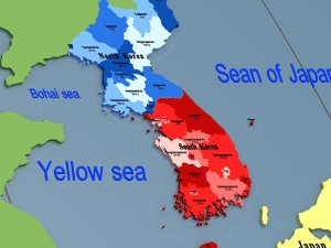
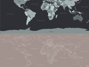
हिंदीkorean peninsula satellite map 3Dモデル


$
99.00 USD
を持っています $0.00 クレジット. クレジットを購入する

- 利用可能フォーマット: Autodesk FBX (.fbx) 214.78 MBWavefront OBJ (.obj) 121.99 MBAutodesk Maya (.mb / .ma) 66.11 MBAutodesk Maya (.mb / .ma) 139.31 MBImage Textures (.jpg) 363.53 MBImage Textures (.jpg) 196.24 MBAutodesk Maya (.mb / .ma) 314.25 MBImage Textures (.jpg) 9.18 MBImage Textures (.jpg) 134.89 MBImage Textures (.jpg) 174.08 MBImage Textures (.jpg) 185.55 MB
- 多角形:4836681
- 頂点:9443826
- アニメーション:No
- テクスチャー加工:
- 装飾:No
- 素材:
- 低ポリ:No
- コレクション:No
- UVW マッピング:No
- 使用中プラグイン:No
- 印刷 準備:No
- 3D スキャン:No
- 成人コンテンツ:No
- ジオメトリ:Polygonal
- 展開済 UVs:Unknown
- ビュー:5750
- 日付: 2017-06-01
- アイテム ID:150848
use 3dmax2014 production.
thank you for coming! 印刷 準備: いいえ
詳細を読むthank you for coming! 印刷 準備: いいえ
フォーマットが必要ですか?
異なるフォーマットが必要な場合、サポートチケットを開き、注文をしてください。3Dモデルをこれらに変換できます: .stl, .c4d, .obj, .fbx, .ma/.mb, .3ds, .3dm, .dxf/.dwg, .max. .blend, .skp, .glb. 3D シーンは変換しません .step、.iges、.stp、.sldprt などの形式。!
異なるフォーマットが必要な場合、サポートチケットを開き、注文をしてください。3Dモデルをこれらに変換できます: .stl, .c4d, .obj, .fbx, .ma/.mb, .3ds, .3dm, .dxf/.dwg, .max. .blend, .skp, .glb. 3D シーンは変換しません .step、.iges、.stp、.sldprt などの形式。!
korean peninsula satellite map 3Dモデル fbx, obj, mb, mb, jpg, jpg, mb, jpg, jpg, jpg, jpg, から sunshineweilian
map google globe land planet latitude longitude science education high-precision state korean north south war administrative districtこのアイテムにコメントはありません。
korean peninsula satellite map - You can use this royalty-free 3D model for both personal and commercial purposes in accordance with the Basic or Extended License.
The Basic License covers most standard use cases, including digital advertisements, design and visualization projects, business social media accounts, native apps, web apps, video games, and physical or digital end products (both free and sold).
The Extended License includes all rights granted under the Basic License, with no usage limitations, and allows the 3D model to be used in unlimited commercial projects under Royalty-Free terms.
-40%
tga tga tga tga tga tga fbx max ma
boneytoes
Other
$17.39
$28.99