English
 Español
 Deutsch
 日本語
日本語 Polska
 Français
 中國
中國 한국의
한국의 Українська
 Italiano
 Nederlands
 Türkçe
 Português
 Bahasa Indonesia
 Русский
 हिंदी
हिंदीTopoExport Frankfurt-am-Main dxf dwg 無料 3Dモデル

$
0.00

- 利用可能フォーマット:
Autodesk Maya (.mb / .ma) 2.80 MB
- アニメーション:No
- テクスチャー加工:No
- 装飾:No
- 素材:
- 低ポリ:No
- コレクション:No
- UVW マッピング:No
- 使用中プラグイン:No
- 印刷 準備:No
- 3D スキャン:No
- 成人コンテンツ:No
- PBR:No
- AIトレーニング:No
- ジオメトリ:Polygonal
- 展開済 UVs:Unknown
- ビュー:1071
- 日付: 2025-03-13
- アイテム ID:562053
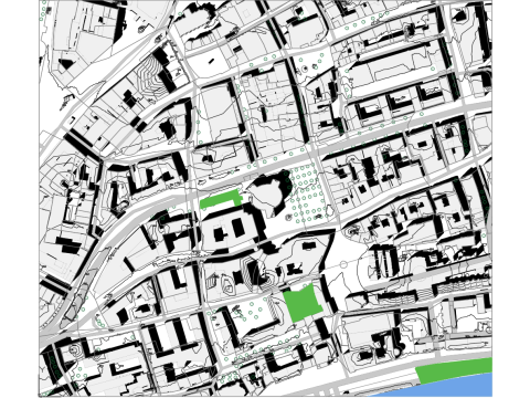
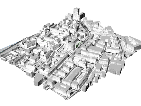
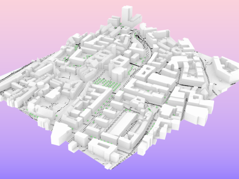
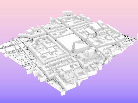
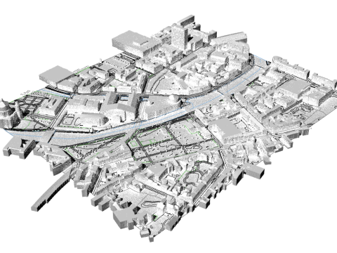
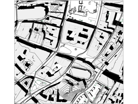
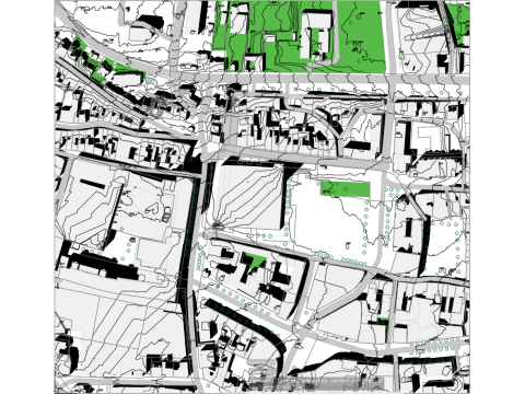
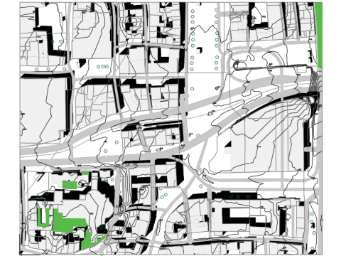
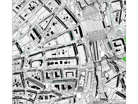
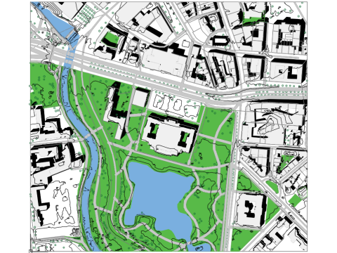
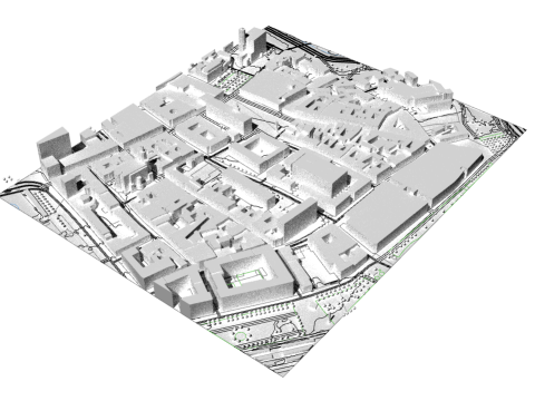
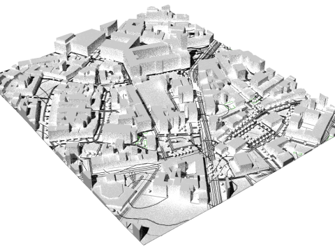
Frankfurt am Main.dwg topoexport.com Geodata description:
Frankfurt am Main Alkis: Buildings (2D) and parcels from Alkis, licensed under dl-de/by-2.0. (Data available at topoexport.com)
3D building model: Buildings in the LOD2 standard from the 3D building model LOD2, licensed under dl-de/by-2.0. (Data available at topoexport.com)
Frankfurt am Main DLM: Roads, railway lines, waterways, and tree canopy cover from DLM, licensed under dl-de/by-2.0.
Frankfurt am Main DGM1: Terrain model (DTM, 1 m) from DGM1, licensed under dl-de/by-2.0. (Data available at topoexport.com)
Nearby cities:
Offenbach am Main.dwg
Hauptwache.dwg
Sachsenhausen.dwg
フォーマットが必要ですか?
異なるフォーマットが必要な場合、サポートチケットを開き、注文をしてください。3Dモデルをこれらに変換できます: .stl, .c4d, .obj, .fbx, .ma/.mb, .3ds, .3dm, .dxf/.dwg, .max. .blend, .skp, .glb. 3D シーンは変換しません .step、.iges、.stp、.sldprt などの形式。!
異なるフォーマットが必要な場合、サポートチケットを開き、注文をしてください。3Dモデルをこれらに変換できます: .stl, .c4d, .obj, .fbx, .ma/.mb, .3ds, .3dm, .dxf/.dwg, .max. .blend, .skp, .glb. 3D シーンは変換しません .step、.iges、.stp、.sldprt などの形式。!
ダウンロード TopoExport Frankfurt-am-Main dxf dwg 無料 3Dモデル mb, から TopoMapper
topoexport frankfurt-am-main dxfこのアイテムにコメントはありません。