English
 Español
 Deutsch
 日本語
日本語 Français
 한국의
한국의 Nederlands
 Türkçe
メイン州地形図 STL モデル 3Dプリントモデル


- 作者による製品サポートのリクエスト

- 利用可能フォーマット:
- アイテム ID:402307
- 日付: 2022-06-17
- コレクション:No
- 幅(mm):184
- 高さ(mm):2
- 奥行(mm):277
- 印刷 準備:Yes
- 3D スキャン:No
- 成人コンテンツ:No
- PBR:No
- AIトレーニング:No
- ビュー:2822
説明
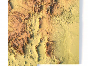
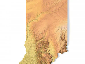
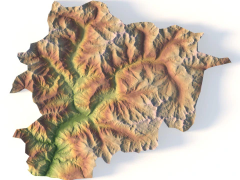
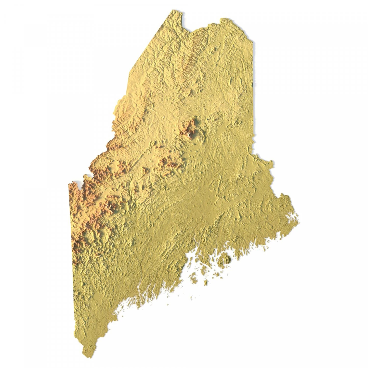
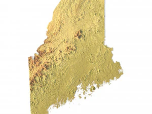
Create Detailed Maine Terrain Models with This High-Resolution 3D STL
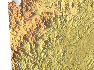
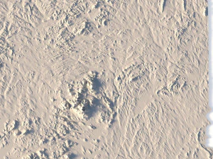
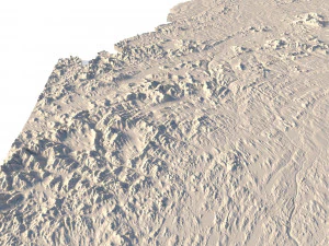
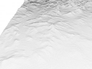
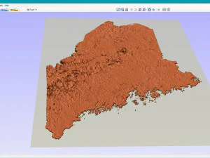
The Maine Topographic Map STL model offers a high-resolution depiction of the state’s diverse topography and geographic features. This 3D model is perfect for creating physical relief maps from materials like wood, metal, plastic, or concrete. Whether used for landform visualization, educational purposes, or professional GIS applications, this model provides accurate elevation data for detailed terrain modeling. It’s suitable for 3D printing, CNC machining, and laser engraving.
- File size: 723 MB / 518 MB
- Model size: 184.02 mm x 277.14 mm x 2.035 mm
- Resolution: 0,06 mm
- Projection: Mercator
- Scaling factor: X — 1; Y — 1; Z — 3
- Polygons: 15 179 102
- Vertices: 7 620 961
- Geometry: Polygonal Tris only
- Base: Open / Closed
Features of the Maine Topographic STL Model
Precise elevation data capturing Maine’s rugged mountains, forests, and coastal landforms.
Compatible with FDM/SLA 3D printers for creating detailed terrain models.
Designed for CNC machining to create relief maps from wood or metal.
Supports high-precision laser engraving for metal surface detailing.
フォーマットが必要ですか?
異なるフォーマットが必要な場合、サポートチケットを開き、注文をしてください。3Dモデルをこれらに変換できます: .stl, .c4d, .obj, .fbx, .ma/.mb, .3ds, .3dm, .dxf/.dwg, .max. .blend, .skp, .glb. フリーフォーマット変換3D シーンは変換しません .step、.iges、.stp、.sldprt などの形式。!
使用情報
メイン州地形図 STL モデル - このロイヤリティフリーの3Dモデルは、基本ライセンスまたは拡張ライセンスに従って、個人および商用目的で使用できます。基本ライセンスは、デジタル広告、デザインおよび視覚化プロジェクト、ビジネスソーシャルメディアアカウント、ネイティブアプリ、ウェブアプリ、ビデオゲーム、物理またはデジタル最終製品(無料および有償)など、ほとんどの標準的な使用事例をカバーしています。
拡張ライセンスには、基本ライセンスで付与されるすべての権利が使用制限なしで含まれており、ロイヤリティフリーの条件の下で、3Dモデルを無制限の商用プロジェクトで使用できます。
詳細を読む