English
 Español
 Deutsch
 日本語
日本語 Polska
 Français
 中國
中國 한국의
한국의 Українська
 Italiano
 Nederlands
 Türkçe
 Português
 Bahasa Indonesia
 Русский
 हिंदी
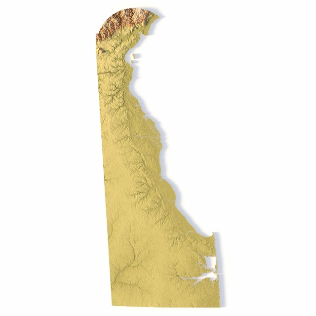
हिंदी地形図 デラウェア州 STL モデル 3Dプリントモデル
- 作者による製品サポートのリクエスト

- 利用可能フォーマット:
- アイテム ID:402261
- 日付: 2022-06-17
- コレクション:No
- 幅(mm):33
- 高さ(mm):0.28
- 奥行(mm):79
- 印刷 準備:No
- 3D スキャン:No
- 成人コンテンツ:No
- PBR:No
- AIトレーニング:No
- ビュー:2140
説明
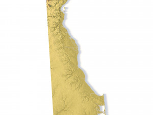
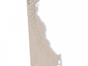
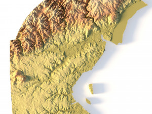
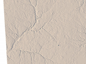
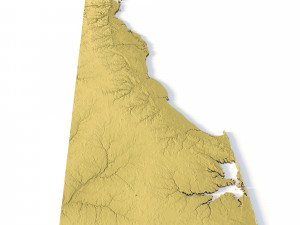
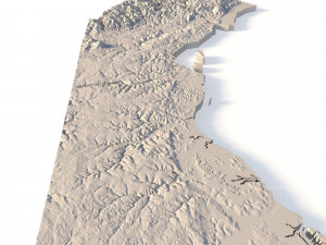
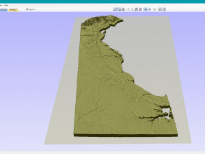
Create Precise Delaware Terrain Models with This 3D STL File
The Topographic Map Delaware STL model offers a highly detailed relief map of Delaware’s landscape. Perfect for creating physical models from wood, metal, plastic, or concrete, this 3D model is ideal for terrain visualization and landform representation. Whether for educational projects, geospatial analysis, or personal use, this model provides accurate elevation data of Delaware’s terrain.
- File size: 144 MB
- Model size: 32.91 mm x 79.38 mm x 0.284 mm
- Projection: Mercator
- Scaling factor: X — 1; Y — 1; Z — 3
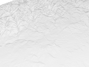
- Polygons: 3 039 422
- Vertices: 1 528 786
- Geometry: Polygonal Tris only
- Base: Closed
Features of the Delaware Topographic STL Model
Compatible with FDM/SLA 3D printers to create terrain models in plastic or photopolymer.
Designed for CNC machines for creating wood or metal models.
Supports high-precision laser engraving for metal surface relief maps.
フォーマットが必要ですか?
異なるフォーマットが必要な場合、サポートチケットを開き、注文をしてください。3Dモデルをこれらに変換できます: .stl, .c4d, .obj, .fbx, .ma/.mb, .3ds, .3dm, .dxf/.dwg, .max. .blend, .skp, .glb. フリーフォーマット変換3D シーンは変換しません .step、.iges、.stp、.sldprt などの形式。!
使用情報
地形図 デラウェア州 STL モデル - このロイヤリティフリーの3Dモデルは、基本ライセンスまたは拡張ライセンスに従って、個人および商用目的で使用できます。基本ライセンスは、デジタル広告、デザインおよび視覚化プロジェクト、ビジネスソーシャルメディアアカウント、ネイティブアプリ、ウェブアプリ、ビデオゲーム、物理またはデジタル最終製品(無料および有償)など、ほとんどの標準的な使用事例をカバーしています。
拡張ライセンスには、基本ライセンスで付与されるすべての権利が使用制限なしで含まれており、ロイヤリティフリーの条件の下で、3Dモデルを無制限の商用プロジェクトで使用できます。
詳細を読む