
 English
 Español
 Deutsch
 日本語
日本語 Polska
 Français
 中國
中國 한국의
한국의 Українська
 Italiano
 Nederlands
 Türkçe
 Português
 Bahasa Indonesia
 Русский
 हिंदी
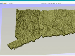
हिंदीConnecticut Topographic Map STL Model 3D Print Model


- Available formats: Stereolithography: stl 118.63 MB
- Collection:No
- Width in millimeters:86
- Height in millimeters:1
- Depth in millimeters:63
- Print Ready:No
- 3D Scan:No
- Adult content:No
- PBR:No
- AI Training:No
- Views:1694
- Date: 2022-06-17
- Item ID:402260
- Rating:
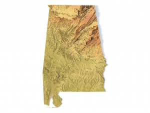
Create Detailed Colorado Terrain Models with This 3D STL
The Colorado Map Topographic STL model provides highly detailed terrain models of the state’s iconic landscape. Ideal for creating raised relief maps from materials like wood, metal, plastic, or concrete, this STL file is perfect for professionals and hobbyists interested in outdoor recreation, geospatial analysis, or landscape visualization. Whether for personal use or professional applications, this model brings the state’s varied landforms to life with precision elevation data.
- File size: 390 MB
- Model size: 86.34 mm x 63.24 mm x 0.995 mm
- Projection: Mercator
- Scaling factor: X — 1; Y — 1; Z — 3
- Polygons: 8 185 972
- Vertices: 4 104 970
- Geometry: Polygonal Tris only
- Base: Closed
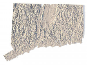
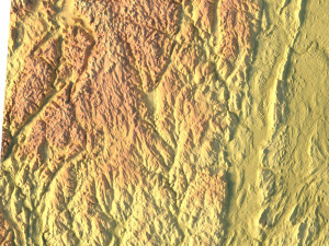
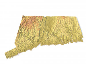
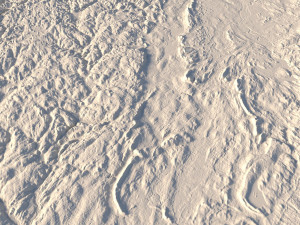
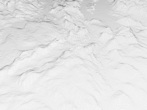
Create Detailed Connecticut Terrain Models with This 3D STL
The Connecticut Topographic Map STL model provides precise topography of Connecticut’s landscape. This 3D model is perfect for creating raised relief maps using materials such as wood, metal, plastic, or concrete. Whether for personal projects or professional terrain visualization, this model offers accurate geospatial data for a wide range of applications, including landscape visualization, educational models, and more.
Print Ready: NoIf you need a different format, please send us a Conversion Request. We can convert 3D models to: .stl, .c4d, .obj, .fbx, .ma/.mb, .3ds, .3dm, .dxf/.dwg, .max. .blend, .skp, .glb. We do not convert 3d scenes and solid formats such as .step, .iges, .stp, .sldprt etc!


