English
 Español
 Deutsch
 日本語
日本語 Polska
 Français
 中國
中國 한국의
한국의 Українська
 Italiano
 Nederlands
 Türkçe
 Português
 Bahasa Indonesia
 Русский
 हिंदी
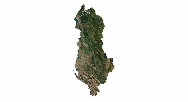
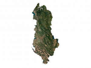
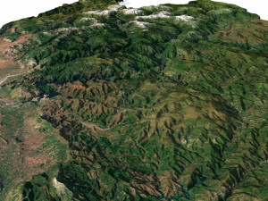
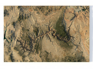
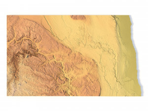
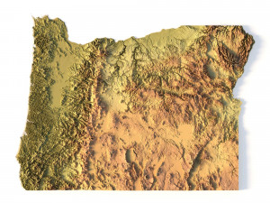
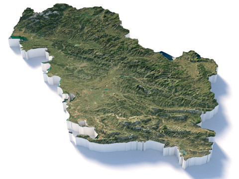
हिंदीAlbania Terrain 3D Map 3D Model

-20%

stl obj c4d
sychev23021983
Landscapes
$31.20
$39.00
$
36.80 USD
You have $0.00 Credits. Buy Credits

- Available formats: Cinema4D (.c4d) 752.37 MB
Render: StandardWavefront OBJ (.obj) 751.37 MB
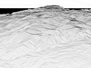
- Polygons:9 984 600
- Vertices:4 996 816
- Animated:No
- Textured:
- Rigged:No
- Materials:
- Low-poly:No
- Collection:No
- UVW mapping:
- Plugins Used:No
- Print Ready:No
- 3D Scan:No
- Adult content:No
- PBR:No
- AI Training:No
- Geometry:Polygonal
- Unwrapped UVs:Unknown
- Views:2964
- Date: 2023-07-14
- Item ID:454417
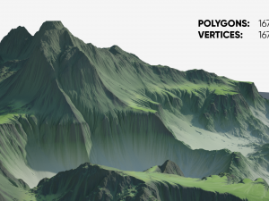
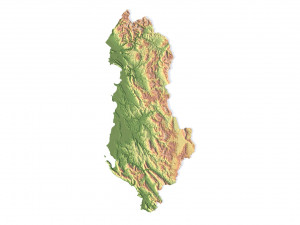
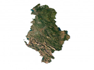
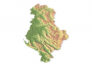
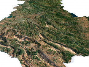
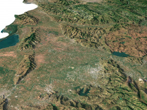
Albania Terrain 3D Map 3D Model c4d, obj, from sychev23021983
Format: C4D/OBJFile size (unzipped): 571 MB
Polygons: 9 984 600
Vertices: 4 996 816
Geometry: Polygonal Tris only
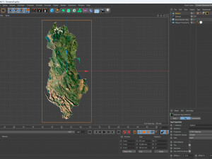
Model size: 875 mm x 1812.5 mm x 14.596 mm
Projection: Mercator
Base: Open
UV layer: Yes (frontal)
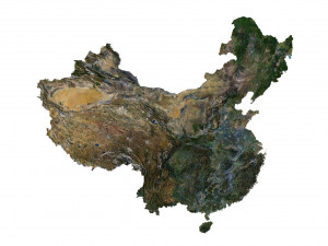
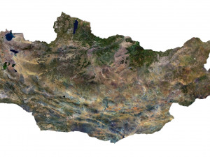
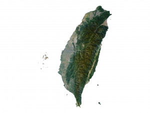
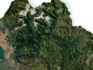
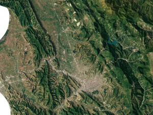
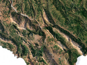
Textures
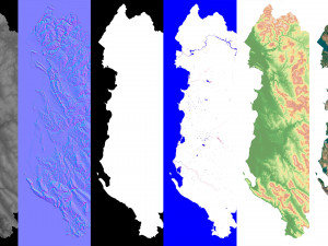
Height Map TIF 3955*8192*16b - You can use this map in the displacement channel instead of the polygonal mesh.
Normal Map TIF 3955*8192*48b - Use this map to reveal fine details of the relief.
Satellite Map TIF 7000*14500*24b
Water Mask TIF 7000*14500*24b - Use this map for masking in the Reflection channel to get glare from the water surface.
Pseudo-color Map 7000*14500*24b - Use this map to get elevation information based on the color shade.
Boundary Mask TIF 7000*14500*24b - Use this map as a mask for your background.
When importing an OBJ file, if you don't have textures displayed, please check the texture paths.
Other models can be made on request.
Modifications, conversion to OBJ, FBX, STL and other formats, more detailed models and better textures on request. Print Ready: No
Need more formats?
If you need a different format, please send us a Conversion Request. We can convert 3D models to: .stl, .c4d, .obj, .fbx, .ma/.mb, .3ds, .3dm, .dxf/.dwg, .max. .blend, .skp, .glb. We do not convert 3d scenes and solid formats such as .step, .iges, .stp, .sldprt etc!Usage Information
Albania Terrain 3D Map - You can use this royalty-free 3D model for both personal and commercial purposes in accordance with the Basic or Extended License.The Basic License covers most standard use cases, including digital advertisements, design and visualization projects, business social media accounts, native apps, web apps, video games, and physical or digital end products (both free and sold).
The Extended License includes all rights granted under the Basic License, with no usage limitations, and allows the 3D model to be used in unlimited commercial projects under Royalty-Free terms.
Read more
Do you provide Money Back Guarantee?
Yes, we do. If you purchased a product and found some error in the renders or description, we'll try to fix the problem as soon as possible. If we cannot correct the error, we will cancel your order and you will get your money back within 24 hours from downloading the item. Read more conditions hereKeywords
There are no comments for this item.


dae fbx mb obj stl png
deformer
Landscapes