English
 Español
 Deutsch
 Türkçe
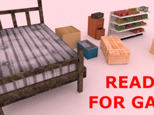
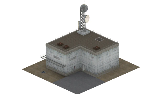
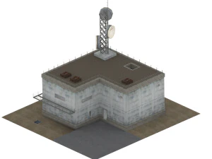
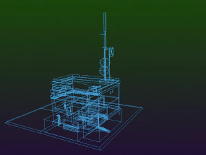
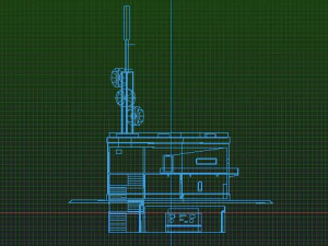
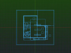
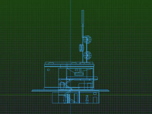
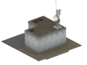
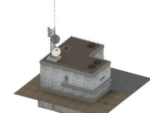
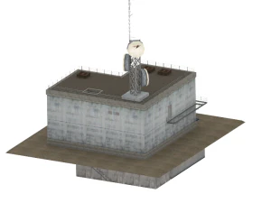
Radar Building Low-poly 3D Model


$
15.00 USD
- Request product support by the author

- Available formats:
- Item ID:478769
- Date: 2023-12-03
- Polygons:686
- Vertices:2147
- Animated:No
- Textured:
- Rigged:No
- Materials:
- Low-poly:
- Collection:No
- UVW mapping:
- Plugins Used:No
- Print Ready:No
- 3D Scan:No
- Adult content:No
- PBR:No
- Geometry:Polygonal
- Unwrapped UVs:Non-overlapping
- Views:1839
Description
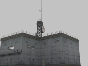
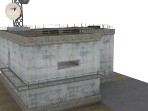
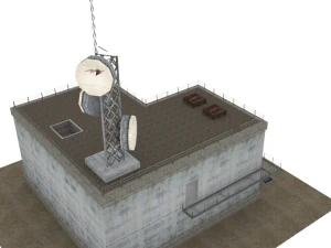
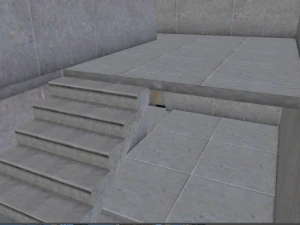
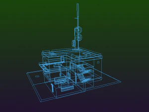
A radar tower is a tower whose function is to support a radar facility, usually a local airport surveillance radar, and hence often at or in the vicinity of an airport or a military air base. In addition, radar towers are used for the installation and operation of search and height finder radars at military radar stations where the mission is to support air defense missions. These missions were characterized as Aircraft Control & Warning (AC&W) or Long Range Surveillance in support of the Semi-automatic Ground Environment (SAGE).The tower typically has a continuously rotating parabolic antenna. Often the antenna is protected from the weather by a radome and is thus not visible from the outside.
For regional air traffic control, en route radar installations are used; for example there are six of these in Germany, erected at selected sites. The data from these radars is fed into the civilian RADNET system and transferred to all civil and military control centres.
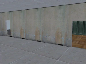
Ideally a radar tower is built on a high spot in the terrain, because this reduces the angle of elevation and thus increases the range of the radar device. In the absence of a suitable high spot, radar towers are used. Radar towers are also need to provide weather protection and services (air conditioning and power) for the radar equipment, communications, operators and maintainers
In Germany the operational command posts of the German Air Force use the Bundeswehr radar towers for the stationary radar sites of the operational command areas.
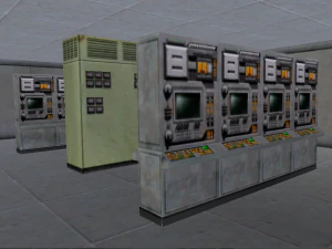
Military radar stations have supported US and allied air defense operations at numerous worldwide locations since World War II. The largest network of military radar stations evolved during the Cold War era to support the air defense of North America as part of the joint US and Canadian command known as the North American Air Defense Command (NORAD). This military radar network became automated in 1960 with the operation of SAGE. SAGE provided the vital command, control, communications, and computers (C4S). Long Range Radar (LRR) stations were electronically connected to SAGE Direction Centers (DCs). This resulted in an integrated air defense system made up of radar, radio, interceptor aircraft, antiaircraft guns and missiles, and command and control (C2) facilities. Most of the radar and radio facilities were not on a military air base, but smaller Air Force Stations (AFS) usually located in rural and often isolated locations often miles away from even small towns. They were manned by up to several hundred Air Force personnel. An online radar museum provides descriptions of military radar stations at radomes.org/museum. Photographs of radar towers and radomes are provided. This includes the AN/FPS-24 search radar tower in a huge 64 foot square, 85 foot tall, five story building. On top of this radar tower was a radar antenna 50 feet tall, 120 feet wide, weighing 85.5 tons and rotating at 5 rpm. An available rigid radome 140 feet in diameter and 96 feet high protected this antenna from adverse weather conditions. Print Ready: No
Need more formats?
If you need a different format, please send us a Conversion Request. We can convert 3D models to: .stl, .c4d, .obj, .fbx, .ma/.mb, .3ds, .3dm, .dxf/.dwg, .max. .blend, .skp, .glb. Free Format ConversionWe do not convert 3d scenes and solid formats such as .step, .iges, .stp, .sldprt etc!
Usage Information
Radar Building - You can use this royalty-free 3D model for both personal and commercial purposes in accordance with the Basic or Extended License.The Basic License covers most standard use cases, including digital advertisements, design and visualization projects, business social media accounts, native apps, web apps, video games, and physical or digital end products (both free and sold).
The Extended License includes all rights granted under the Basic License, with no usage limitations, and allows the 3D model to be used in unlimited commercial projects under Royalty-Free terms.
Read more
Do you provide Money Back Guarantee?
Yes, we do. If you purchased a product and found some error in the renders or description, we'll try to fix the problem as soon as possible. If we cannot correct the error, we will cancel your order and you will get your money back within 24 hours from downloading the item. Read more conditions hereKeywords
There are no comments for this item.